Laguna Cáceres (Bolivia)
| Laguna Cáceres | ||
|---|---|---|

|
||
| Satellite photo of the Laguna Cáceres | ||
| Geographical location | Santa Cruz Department , Germán Busch Province , Bolivia | |
| Tributaries | Río Pimiento , Tutuyú Canal , Sicurí Canal | |
| Drain | Tamengo Canal | |
| Places on the shore | Puerto Suarez | |
| Location close to the shore | Corumbá , Puerto Quijarro | |
| Data | ||
| Coordinates | 18 ° 56 ′ 0 ″ S , 57 ° 48 ′ 0 ″ W | |
|
|
||
| Altitude above sea level | 83 m | |
| surface | 33-200 km² | |
| length | 8 kilometers | |
| width | 6 km | |
| Maximum depth | 5 m | |
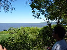
The Laguna Cáceres is a lake in the Germán Busch province in the Santa Cruz department in the lowlands of Bolivia. The lake is located in the Bolivian border region to the neighboring state of Brazil to the east in the ANMI nature reserve (Área Natural de manejo Integrado de Otuquis).
geography
The Laguna Caceres is located at an altitude of 83 m in the Bolivian part of the Pantanal , one of the largest inland - wetlands of the earth. The lake is eight kilometers in length and almost six kilometers in width, but the total area of the lake fluctuates between 33 and 200 km² depending on the season. The lake is enclosed by wetlands, surrounded by bushland, some of which has been cleared for large-scale agriculture.
Hydrology
The main tributaries in the north of the lake are the Río Pimiento as well as the Tutuyú Canal and Sicurí Canal , which are part of the extensive wetlands of the Río Paraguay . In the southeast, the lake is connected to the Paraguay River via the ten-kilometer-long Tamengo Canal .
Web links
- Laguna Caceres In: Turística y Medio Ambiente. Gobierno Autónomo Departamental Santa Cruz ( Spanish )
- Flora and Vegetation of "Las Piedritas" and the Margin of Laguna Caceres, Puerto Suarez, Bolivian Pantanal Ruedi Frey ( English )
- El Pantanal Boliviano ( Spanish ; PDF; 665 kB)

