Langano
| Langano | ||
|---|---|---|

|
||
| Southwest bank | ||
| Geographical location | East African Trench in Ethiopia ( East Africa ) | |
| Tributaries | smaller rivers from the Arsi Mountains | |
| Drain | Horo Kelo // Abijatta | |
| Places on the shore | Langano | |
| Data | ||
| Coordinates | 7 ° 37 ′ N , 38 ° 46 ′ E | |
|
|
||
| Altitude above sea level | 1582 m | |
| surface | 230 km² | |
| length | 22.2 km | |
| width | 14.8 km | |
| Maximum depth | 46 m | |
|
particularities |
||
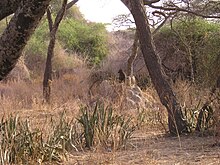
The Langano ( Amharic ላንጋኖ ሐይቅ ) is a lake in Ethiopia . It is located in the Ethiopian part of the East African Rift , about 200 kilometers south of Addis Ababa . It is 1582 meters above sea level, 22 kilometers long, up to 15 kilometers wide and has a maximum depth of 46 meters.
The Langano is one of the few lakes in Ethiopia where swimming is safe. Due to its high soda content, there is no risk of schistosomiasis . The water has a red-brown color due to the soda content and feels very soft and soapy. Because of this and the fact that it is in the immediate vicinity of the Abijatta-Shalla National Park with its rich bird life, Langano is a popular destination not only for tourists. There are three hotel complexes on its banks, the Bishangari , the Bekele Mola Hotel and the Wabe Shebbelle Resort .
Between the Langano Lake and Zway Lake which is volcanic massif of Alutu .


