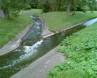
Langendreerbach
| Langendreerbach | ||
|
Confluence of the Harpener Bach and Langendreerbach (on the right in the picture) to the Oelbach |
||
| Data | ||
| Water code | DE : 276924 | |
| location | Bochum , Ruhr area , North Rhine-Westphalia , Germany | |
| River system | Rhine | |
| Drain over | Oelbach → Ruhr → Rhine → North Sea | |
| source | in Langendreer 51 ° 28 ′ 12 ″ N , 7 ° 20 ′ 19 ″ E |
|
| confluence | with the Harpener Bach to Oelbach Coordinates: 51 ° 27 '59 " N , 7 ° 17' 33" E 51 ° 27 '59 " N , 7 ° 17' 33" E
|
|
The Langendreerbach is a flowing body of water in the Langendreer district of Bochum . It rises near the Heimelsberg path. It first flows north and crosses under Oberstraße and then bends west. In the further course the brook is largely piped and appears in an open form north of the Unterstrasse, immediately west of the sports field. It flows south of the Ümminger See with the Harpener Bach , at this point the Oelbach begins .
See also
Web links
Commons : Langendreerbach - collection of images, videos and audio files
