Oelbach
| Oelbach | ||
|
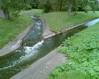
Confluence of the Harpener Bach and Langendreerbach to the Oelbach |
||
| Data | ||
| Water code | DE : 27692 | |
| location | North Rhine-Westphalia , Germany | |
| River system | Rhine | |
| Drain over | Ruhr → Rhine → North Sea | |
| origin | Confluence of the Harpener Bach and Langendreerbach rivers 51 ° 27 ′ 59 ″ N , 7 ° 17 ′ 32 ″ E |
|
| Source height | 81 m above sea level NN | |
| muzzle | At Herbede in the Ruhr Coordinates: 51 ° 25 '50 " N , 7 ° 16' 17" E 51 ° 25 '50 " N , 7 ° 16' 17" E |
|
| Mouth height | 72 m above sea level NN | |
| Height difference | 9 m | |
| Bottom slope | 1.7 ‰ | |
| length | 5.3 km 13.4 km (including Harpener Bach ) |
|
| Catchment area | 55.815 km² | |
| Reservoirs flowed through | Oelbach estuary pond | |

|
Tributaries and hydraulic structures
|
|||||||||||||||||||||||||||||||||||||||||||||||||||||||||||||||||||||||||||||||||||||||||||||||||||||||||||||||||||||||||||
The Oelbach is a right tributary of the Ruhr with a catchment area in the east of Bochum and in the far west of Dortmund ( Bövinghausen ).
course
The Oelbach begins south of the Ümminger See at the point where the Harpener Bach and Langendreerbach flow together. However, the name Oelbachtal also includes the entire Bachtal of the Harpener Bach.
With the inflow of the Schattbach , it absorbs more wastewater and flows past Haus Heven and finally passes through the Oelbachtal sewage treatment plant .
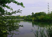
It used to feed two large sedimentation ponds and then flowed into the Ruhr at Haus Blumenau . Today it still feeds three fining ponds , one of which is the Oelbach estuary pond before it flows into the Kemnader See and thus into the Ruhr at the northeastern end .
The Lottenbach , also known as the Stiepeler Bach, used to flow to the Oelbach at Blennemanns Hof, in the area of the later estuary ponds. It now flows into Lake Kemnader.
The uppermost part of the valley is protected as the Oelbachtal nature reserve and the Upper Oelbachtal nature reserve .
history
In earlier times the entire valley was a marshy brook valley in which the Oelbach could change its bed. Karl Leich reported in the Bochum Heimatbuch in 1954 that beavers also lived in the valley in earlier times .
The stream used to be known as Meeßbach , Blennebach , Mühlenbach , Dorfbach , Hevener Bach or Aulbach . The name Oelbach is derived from the old name Aulbach . This Aulbach originated in the upper village of the Bochum district of Langendreer and flowed through the three parts of the village, before moving to the current bed of the Oelbach to the Ruhr.
In the past, the water power of the Oelbach was also used to drive water wheels:
- Dairy von Bönen's scythe hammer
- Meesmann hammer
- Mill of the House of Heven
- Reckhammer at Haus Heven
- Oil mill at Haus Heven
- Dönhofer Mühlen (also called Mehlings Mühle)
- Luhn's mill
- Luhn's hammer
The Aulbach disappeared into the canal system due to mining and building . The Köttelbecke called Langendreerbach, which still exists today, is only an overflow channel for high loads on the canal in rainy weather.
The previously numerous collieries , Lorraine , Amalia , Caroline , Prince of Prussia , Robert Müser , Vollmond , Colonia , Mansfeld , Urbanus , Klosterbusch and Dannenbaum drained their mine water, especially waste water from the coal washing plant , into the stream. In order to recover the high proportion of fine coal in the water and to clarify the water, onshore ponds were built, which were later renatured or filled. The Harpen ponds and the Ümminger See , which today serve as rain retention basins , have been preserved.
Due to the sewage and subsidence , the stream was often blocked or overflowed and impaired the meadows of the residents . Therefore, from 1904 the Oelbach and its feeding streams were straightened and canalized. Before the confluence with the Ruhr, another two ponds were built, which had to give way when the Kemnader See was built .
Today the Oelbach discharges waste water from households and industry as well as mine water.
The water has water quality 3, so it is heavily polluted. Renaturation is not expected to begin in the next few years either.
See also
literature
- District of Bochum (Ed.): Explanatory report on the Oelbach melioration project . Verlag Stumpf, Bochum, approx. 1904
- Emil Tetzlaff: Langendreerer Heimatbuch. 1923
- Stapperfenne (ed.): Heven, through 11 centuries.
- Hans W. Bimbel: The Ölbachtal. Small contributions to local history 14. In: Der Bochumer Wanderer, Heft 4, 1969, pages 40-51
Individual evidence
- ↑ a b German basic map 1: 5000
- ↑ a b Topographical Information Management, Cologne District Government, Department GEObasis NRW ( Notes )
- ↑ Kortumgesellschaft, Karl Leichhardt: What the Oelbach told. History of the Oelbach. In: Bochumer Heimatbuch, 1954 ( online )
- ↑ Michael Weeke: "Like manure, acid, benzene , salt." In: WAZ, local section Bochum, March 27, 2008 ( online )

