Lathrop (California)
| Lathrop | ||
|---|---|---|
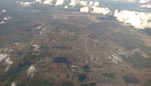
 Lathrop (left) and the neighboring town of Manteca (center) |
||
| Location in California | ||
|
|
||
| Basic data | ||
| State : | United States | |
| State : | California | |
| County : | San Joaquin County | |
| Coordinates : | 37 ° 49 ′ N , 121 ° 17 ′ W | |
| Time zone : | Pacific ( UTC − 8 / −7 ) | |
| Residents : | 14,625 (as of 2006) | |
| Population density : | 344.9 inhabitants per km 2 | |
| Area : | 43.3 km 2 (approx. 17 mi 2 ) of which 42.4 km 2 (approx. 16 mi 2 ) is land |
|
| Height : | 7 m | |
| Postal code : | 95330 | |
| Area code : | +1 209 | |
| FIPS : | 06-40704 | |
| GNIS ID : | 1658948 | |
| Website : | www.ci.lathrop.ca.us | |
| Mayor : | Kristy Sayles | |
Lathrop is an American city in San Joaquin County in the US state of California . It has about 12,500 inhabitants (as of 2004). The urban area has a size of 43.3 km².
Web links
Commons : Lathrop - Collection of Images
