San Joaquin County
| administration | |
|---|---|
| US state : | California |
| Administrative headquarters : | Stockton |
| Foundation : | 1850 |
| Demographics | |
| Residents : | 685,306 (2010) |
| Population density : | 189.1 inhabitants / km 2 |
| geography | |
| Total area : | 3694 km² |
| Water surface : | 70 km² |
| map | |
| Website : www.co.san-joaquin.ca.us | |
The San Joaquin County is a county in the US state of California . At the 2010 census , the county had 685,306 people and a population density of 189.1 people per square kilometer. The county seat is Stockton .
geography
The county is located in California's long valley , around 100 km east of the San Francisco Bay Area and has an area of 3694 km². It borders on the following counties:
| Sacramento County | Amador County | |
| Contra Costa County , Alameda County |

|
Calaveras County |
| Santa Clara County | Stanislaus County |
history
The county was founded in 1850. The San Joaquin River , which flows through the county, gave it its name. On an expedition in the early years of the 19th century, Gabriel Moraga discovered the area we know today and named it San Joaquin after the Spanish name for Saint Joachim.
35 structures and sites in the county are on the National Register of Historic Places .
Demographic data
| growth of population | |||
|---|---|---|---|
| Census | Residents | ± in% | |
| 1850 | 3647 | - | |
| 1860 | 9435 | 158.7% | |
| 1870 | 21,050 | 123.1% | |
| 1880 | 24,340 | 15.6% | |
| 1890 | 28,629 | 17.6% | |
| 1900 | 35,452 | 23.8% | |
| 1910 | 50,731 | 43.1% | |
| 1920 | 79.905 | 57.5% | |
| 1930 | 102,940 | 28.8% | |
| 1940 | 134.207 | 30.4% | |
| 1950 | 200,750 | 49.6% | |
| 1960 | 249,989 | 24.5% | |
| 1970 | 290.208 | 16.1% | |
| 1980 | 347,342 | 19.7% | |
| 1990 | 480,628 | 38.4% | |
| 2000 | 563,598 | 17.3% | |
| 2010 | 685.306 | 21.6% | |
| Before 1900 1900–1990 2000 + 2010 | |||
According to the 2000 census , San Joaquin County's population was 563,598. There were 181,629 households and 134,768 families. The population density was 156 inhabitants per square kilometer. The racial the population was composed of 58.13% White, 6.69% African American, 1.13% Native American, 11.41% Asian, 0.35% Pacific Islander, and 16.26% other races Groups; 6.05% were from two or more races. 30.53% of the population were Hispanic or Latino of any of the above mentioned groups.
Of the 181,629 households, 40.50% had children and young people under the age of 18 living with them. 54.30% were married couples living together, 14.00% were single mothers. 25.80% were not families. 20.70% were single households and 8.40% had someone who was 65 years of age or older. The average household size was 3.00 and the average family size was 3.48 people.
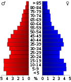
For the entire county, the population was composed of 31.00% residents under 18 years of age, 10.00% between 18 and 24 years of age, 28.80% between 25 and 44 years of age, 19.60% between 45 and 64 years of age 10.60% were 65 years of age or over. The median age was 32 years. For every 100 females there were statistically 99.90 males, for every 100 females aged 18 and over there were statistically 97.20 males.
The median income for a household in the county is $ 41,282 , and the median income for a family is $ 46,919. Males had a median income of $ 39,246 versus $ 27,507 for females. The per capita income was $ 17,365. 17.70% percent of the population and 13.50% of families are below the poverty line. 23.70% of these were under 18 years of age and 10.00% were 65 years of age or older.
cities and communes
Census-designated places (CDP)
Individual evidence
- ↑ GNIS-ID: 277303. Retrieved on February 22, 2011 (English).
- ↑ Search mask database in the National Register Information System. National Park Service , accessed August 27, 2017.
- ^ US Census Bureau - Census of Population and Housing.Retrieved March 15, 2011
- ^ Extract from Census.gov.Retrieved February 28, 2011
- ↑ Extract from census.gov (2000 + 2010). Accessed April 2, 2012
Web links
Coordinates: 37 ° 56 ′ N , 121 ° 16 ′ W

