
Trinity County, California
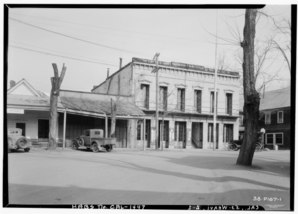 Trinity County Courthouse (1934) |
|
| administration | |
|---|---|
| US state : | California |
| Administrative headquarters : | Weaverville |
| Foundation : | 1850 |
| Demographics | |
| Residents : | 13,786 (2010) |
| Population density : | 1.7 inhabitants / km 2 |
| geography | |
| Total area : | 8307 km² |
| Water surface : | 75 km² |
| map | |
 |
|
| Website : www.trinitycounty.org | |
The Trinity County is a county in the US state of California . The county seat is Weaverville .
geography
The county is located in northwestern California and has an area of 8,307 square kilometers, of which 75 square kilometers are water. It is bordered by counties in a clockwise direction: Siskiyou County , Shasta County , Tehama County , Mendocino County, and Humboldt County .
history
Trinity County was one of the founding counties of California in 1850. Parts of it were ceded to Klamath County in 1852 and Humboldt County in 1853. Klamath County was dissolved in 1876 due to corruption and widespread electoral fraud.
The county takes its name from the Trinity River , which in turn was named in 1845 by Major Pearson B. Messwert, who had the mistaken impression that the river would flow into Trinidad Bay .
A total of 4 buildings and sites in the county are listed on the National Register of Historic Places .
Demographic data
| growth of population | |||
|---|---|---|---|
| Census | Residents | ± in% | |
| 1850 | 1635 | - | |
| 1860 | 5125 | 213.5% | |
| 1870 | 3213 | -37.3% | |
| 1880 | 4999 | 55.6% | |
| 1890 | 3710 | -25.8% | |
| 1900 | 4383 | 18.1% | |
| 1910 | 3301 | -24.7% | |
| 1920 | 2551 | -22.7% | |
| 1930 | 2809 | 10.1% | |
| 1940 | 3970 | 41.3% | |
| 1950 | 5087 | 28.1% | |
| 1960 | 9706 | 90.8% | |
| 1970 | 7615 | -21.5% | |
| 1980 | 11,858 | 55.7% | |
| 1990 | 13,063 | 10.2% | |
| 2000 | 13,022 | -0.3% | |
| 2010 | 13,786 | 5.9% | |
| Before 1900
1900–1990 2000 + 2010 |
|||
.jpg)

Trinity County's population was 13,022 as of the 2000 census . There were 5,587 households and 3,625 families. The population density was 2 people per square kilometer. The racial the population was composed of 88.87% White, 0.45% African American, 4.85% Native American, 0.47% Asian, 0.12% Pacific Islander, and 0.88% other races Groups; 4.38% were from two or more races. Hispanic or Latino of any race was 3.97% of the population.
Of the 5587 households, 25.40% had children and adolescents under the age of 18 living with them. 50.50% were married couples living together, 10.10% were single mothers. 35.10% were not families. 29.50% are single households and 11.10% have someone who is 65 years of age or older. The average household size was 2.29 and the average family size was 2.80.
For the entire county, the population was composed of 22.80% of residents under 18 years of age, 5.10% between 18 and 24 years of age, 22.70% between 25 and 44 years of age, 32.10% between 45 and 64 years of age 17.20% were 65 years of age or over. The median age was 45 years. For every 100 females there were 104.20 males, and for every 100 females aged 18 and over there were 102.60 males.
The median income for a household in the 27,711 USD , and the median income for a family was 34,343 USD. Males had a median income of $ 31,131 versus $ 24,271 for females. The per capita income was $ 16,868. 18.70% percent of the population and 14.10% of families are below the poverty line. 26.20% of these were under 18 years of age and 7.20% were 65 years of age or older.
Communities
Web links
Individual evidence
- ↑ GNIS-ID: 277317. Retrieved on February 22, 2011 (English).
- ↑ Search mask database in the National Register Information System. National Park Service , accessed August 27, 2017.
- ↑ US Census Bureau - Census of Population and Housing . Retrieved March 15, 2011
- ↑ Extract from Census.gov . Retrieved February 28, 2011
- ↑ Extract from census.gov (2000 + 2010). Accessed April 2, 2012
List of counties in California
Alameda |
Alpine |
Amador |
Butte |
Calaveras |
Colusa |
Contra Costa |
Del Norte |
El Dorado |
Fresno |
Glenn |
Humboldt |
Imperial |
Inyo |
Core |
Kings |
Lake |
Let |
Los Angeles |
Madera |
Marin |
Mariposa |
Mendocino |
Merced |
Modoc |
Mono |
Monterey |
Napa |
Nevada |
Orange |
Placer |
Plumas |
Riverside |
Sacramento |
San Benito |
San Bernardino |
San Diego |
San Francisco |
San Joaquin |
San Luis Obispo |
San Mateo |
Santa Barbara |
Santa Clara |
Santa Cruz |
Shasta |
Sierra |
Siskiyou |
Solano |
Sonoma |
Stanislaus |
Sutter |
Tehama |
Trinity |
Tulare |
Tuolumne |
Ventura |
Yolo |
Yuba
Coordinates: 40 ° 40 ′ N , 123 ° 7 ′ W