San Bernardino County
 San Bernardino County Court House |
|
| administration | |
|---|---|
| US state : | California |
| Administrative headquarters : | San Bernardino |
| Address of the administrative headquarters: |
351 North Arrowhead Avenue San Bernardino, CA |
| Foundation : | 1853 |
| Made up from: | Los Angeles County |
| Demographics | |
| Residents : | 2,035,210 (2010) |
| Population density : | 39.2 inhabitants / km 2 |
| geography | |
| Total area : | 52,073 km² |
| Water surface : | 137 km² |
| map | |
| Website : www.sbcounty.gov | |
San Bernardino County in the US state of California is the largest county in the heartland of the USA . The county seat is in San Bernardino .
geography
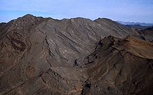
The county covers an area of 52,073 square kilometers and is located in southeastern California and consists almost exclusively of desert and mountains. It extends from the outskirts of Los Angeles to the Nevada border and the Colorado River . In 2010 there were 2,035,210 people in the county. The county is part of the Greater Los Angeles Area . With its area, the county is larger than the second largest German state of Lower Saxony or Bosnia and Herzegovina .
The county has three major regions: the Mojave Desert , the San Bernardino Mountains, and the San Bernardino Valley.
history
San Bernardino County was formed from Los Angeles County in 1853 . Parts of this county were given to Riverside County in 1893 . The Spaniards gave the elevations in southern California with their snow caps the name San Bernardino in honor of St. Bernardine of Siena . On May 15, 1940, the brothers Richard and Maurice McDonald opened the first McDonald’s restaurant in San Bernardino .
In San Bernardino County is a National Historic Landmark , the Goldstone Deep Space Communications Complex . 61 other structures and sites in the county are on the National Register of Historic Places .
Demographic data
| growth of population | |||
|---|---|---|---|
| Census | Residents | ± in% | |
| 1860 | 5551 | - | |
| 1870 | 3988 | -28.2% | |
| 1880 | 7786 | 95.2% | |
| 1890 | 25,497 | 227.5% | |
| 1900 | 27,929 | 9.5% | |
| 1910 | 56,706 | 103% | |
| 1920 | 73.401 | 29.4% | |
| 1930 | 133,900 | 82.4% | |
| 1940 | 161.108 | 20.3% | |
| 1950 | 281,642 | 74.8% | |
| 1960 | 503,591 | 78.8% | |
| 1970 | 684.072 | 35.8% | |
| 1980 | 895.016 | 30.8% | |
| 1990 | 1,418,380 | 58.5% | |
| 2000 | 1,709,434 | 20.5% | |
| 2010 | 2,035,210 | 19.1% | |
| Before 1900
1900–1990 2000 + 2010 |
|||


According to the 2000 census , San Bernardino County had a population of 1,709,434. There were 528,594 households and 404,374 families. The population density was 33 people per square kilometer. The racial the population was composed of 58.91% White, 9.09% African American, 1.17% Native American, 4.69% Asian, 0.30% Pacific Islander, and 20.82% other races Groups; 5.03% from two or more races. Hispanic or Latino of any race was 39.16% of the population.
Of the 528,594 households, 43.70% had children and adolescents under the age of 18 living with them. 55.80% were married couples living together, 14.80% were single mothers. 23.50% were not families. 18.40% are single households and 6.60% have someone living there who is 65 years of age or over. The average household size was 3.15 and the average family size was 3.58.
For the entire county, the population was composed of 32.30% of residents under the age of 18, 10.30% between 18 and 24 years of age, 30.20% between 25 and 44 years of age, and 18.70% between 45 and 64 years of age 8.60% were 65 years of age or over. The average age was 30 years. For every 100 females there were 99.60 males, and for every 100 females aged 18 and over there were 97.20 males.
The median income for a household in the 42,066 USD , and the median income for a family was 46,574 USD. Males had a median income of $ 37,025 versus $ 27,993 for females. The per capita income was $ 16,856. 15.80% percent of the population and 12.60% of families are below the poverty line. 20.60% of these were under 18 years of age and 8.40% were 65 years of age or older.
towns and places
Courthouse
The San Bernadino County's Courthouse is listed as a Historic Place on NRHP No. 97001632.
See also
- Big Bear Solar Observatory , a solar observatory just north of Big Bear Lake .
Individual evidence
- ↑ GNIS-ID: 277300. Retrieved on February 22, 2011 (English).
- ↑ Listing of National Historic Landmarks by State: California . National Park Service , accessed August 27, 2017.
- ↑ Search mask database in the National Register Information System. National Park Service , accessed August 27, 2017.
- ↑ US Census Bureau - Census of Population and Housing . Retrieved March 15, 2011
- ↑ Extract from Census.gov . Retrieved February 28, 2011
- ↑ Extract from census.gov (2000 + 2010). Accessed April 2, 2012
- ^ Extract from the National Register of Historic Places . Retrieved March 13, 2011
Web links
Coordinates: 34 ° 50 ′ N , 116 ° 11 ′ W

