
Messerich
| coat of arms | Germany map | |
|---|---|---|

|
Coordinates: 49 ° 56 ' N , 6 ° 29' E |
|
| Basic data | ||
| State : | Rhineland-Palatinate | |
| County : | Eifel district Bitburg-Prüm | |
| Association municipality : | Bitburger Land | |
| Height : | 235 m above sea level NHN | |
| Area : | 6.52 km 2 | |
| Residents: | 583 (Dec. 31, 2019) | |
| Population density : | 89 inhabitants per km 2 | |
| Postal code : | 54636 | |
| Area code : | 06568 | |
| License plate : | BIT, PRÜ | |
| Community key : | 07 2 32 079 | |
| Association administration address: | Hubert-Prim-Strasse 7 54634 Bitburg |
|
| Website : | ||
| Local Mayor : | Otmar Schröder | |
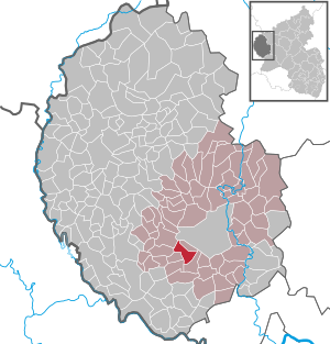
| Location of the local community Messerich in the Eifelkreis Bitburg-Prüm | ||
  |
||

Messerich is a municipality in the Eifelkreis Bitburg-Prüm in Rhineland-Palatinate . It belongs to the Verbandsgemeinde Bitburger Land .
geography
The place is in the Nimstal in the west of the Eifel , immediately southwest of the district town of Bitburg .
The living spaces Am Weilerbach, Messerich station and Kobenhof also belong to Messerich.
history
The favorable location in Bitburger Gutland has already attracted Roman settlers. The first written mention of the place took place in 1066 as Miezriche .
Until the end of the 18th century, Messerich was part of the Bitburg provost in the Duchy of Luxembourg . In 1794, French revolutionary troops occupied the Austrian Netherlands , to which the region then belonged. Under French administration, the place belonged from 1795 to 1814 to the Arrondissement Bitburg in the department of forests . In 1800, Messerich became the seat of a Mairie .
Due to the agreements made at the Congress of Vienna (1815), the region was assigned to the Kingdom of Prussia . The resulting from the French Mairie was the Prussian administration 1816 mayoralty Messerich the Bitburg in Trier assigned that from 1822 to the Rhine province belonged. In 1856 Messerich came to the mayor's office in Alsdorf and in 1914 to the mayor's office in Wolsfeld (from 1927 Wolsfeld office ), in 1970 to the Bitburg-Land community and in 2014 to the Bitburger Land community .
- Population development
The development of the population of Messerich, the values from 1871 to 1987 are based on censuses:
|
|
religion
89% of the population are Catholic, 5% Protestant. The Catholic parish of St. Martin , to which the subsidiary churches St. Jakobus in Niederstedem and St. Brictius in Oberstedem also belong, is part of the Irrel parish community in the Bitburg deanery of the Trier diocese . The Evangelical Church Community of Bitburg of the Evangelical Church in the Rhineland is responsible for the Protestants .
politics
Municipal council
The municipal council in Messerich consists of twelve council members, who were elected by a majority vote in the local elections on May 26, 2019 , and the honorary local mayor as chairman. Until 2009, the council had eight council members.
coat of arms
|
|
Blazon : "In gold, a stylized Romanesque black pillar arch on a two-tiered base plate around a sacrament house of the same kind with a silver window, raised by a five-point red tournament collar." |
| Founding of the coat of arms: The golden coat of arms is a symbol of the centuries-old connection between Messerich and Malberg. The lords of Manderscheid-Kail as landlords are symbolized by the red tournament collar. The stylized representation of the Romanesque column arch and the sacrament house testify to parts of the unmistakably typical church inventory. |
Culture and sights


Buildings
- Monument zone in the almost undamaged northern part of the village
- Catholic parish church of St. Martin with cemetery from the 12th century
- Stedemer Kapellchen from 1871
- Several very old crossroads are spread across the municipality .
- The town center is the location of several historic houses and old farms .
See also: List of cultural monuments in Messerich
Green spaces and recreation
- Hiking and cycling in and around Messerich
See also: List of natural monuments in Messerich
Regular events
- Annual fair or parish fair
- Traditional rattling or rattling on Good Friday and Holy Saturday
- Hut burning on the first weekend after Ash Wednesday (so-called Scheef Sunday)
Others
In 2004 the community received a silver medal in the competition Our village should become more beautiful - our village has a future in the federal decision.
traffic
Messerich was the station of the Erdorf – Bitburg – Irrel – Igel branch line ( Nims-Sauertalbahn ). After the railway was shut down and the tracks were torn down (1997), a cycle path has existed on the route since 2002. The station building has been privately owned for many years.
Web links
- Local community Messerich on the website of the Verbandsgemeinde Bitburger Land
- To search for cultural assets of the local community Messerich in the database of cultural assets in the Trier region .
Individual evidence
- ↑ State Statistical Office of Rhineland-Palatinate - population status 2019, districts, communities, association communities ( help on this ).
- ↑ State Statistical Office Rhineland-Palatinate (ed.): Official directory of the municipalities and parts of the municipality. Status: January 2019 [ Version 2020 is available. ] . S. 107 (PDF; 3 MB).
- ↑ State Statistical Office Rhineland-Palatinate: Regional data.
- ↑ 2011 census
- ^ The Regional Returning Officer Rhineland-Palatinate: Local elections 2019, city and municipal council elections
- ↑ Description of the coat of arms of Messerich on the pages of the Verbandsgemeinde Bitburger Land
- ↑ Messerich-Oberweis, Brecht, Wißmannsdorf, Hermesdorf, Biersdorf reservoir Bitburg. Retrieved February 2, 2018 .
- ↑ Cycling in Römersköpfchen near Messerich. Retrieved February 2, 2018 .
- ↑ Hüttenbrennen in the Eifel. Retrieved May 1, 2016 .
- ↑ Hut Sunday in the Eifel. Retrieved August 10, 2017 .
Bath | Balesfeld | Baustert | Bettingen | Bickendorf | Biersdorf am See | Birtlingen | Brecht | Brimingen | Burbach | Dahlem | Dockendorf | Dudeldorf | Echtershausen | Ehlenz | Enzen | Esslingen | Etteldorf | Feilsdorf | Flowem | Gindorf | Gondorf | Gransdorf | Halsdorf | Hamm | Heilenbach | Hütterscheid | Hüttingen an der Kyll | Idenheim | Idesheim | Ingendorf | Kyllburg | Kyllburgweiler | Ließem | Malberg | Malberg soft | Meckel | Messerich | Metterich | Mülbach | Nattenheim | Neidenbach | Neuheilenbach | Niederstedem | Niederweiler | Oberkail | Oberstedem | Oberweiler | Oberweis | Olsdorf | Orsfeld | Pickleneem | Rittersdorf | Röhl | Saint Thomas | Sharply cheap | Schleid | Seffern | Seffer soft | Field of being | Steinborn | Stockem | Sülm | Trimport | Usch | Wettlingen | Wiersdorf | Wilsecker | Wissmannsdorf | Wolsfeld | Zendscheid