
Gindorf
| coat of arms | Germany map | |
|---|---|---|

|
Coordinates: 50 ° 1 ′ N , 6 ° 39 ′ E |
|
| Basic data | ||
| State : | Rhineland-Palatinate | |
| County : | Eifel district Bitburg-Prüm | |
| Association municipality : | Bitburger Land | |
| Height : | 368 m above sea level NHN | |
| Area : | 6.57 km 2 | |
| Residents: | 323 (Dec. 31, 2019) | |
| Population density : | 49 inhabitants per km 2 | |
| Postal code : | 54657 | |
| Area code : | 06565 | |
| License plate : | BIT, PRÜ | |
| Community key : | 07 2 32 043 | |
| Association administration address: | Hubert-Prim-Strasse 7 54634 Bitburg |
|
| Website : | ||
| Local Mayor : | Marcus Franzen | |
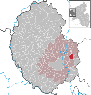
| Location of the local community Gindorf in the Eifelkreis Bitburg-Prüm | ||
  |
||

Gindorf in der Eifel is a municipality in the Eifelkreis Bitburg-Prüm in Rhineland-Palatinate . It has been part of the Bitburger Land community since July 1, 2014 .
geography
Gindorf is located northeast of Bitburg on the Gindorfer plateau , a landscape area of the so-called Gutland . Gindorf also includes the Lissenhof and Wiesenhof residential areas .
history

The place was first mentioned in a document in 893 in the Prümer Urbar under the name "Gingeyndorpht".
Until the end of the 18th century, the place belonged to the Bitburg provost , which was part of the Duchy of Luxembourg .
After 1792 French revolutionary troops occupied the Austrian Netherlands , to which the Duchy of Luxembourg and thus Gindorf belonged at that time, and annexed it in 1795 . Under French administration , Gindorf was assigned to the canton of Dudeldorf in 1795 , which administratively belonged to the arrondissement of Bitburg in the department of forests . Gindorf was the seat of a mairie .
Due to the resolutions at the Congress of Vienna , the region came to the Kingdom of Prussia in 1815 . Under the Prussian administration, Gindorf belonged to the Ordorf mayor in the Bitburg district, newly established in 1816, in the Trier administrative district .
- Population development
The development of the population of Gindorf, the values from 1871 to 1987 are based on censuses:
|
|
politics
Municipal council
The council in Gindorf consists of eight council members, who in the local elections on May 26, 2019 in a majority vote were elected, and the honorary mayor as chairman.
coat of arms
|
|
Blazon : "Under a silver shield head with seven blue diagonal right-hand bars, a gold, six-armed cross in red." |
| Justification for the coat of arms: The colors of the strips indicate the former sovereignty of Luxembourg . The six-armed cross is the attribute of the church and local patrons, St. Urban . |
See also
Web links
- Local community Gindorf on the website of the Verbandsgemeinde Bitburger Land
- To search for cultural assets of the Gindorf community in the database of cultural assets in the Trier region .
Individual evidence
- ↑ State Statistical Office of Rhineland-Palatinate - population status 2019, districts, communities, association communities ( help on this ).
- ↑ State Statistical Office Rhineland-Palatinate (ed.): Official directory of the municipalities and parts of the municipality. Status: January 2019 [ Version 2020 is available. ] . S. 107 (PDF; 3 MB).
- ^ Heinrich Beyer : Middle Rhine document book. Volume I, Coblenz: Hölscher, 1860, p. 151 ( dilibri.de ).
- ↑ Clomes: attempt at a statistical-geographic description of the Grand Duchy of Luxembourg. Schmit-Bruck, 1840, p. 4 ( Google Books ).
- ↑ Georg Bärsch : Description of the government district of Trier: according to official sources ... Volume 2, Lintz, 1846, p. 26 ( Google Books ).
- ^ Johann Friedrich Schannat , Georg Bärsch : Eiflia illustrata or geographical and historical description of the Eifel. Mayer, 1852, p. 549 ( Google Books ).
- ↑ State Statistical Office Rhineland-Palatinate: Regional data.
- ^ The Regional Returning Officer Rhineland-Palatinate: Local elections 2019, city and municipal council elections
- ↑ coat of arms. In: Gindorf. Verbandsgemeinde Bitburger Land, accessed on October 6, 2015 .
Bath | Balesfeld | Baustert | Bettingen | Bickendorf | Biersdorf am See | Birtlingen | Brecht | Brimingen | Burbach | Dahlem | Dockendorf | Dudeldorf | Echtershausen | Ehlenz | Enzen | Esslingen | Etteldorf | Feilsdorf | Flowem | Gindorf | Gondorf | Gransdorf | Halsdorf | Hamm | Heilenbach | Hütterscheid | Hüttingen an der Kyll | Idenheim | Idesheim | Ingendorf | Kyllburg | Kyllburgweiler | Ließem | Malberg | Malberg soft | Meckel | Messerich | Metterich | Mülbach | Nattenheim | Neidenbach | Neuheilenbach | Niederstedem | Niederweiler | Oberkail | Oberstedem | Oberweiler | Oberweis | Olsdorf | Orsfeld | Pickleneem | Rittersdorf | Röhl | Saint Thomas | Sharply cheap | Schleid | Seffern | Seffer soft | Field of being | Steinborn | Stockem | Sülm | Trimport | Usch | Wettlingen | Wiersdorf | Wilsecker | Wissmannsdorf | Wolsfeld | Zendscheid