
Mülbach
| coat of arms | Germany map | |
|---|---|---|

|
Coordinates: 49 ° 58 ' N , 6 ° 24' E |
|
| Basic data | ||
| State : | Rhineland-Palatinate | |
| County : | Eifel district Bitburg-Prüm | |
| Association municipality : | Bitburger Land | |
| Height : | 270 m above sea level NHN | |
| Area : | 1.55 km 2 | |
| Residents: | 112 (Dec. 31, 2019) | |
| Population density : | 72 inhabitants per km 2 | |
| Postal code : | 54636 | |
| Area code : | 06527 | |
| License plate : | BIT, PRÜ | |
| Community key : | 07 2 32 083 | |
| Association administration address: | Hubert-Prim-Strasse 7 54634 Bitburg |
|
| Website : | ||
| Local Mayor : | Stefan Weil | |
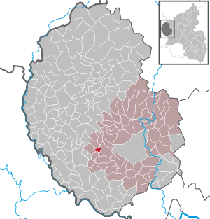
| Location of the local community Mülbach in the Eifelkreis Bitburg-Prüm | ||
  |
||

Mülbach is a municipality in the Eifelkreis Bitburg-Prüm in Rhineland-Palatinate . It belongs to the Verbandsgemeinde Bitburger Land .
geography
Mülbach is located in the Eifel west of Bitburg on the lower reaches of the Mühlbach. The Deltenhof and Tempelhof residential areas also belong to the community.
history
An extensive field of rubble in the Tempelhof district indicates a settlement in Roman times. The first written mention of the place took place in 1177 as Molbach . Before 1325 it belonged to the Luxembourg subpropstei , but in the following years the place passed to the lords of Bettingen and Neuerburg .
- Population development
The development of the population of Mülbach, the values from 1871 to 1987 are based on censuses:
|
|
politics
Municipal council
The municipal council in Mülbach consists of six council members, who were elected by a majority vote in the local elections on May 26, 2019 , and the honorary local mayor as chairman.
coat of arms
coat of arms
|
|
|
| Reasons for the coat of arms: The blue wave bar, symbolizing the Mühlenbach, divides the coat of arms into a red temple on a yellow background, which stands for the presence of the Knights Templar and bears the colors of the County of Manderscheid, and a blue mill wheel on a silver background, symbolizing the mills with the Luxembourgish ones National colors. |
economy
Most of the employed residents commute to Bitburg and neighboring Luxembourg. There is an agricultural contractor in the village.
Attractions
A rectangular chapel, closing on three sides, shows the date 1876 and the initials of the builder in the door jambs. It was restored in 1975 and is privately owned.
Web links
- Local community Mülbach on the website of the Verbandsgemeinde Bitburger Land
- To search for cultural assets of the local community Mülbach in the database of cultural assets in the Trier region .
Individual evidence
- ↑ State Statistical Office of Rhineland-Palatinate - population status 2019, districts, communities, association communities ( help on this ).
- ↑ State Statistical Office Rhineland-Palatinate (ed.): Official directory of the municipalities and parts of the municipality. Status: January 2019 [ Version 2020 is available. ] . S. 107 (PDF; 3 MB).
- ↑ State Statistical Office Rhineland-Palatinate: Regional data.
- ^ The Regional Returning Officer Rhineland-Palatinate: Local elections 2019, city and municipal council elections
- ↑ Declaration of the coat of arms. Retrieved July 30, 2016 .
Bath | Balesfeld | Baustert | Bettingen | Bickendorf | Biersdorf am See | Birtlingen | Brecht | Brimingen | Burbach | Dahlem | Dockendorf | Dudeldorf | Echtershausen | Ehlenz | Enzen | Esslingen | Etteldorf | Feilsdorf | Flowem | Gindorf | Gondorf | Gransdorf | Halsdorf | Hamm | Heilenbach | Hütterscheid | Hüttingen an der Kyll | Idenheim | Idesheim | Ingendorf | Kyllburg | Kyllburgweiler | Ließem | Malberg | Malberg soft | Meckel | Messerich | Metterich | Mülbach | Nattenheim | Neidenbach | Neuheilenbach | Niederstedem | Niederweiler | Oberkail | Oberstedem | Oberweiler | Oberweis | Olsdorf | Orsfeld | Pickleneem | Rittersdorf | Röhl | Saint Thomas | Sharply cheap | Schleid | Seffern | Seffer soft | Field of being | Steinborn | Stockem | Sülm | Trimport | Usch | Wettlingen | Wiersdorf | Wilsecker | Wissmannsdorf | Wolsfeld | Zendscheid