
Enzen (Eifel)
| coat of arms | Germany map | |
|---|---|---|

|
Coordinates: 49 ° 55 ' N , 6 ° 22' E |
|
| Basic data | ||
| State : | Rhineland-Palatinate | |
| County : | Eifel district Bitburg-Prüm | |
| Association municipality : | Bitburger Land | |
| Height : | 230 m above sea level NHN | |
| Area : | 1.71 km 2 | |
| Residents: | 34 (Dec. 31, 2019) | |
| Population density : | 20 inhabitants per km 2 | |
| Postal code : | 54646 | |
| Area code : | 06522 | |
| License plate : | BIT, PRÜ | |
| Community key : | 07 2 32 032 | |
| Association administration address: | Hubert-Prim-Strasse 7 54634 Bitburg |
|
| Website : | ||
| Local Mayor : | Manfred Elsen | |
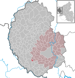
| Location of the local community Enzen in the Eifelkreis Bitburg-Prüm | ||
  |
||

_02.jpg)
Enzen is a municipality in the Eifelkreis Bitburg-Prüm in Rhineland-Palatinate . It has been part of the Bitburger Land community since July 1, 2014 .
geography
Enzen is located about 10 km southwest of the district town of Bitburg on the Enz river, which gives the place its name . The state border with Luxembourg runs approx. 10 km west of Enzen. The German-Luxembourg Nature Park extends to the northwest. Largely parallel to the Enz, the state road 4 crosses the Eifelort, which connects it with Irrel and the federal road 50 located 10 km to the north .
55% of the municipality area, which is quite small at 1.71 km², is used for agriculture , with 29% a comparatively small proportion of forest (as of 2017). Neighboring communities are Halsdorf and Stockem in the north, Peffingen in the southeast, Schankweiler in the south and Nusbaum in the west. The next larger town is Mettendorf 4 km northwest of Enzen.
The Stockfelder Hof and Wiesenhof residential areas also belong to Enzen .
history
The first written mention of the place as "Henence" comes from the year 1150, when it was owned by the Counts of Vianden in the Duchy of Luxembourg . From 1816 the community belonged to the Stockem mayor , a year after it fell to Prussia . In 1848 there were 62 inhabitants in seven houses in the small village. The Stockem mayor merged in 1856 with other districts to form the Baustert mayor , based in Oberweis . A slow but steady population decline has been recorded since 1871, from 76 to only 34 inhabitants today (as of December 31, 2019).
- Population development
The development of the population of Enzen, the values from 1871 to 1987 are based on censuses:
|
|
politics
Municipal council
The municipal council in Enzen consists of six council members, who were elected by a majority vote in the local elections on May 26, 2019 , and the honorary local mayor as chairman.
coat of arms
|
|
|
| Justification of the coat of arms: The coat of arms is based on that of the County of Vianden , to which Enzen belonged until the end of the 18th century. The red base tone with the silver bar indicate this. The local and chapel patron John the Baptist is symbolized by the silver lecture cross. |
Attractions
In addition to a small chapel (St. Johannes branch church), the natural monument “Wacholdergebiet” in Stockemerberg is also a sight. The historic bridge over the Enz is located at an ancient ford .
Web links
- Local community Enzen on the website of the Verbandsgemeinde Bitburger Land
- To search for cultural assets of the local community Enzen in the database of cultural assets in the Trier region .
- Brief portrait of Enzen ( memento from August 8, 2013 in the web archive archive.today ) on SWR television
Individual evidence
- ↑ State Statistical Office of Rhineland-Palatinate - population status 2019, districts, communities, association communities ( help on this ).
- ↑ a b State Statistical Office Rhineland-Palatinate: Regional data.
- ↑ State Statistical Office Rhineland-Palatinate (ed.): Official directory of the municipalities and parts of the municipality. Status: January 2019 [ Version 2020 is available. ] . S. 106 (PDF; 3 MB).
- ^ The Regional Returning Officer Rhineland-Palatinate: Local elections 2019, city and municipal council elections
- ↑ Declaration of the coat of arms. Retrieved July 5, 2016 .
Bath | Balesfeld | Baustert | Bettingen | Bickendorf | Biersdorf am See | Birtlingen | Brecht | Brimingen | Burbach | Dahlem | Dockendorf | Dudeldorf | Echtershausen | Ehlenz | Enzen | Esslingen | Etteldorf | Feilsdorf | Flowem | Gindorf | Gondorf | Gransdorf | Halsdorf | Hamm | Heilenbach | Hütterscheid | Hüttingen an der Kyll | Idenheim | Idesheim | Ingendorf | Kyllburg | Kyllburgweiler | Ließem | Malberg | Malberg soft | Meckel | Messerich | Metterich | Mülbach | Nattenheim | Neidenbach | Neuheilenbach | Niederstedem | Niederweiler | Oberkail | Oberstedem | Oberweiler | Oberweis | Olsdorf | Orsfeld | Pickleneem | Rittersdorf | Röhl | Saint Thomas | Sharply cheap | Schleid | Seffern | Seffer soft | Field of being | Steinborn | Stockem | Sülm | Trimport | Usch | Wettlingen | Wiersdorf | Wilsecker | Wissmannsdorf | Wolsfeld | Zendscheid