
Kyllburgweiler
| coat of arms | Germany map | |
|---|---|---|

|
Coordinates: 50 ° 3 ' N , 6 ° 37' E |
|
| Basic data | ||
| State : | Rhineland-Palatinate | |
| County : | Eifel district Bitburg-Prüm | |
| Association municipality : | Bitburger Land | |
| Height : | 340 m above sea level NHN | |
| Area : | 7.26 km 2 | |
| Residents: | 114 (Dec. 31, 2019) | |
| Population density : | 16 inhabitants per km 2 | |
| Postal code : | 54655 | |
| Area code : | 06563 | |
| License plate : | BIT, PRÜ | |
| Community key : | 07 2 32 071 | |
| Association administration address: | Hubert-Prim-Strasse 7 54634 Bitburg |
|
| Website : | ||
| Mayoress : | Christiane Schwinnen | |
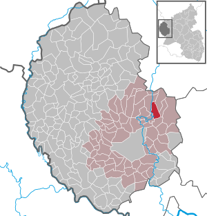
| Location of the local community Kyllburgweiler in the Eifelkreis Bitburg-Prüm | ||
  |
||

Kyllburgweiler [ ˈkɪl- ] is a municipality in the Eifelkreis Bitburg-Prüm in Rhineland-Palatinate . It belongs to the Verbandsgemeinde Bitburger Land .
geography
Kyllburgweiler is located in the Eifel on the Gindorfer plateau, which is part of the Gutland . The Landmauerhof residential area also belongs to Kyllburgweiler .
history
Kyllburgweiler was first mentioned in 1224 as Wilre (Latin: villaris = belonging to an estate ) and probably goes back to an early settlement in Roman times . Corresponding finds support this assumption. Until the end of the 18th century, the Cistercian convent of St. Thomas was the landlord in Kyllburgweiler. The sovereignty lay with Kurtrier . In 1569 the residents of Kyllburgweiler built a chapel from their own resources.
- Population development
The development of the population of the municipality of Kyllburgweiler, the values from 1871 to 1987 are based on censuses:
|
|
politics
Municipal council
The council in Kyllburgweiler consists of six council members, who in the local elections on May 26, 2019 in a majority vote were elected, and the honorary mayor as chairman.
coat of arms
|
|
Blazon : "Under a silver shield head, inside a blue sword with a golden hilt, in black a diagonal, red-and-white shafted bar." |
| Justification for the coat of arms: The red and white bar is to be understood as an indication of the rule of the Cistercian convent of St. Thomas . The old chapel in Kyllburgweiler traced back to the earlier patronage of St. Lucia , whose attribute is the sword. |
Attractions
- Various road and penance crosses, the oldest from 1634, can be found in the Kyllburgweiler district.
- The St. Wendelinus Chapel, dating back to the 16th century, is still owned by the local community today.
Web links
- Local community Kyllburgweiler on the website of the Verbandsgemeinde Bitburger Land
- To search for cultural assets of the local community Kyllburgweiler in the database of cultural assets in the Trier region .
- Short portrait of Kyllburgweiler ( memento from February 12, 2013 in the web archive archive.today ) at Hierzuland , SWR television
Individual evidence
- ↑ State Statistical Office of Rhineland-Palatinate - population status 2019, districts, communities, association communities ( help on this ).
- ↑ State Statistical Office Rhineland-Palatinate (ed.): Official directory of the municipalities and parts of the municipality. Status: January 2019 [ Version 2020 is available. ] . S. 107 (PDF; 3 MB).
- ↑ State Statistical Office Rhineland-Palatinate: Regional data.
- ^ The Regional Returning Officer Rhineland-Palatinate: Local elections 2019, city and municipal council elections
Bath | Balesfeld | Baustert | Bettingen | Bickendorf | Biersdorf am See | Birtlingen | Brecht | Brimingen | Burbach | Dahlem | Dockendorf | Dudeldorf | Echtershausen | Ehlenz | Enzen | Esslingen | Etteldorf | Feilsdorf | Flowem | Gindorf | Gondorf | Gransdorf | Halsdorf | Hamm | Heilenbach | Hütterscheid | Hüttingen an der Kyll | Idenheim | Idesheim | Ingendorf | Kyllburg | Kyllburgweiler | Ließem | Malberg | Malberg soft | Meckel | Messerich | Metterich | Mülbach | Nattenheim | Neidenbach | Neuheilenbach | Niederstedem | Niederweiler | Oberkail | Oberstedem | Oberweiler | Oberweis | Olsdorf | Orsfeld | Pickleneem | Rittersdorf | Röhl | Saint Thomas | Sharply cheap | Schleid | Seffern | Seffer soft | Field of being | Steinborn | Stockem | Sülm | Trimport | Usch | Wettlingen | Wiersdorf | Wilsecker | Wissmannsdorf | Wolsfeld | Zendscheid