
Wilsecker
| coat of arms | Germany map | |
|---|---|---|

|
Coordinates: 50 ° 2 ′ N , 6 ° 35 ′ E |
|
| Basic data | ||
| State : | Rhineland-Palatinate | |
| County : | Eifel district Bitburg-Prüm | |
| Association municipality : | Bitburger Land | |
| Height : | 339 m above sea level NHN | |
| Area : | 4.53 km 2 | |
| Residents: | 181 (Dec. 31, 2019) | |
| Population density : | 40 inhabitants per km 2 | |
| Postal code : | 54655 | |
| Area code : | 06563 | |
| License plate : | BIT, PRÜ | |
| Community key : | 07 2 32 135 | |
| Association administration address: | Hubert-Prim-Strasse 7 54634 Bitburg |
|
| Website : | ||
| Mayoress : | Marlene Burggraf | |
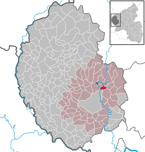
| Location of the local community Wilsecker in the Eifelkreis Bitburg-Prüm | ||
  |
||

Wilsecker is a municipality in the Eifelkreis Bitburg-Prüm in Rhineland-Palatinate . It belongs to the Verbandsgemeinde Bitburger Land .
geography
The local community is located in the Eifel , about 1 km south of Kyllburg . Wilsecker to include the residential places ACHTERHOF, Buchenhof, House Bertert, Heidhof, Nikolaushof and Zwengelshof.
history
The place was first mentioned in 893 as "Willesacger". In 1563 the village comprised 10, in 1684 seven fireplaces .
Until the end of the 18th century, the place belonged to the office of Kyllburg in the Electorate of Trier . After taking possession of the left bank of the Rhine (1794) and taking over the French administrative structures (1798), Wilsecker belonged to Mairie Kyllburg in the canton of the same name , which administratively belonged to the arrondissement of Prüm in the Saardepartement .
Due to the resolutions at the Congress of Vienna , the region came to the Kingdom of Prussia in 1815 . Under the Prussian administration, Wilsecker belonged to the Kyllburg mayor's office in the Bitburg district, newly established in 1816, in the Trier administrative district .
- Population development
The development of the population of Wilsecker, the values from 1871 to 1987 are based on censuses.
|
|

politics
Municipal council
The council in Wilsecker consists of six council members, who in the local elections on May 26, 2019 in a majority vote were elected, and the volunteer local mayor as chairman.
partnership
Since 2007 there has been a partnership with the "52 EMS Armament Flight" unit at Airbase Spangdahlem . The desire for a partnership came from the American side in order to bring the German way of life, customs, i.e. country and people closer to the American citizens.
coat of arms
|
|
Blazon : "Under a red shield head with 3 golden balls, in gold a red diamond cross." |
| Foundation of the coat of arms: A church in Wilsecker is documented very early. Already in the Prüm property register of 1222 Caesarius mentions it as "sita in uilla appellatur willesacger" (located in the place called Willesacer). The patron saint of the church and the place is St. Nicholas. He has 3 golden balls as an attribute. The von Wilsacker / Wilsecker family, including Cono von Wilsacker in 1356, had 5 (3: 2) red diamonds as a coat of arms in gold. |
Culture and sights
;_Nischenkreuz_Kyllburger_Typ_von_1623_a.jpg)
Buildings
- The current church is dedicated to St. Nicholas and was inaugurated in 1862. A statue of the namesake stands on the altar. This altar comes from the Bader Church and came to Wilsecker between 1907 and 1921 after the church there was rebuilt. A figure of St. Eligius , the patron of the Bader Church, is carved into the antependium . In the middle niche of the wooden structure stands a figure of the painful mother with her dead son.
- There are several crossroads across the municipality .
- The town center is the location of several historic houses and old farms
See also: List of cultural monuments in Wilsecker
Green spaces and recreation
- Wilsecker Linde stands northeast of the village, Gewann In Kuhnert
- The two main hiking trails of the Eifelverein No. 4 from Kreuzau (Düren) to Trier and No. 16 from Alf on the Moselle to Neuerburg run through the village . Both routes lead the hiker coming from Kyllburg after approx. 2 km on a somewhat strenuous, steep path to the natural monument "Wilsecker Linde". The Kyllburg hiking trail C2 leads to the linden tree and from there via Etteldorf to Wilsecker.
See also: List of natural monuments in Wilsecker
Regular events
- Annual fair or parish fair
- Traditional rattling or rattling on Good Friday and Holy Saturday
- Hut burning on the first weekend after Ash Wednesday (so-called Scheef Sunday)
Economy and Infrastructure
The Bundesautobahn 60 crosses the Kyll near Wilsecker . The Kylltal Bridge has a total length of 645 m and a height of 93 m above ground. The span is 223 m, making the bridge the largest prestressed concrete arch bridge in Germany.
See also: Wilsecker Tunnel
literature
- Ernst Wackenroder (arr.): The art monuments of the Bitburg district (= Paul Clemen [Hrsg.]: The art monuments of the Rhine province . Volume 12 / I ). Trier 1983, ISBN 3-88915-006-3 , p. 133, 162–163 (315 p., With 12 plates and 227 illustrations in the text. Reprinted by the Schwann edition, Düsseldorf 1927).
Web links
- Local community Wilsecker
- Local community Wilsecker on the website of the Verbandsgemeinde Bitburger Land
- To search for cultural assets of the local community Wilsecker in the database of cultural assets in the Trier region .
Individual evidence
- ↑ State Statistical Office of Rhineland-Palatinate - population status 2019, districts, communities, association communities ( help on this ).
- ↑ State Statistical Office Rhineland-Palatinate (ed.): Official directory of the municipalities and parts of the municipality. Status: January 2019 [ Version 2020 is available. ] . S. 109 (PDF; 3 MB).
- ^ Wilhelm Fabricius : Explanations of the historical atlas of the Rhine province, 2nd volume: The map of 1789. Bonn 1898, p. 151.
- ^ A b Georg Bärsch : Description of the government district of Trier: according to official sources ... , Volume 2, Lintz, 1846, p. 22 ( Google Books )
- ↑ State Statistical Office Rhineland-Palatinate - regional data
- ^ The Regional Returning Officer Rhineland-Palatinate: Local elections 2019, city and municipal council elections
- ↑ Declaration of the coat of arms. Retrieved August 1, 2017 .
- ↑ Wilsecker hiking route. Retrieved February 2, 2018 .
- ↑ Hüttenbrennen in the Eifel. Retrieved May 1, 2016 .
- ↑ Hut Sunday in the Eifel. Retrieved August 10, 2017 .
Bath | Balesfeld | Baustert | Bettingen | Bickendorf | Biersdorf am See | Birtlingen | Brecht | Brimingen | Burbach | Dahlem | Dockendorf | Dudeldorf | Echtershausen | Ehlenz | Enzen | Esslingen | Etteldorf | Feilsdorf | Flowem | Gindorf | Gondorf | Gransdorf | Halsdorf | Hamm | Heilenbach | Hütterscheid | Hüttingen an der Kyll | Idenheim | Idesheim | Ingendorf | Kyllburg | Kyllburgweiler | Ließem | Malberg | Malberg soft | Meckel | Messerich | Metterich | Mülbach | Nattenheim | Neidenbach | Neuheilenbach | Niederstedem | Niederweiler | Oberkail | Oberstedem | Oberweiler | Oberweis | Olsdorf | Orsfeld | Pickleneem | Rittersdorf | Röhl | Saint Thomas | Sharply cheap | Schleid | Seffern | Seffer soft | Field of being | Steinborn | Stockem | Sülm | Trimport | Usch | Wettlingen | Wiersdorf | Wilsecker | Wissmannsdorf | Wolsfeld | Zendscheid