
Balesfeld
| coat of arms | Germany map | |
|---|---|---|

|
Coordinates: 50 ° 6 ' N , 6 ° 32' E |
|
| Basic data | ||
| State : | Rhineland-Palatinate | |
| County : | Eifel district Bitburg-Prüm | |
| Association municipality : | Bitburger Land | |
| Height : | 435 m above sea level NHN | |
| Area : | 2.35 km 2 | |
| Residents: | 195 (Dec. 31, 2019) | |
| Population density : | 83 inhabitants per km 2 | |
| Postal code : | 54597 | |
| Area code : | 06553 | |
| License plate : | BIT, PRÜ | |
| Community key : | 07 2 32 203 | |
| LOCODE : | DE BQD | |
| Association administration address: | Hubert-Prim-Strasse 7 54634 Bitburg |
|
| Website : | ||
| Local Mayor : | Ernst Nober | |
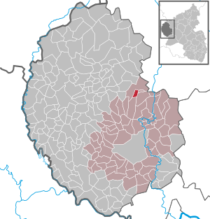
| Location of the local community Balesfeld in the Eifelkreis Bitburg-Prüm | ||
  |
||

_01.jpg)
Balesfeld in the Kyllburger Waldeifel is a municipality in the Eifelkreis Bitburg-Prüm in Rhineland-Palatinate . Since 1 July 2014, it is one municipality Bitburger Land at.
geography

Balesfeld is located in the Neidenbacher sandstone plateau , which belongs to the Eastern Eifel . The two residential areas of Hof and Neuenweiher to the north of the main town also belong to the community . The Balesfeld Bach flows through Balesfeld .
history
The Kyllburger Waldeifel was settled early. The Roman road from Trier to Cologne ran over the heights between Neidenbach and Balesfeld. It can still be seen in the terrain and on topographic maps.
Balesfeld was first mentioned in a document in the Prümer Urbar in 893 as "Baldenshart". The first two syllables of the place name go back to the personal name Baldin; the last syllable "hardt" means mountain forest.
Until 1576 Balesfeld belonged to the territory of the Prüm Abbey . The Trier Elector Jakob III. von Eltz took over the Prüm territory, from then until the end of the 18th century the place belonged to the electorate of Trier and to the Seffern mayor within the Prüm office .
In 1794 French revolutionary troops occupied the left bank of the Rhine . Under French administration , Balesfeld was assigned to the canton of Kyllburg in 1798 , which belonged to the Prüm arrondissement in the Saardepartement . Balesfeld belonged to the Mairie Burbach .
Due to the resolutions passed at the Congress of Vienna , the region became part of the Kingdom of Prussia in 1815 . Under the Prussian administration, Balesfeld belonged to the mayor's office of Burbach in the newly formed district of Prüm in the Trier administrative district .
- Population development
The development of the population of Balesfeld, the values from 1871 to 1987 are based on censuses:
|
|
politics
Municipal council
The municipal council in Balesfeld consists of six council members, who were elected in the local elections on May 26, 2019 in a majority vote, and the honorary local mayor as chairman.
Local mayor
- Ernst Nober (elected at the constituent meeting of the municipal council on June 25, 2019)
coat of arms
|
|
Blazon : "Divided from silver over red by a gusset cut, three red lilies above, the silver crook of a bishop's staff below." |
| Justification of the coat of arms: The bishop's staff stands for the former affiliation to the Prüm Abbey , the colors red and silver to the Electorate of Trier . |
See also
Web links
- Local community Balesfeld on the website of the Verbandsgemeinde Bitburger Land
- To search for cultural assets of the local community Balesfeld in the database of cultural assets in the Trier region .
- Brief portrait of Balesfeld ( memento from August 1, 2014 in the web archive archive.today ) on Hierzuland , SWR television
- Literature about Balesfeld in the Rhineland-Palatinate State Bibliography
Individual evidence
- ↑ a b State Statistical Office of Rhineland-Palatinate - population status 2019, districts, municipalities, association communities ( help on this ).
- ↑ State Statistical Office Rhineland-Palatinate (ed.): Official directory of the municipalities and parts of the municipality. Status: January 2019 [ Version 2020 is available. ] . S. 109 (PDF; 3 MB).
- ^ Johann Friedrich Schannat , Georg Bärsch : Eiflia illustrata or geographical and historical description of the Eifel. Volume 3, Issue 2, Part 1, Mayer, 1854, p. 218 ( Google Books )
- ^ Georg Bärsch : Description of the government district of Trier , Volume 2, Trier, Lintz, 1846, p. 62 ( Google Books )
- ↑ State Statistical Office Rhineland-Palatinate: Regional data.
- ^ The Regional Returning Officer Rhineland-Palatinate: Local elections 2019, city and municipal council elections. Retrieved August 13, 2019 .
- ↑ Description of the coat of arms on the website of the Bitburger Land association
Bath | Balesfeld | Baustert | Bettingen | Bickendorf | Biersdorf am See | Birtlingen | Brecht | Brimingen | Burbach | Dahlem | Dockendorf | Dudeldorf | Echtershausen | Ehlenz | Enzen | Esslingen | Etteldorf | Feilsdorf | Flowem | Gindorf | Gondorf | Gransdorf | Halsdorf | Hamm | Heilenbach | Hütterscheid | Hüttingen an der Kyll | Idenheim | Idesheim | Ingendorf | Kyllburg | Kyllburgweiler | Ließem | Malberg | Malberg soft | Meckel | Messerich | Metterich | Mülbach | Nattenheim | Neidenbach | Neuheilenbach | Niederstedem | Niederweiler | Oberkail | Oberstedem | Oberweiler | Oberweis | Olsdorf | Orsfeld | Pickleneem | Rittersdorf | Röhl | Saint Thomas | Sharply cheap | Schleid | Seffern | Seffer soft | Field of being | Steinborn | Stockem | Sülm | Trimport | Usch | Wettlingen | Wiersdorf | Wilsecker | Wissmannsdorf | Wolsfeld | Zendscheid