
Oberweiler (Eifel)
| coat of arms | Germany map | |
|---|---|---|

|
Coordinates: 50 ° 3 ' N , 6 ° 27' E |
|
| Basic data | ||
| State : | Rhineland-Palatinate | |
| County : | Eifel district Bitburg-Prüm | |
| Association municipality : | Bitburger Land | |
| Height : | 430 m above sea level NHN | |
| Area : | 5.31 km 2 | |
| Residents: | 166 (Dec. 31, 2019) | |
| Population density : | 31 inhabitants per km 2 | |
| Postal code : | 54636 | |
| Area code : | 06569 | |
| License plate : | BIT, PRÜ | |
| Community key : | 07 2 32 098 | |
| Community structure: | 2 districts | |
| Association administration address: | Hubert-Prim-Strasse 7 54634 Bitburg |
|
| Website : | ||
| Local Mayor : | Nico Steinbach ( SPD ) | |
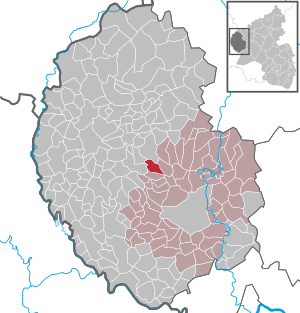
| Location of the local community of Oberweiler in the Eifel district of Bitburg-Prüm | ||
  |
||


Oberweiler is a municipality in the Eifelkreis Bitburg-Prüm in Rhineland-Palatinate . It belongs to the Verbandsgemeinde Bitburger Land .
geography
Oberweiler is located in the southwest Eifel approx. 15 km northwest of the district town of Bitburg . The community area extends on the ridge between Nims and Prüm and is drained by the Finkenbach. 38.2% of the 5.31 km² municipal area is a comparatively small proportion of agricultural land , 54.7% consists of forest.
The Beifels, Oberweiler and Waxweiler Strasse residential areas also belong to Oberweiler.
history
A fortification with moats on the "Ritschberg", which originally stood in the Beifels district, is evidence of pre-Christian times . The first written mention of the place as "Wilre Juxta Ham" comes from the year 1257, whereby this name together stood for the now separate places Oberweiler and Niederweiler. The place name alone could be proven for 1473, when it was still operating as "Oberwiller". At that time, the village consisted of five households, as can be seen in the Luxembourg fire place directory . From the Middle Ages on, the “Beifels” farm was located near Oberweiler, which was destroyed in a fire in 1962.
As a subordinate rule, Oberweiler belonged to the Duchy of Luxembourg until the French era at the end of the 18th century . It was administered by the Mairie and later mayor of Biersdorf , which was incorporated into the mayor's office of Bickendorf in 1856 (renamed to Amt Bickendorf in 1927). The latter was merged with four other offices to form the Verbandsgemeinde Bitburg-Land in 1970 as part of the Rhineland-Palatinate municipal reform.
On July 1, 1967, the previously independent municipality of Beifels was incorporated with the last two inhabitants.
- Population development
The development of the population of Oberweiler, the values from 1871 to 1987 are based on censuses.
|
|
politics
Municipal council
The municipal council in Oberweiler consists of six council members, who were elected by a majority vote in the local elections on May 26, 2019 , and the honorary local mayor as chairman.
coat of arms
|
|
|
|
Justification of the coat of arms: The three lilies in the head of the shield indicate the lords of the von Heisgen family.
The patron saint of the chapel is St. Hubertus, who has a deer antler with a cross as an attribute. |
Culture and sights
Buildings
- Catholic branch church St. Hubertus from 1950.
- Nearby is the private Merkeshausen Castle from 1892 on the banks of the Prüm. ⊙
)_01.jpg)
See also: List of cultural monuments in Oberweiler
Green spaces and recreation
- Accident cross on the main road. The cross recalls a tragic accident. In 1806, the Greten couple had a fatal accident when their team of oxen ran away.
- Memorial to the war victims at the cemetery
- Hiking routes in and around Oberweiler
_01.jpg)
Regular events
- Annual fair or parish fair . The Hubertus Festival takes place at the beginning of November.
- Autumn festival - in October, the chapel's friends' association invites you to the autumn festival in the parish hall.
- Traditional rattling or rattling on Good Friday and Holy Saturday
- Hut burning on the first weekend after Ash Wednesday (so-called Scheef Sunday)
literature
- Ernst Wackenroder (arr.): The art monuments of the Bitburg district (= Paul Clemen [Hrsg.]: The art monuments of the Rhine province . Volume 12 / I ). Trier 1983, ISBN 3-88915-006-3 , p. 91–92 (315 p., With 12 plates and 227 illustrations in the text. Reprinted by the Schwann edition, Düsseldorf 1927).
Web links
- Homepage of the local community Oberweiler
- Ortgemeinde Oberweiler on the website of the Verbandsgemeinde Bitburger Land
- To search for cultural assets of the local community Oberweiler (Eifel) in the database of cultural assets in the Trier region .
Individual evidence
- ↑ State Statistical Office of Rhineland-Palatinate - population status 2019, districts, communities, association communities ( help on this ).
- ↑ State Statistical Office Rhineland-Palatinate (ed.): Official directory of the municipalities and parts of the municipality. Status: January 2019 [ Version 2020 is available. ] . S. 108 (PDF; 3 MB).
- ↑ State Statistical Office Rhineland-Palatinate: Regional data.
- ^ The Regional Returning Officer Rhineland-Palatinate: Local elections 2019, city and municipal council elections
- ↑ Declaration of the coat of arms of Oberweiler
- ↑ Hiking route Wolsfeld Hiking 60 plus. Retrieved February 2, 2018 .
- ↑ Hüttenbrennen in the Eifel. Retrieved May 1, 2016 .
- ↑ Hut Sunday in the Eifel. Retrieved August 10, 2017 .
Bath | Balesfeld | Baustert | Bettingen | Bickendorf | Biersdorf am See | Birtlingen | Brecht | Brimingen | Burbach | Dahlem | Dockendorf | Dudeldorf | Echtershausen | Ehlenz | Enzen | Esslingen | Etteldorf | Feilsdorf | Flowem | Gindorf | Gondorf | Gransdorf | Halsdorf | Hamm | Heilenbach | Hütterscheid | Hüttingen an der Kyll | Idenheim | Idesheim | Ingendorf | Kyllburg | Kyllburgweiler | Ließem | Malberg | Malberg soft | Meckel | Messerich | Metterich | Mülbach | Nattenheim | Neidenbach | Neuheilenbach | Niederstedem | Niederweiler | Oberkail | Oberstedem | Oberweiler | Oberweis | Olsdorf | Orsfeld | Pickleneem | Rittersdorf | Röhl | Saint Thomas | Sharply cheap | Schleid | Seffern | Seffer soft | Field of being | Steinborn | Stockem | Sülm | Trimport | Usch | Wettlingen | Wiersdorf | Wilsecker | Wissmannsdorf | Wolsfeld | Zendscheid