
Seffern
| coat of arms | Germany map | |
|---|---|---|

|
Coordinates: 50 ° 4 ′ N , 6 ° 30 ′ E |
|
| Basic data | ||
| State : | Rhineland-Palatinate | |
| County : | Eifel district Bitburg-Prüm | |
| Association municipality : | Bitburger Land | |
| Height : | 370 m above sea level NHN | |
| Area : | 4.92 km 2 | |
| Residents: | 295 (Dec. 31, 2019) | |
| Population density : | 60 inhabitants per km 2 | |
| Postal code : | 54636 | |
| Area code : | 06569 | |
| License plate : | BIT, PRÜ | |
| Community key : | 07 2 32 119 | |
| Association administration address: | Hubert-Prim-Strasse 7 54634 Bitburg |
|
| Website : | ||
| Local Mayor : | Michael Mueller | |
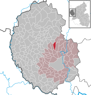
| Location of the local community Seffern in the Eifelkreis Bitburg-Prüm | ||
  |
||


Seffern is a municipality in the Eifelkreis Bitburg-Prüm in Rhineland-Palatinate . It belongs to the Verbandsgemeinde Bitburger Land .
geography
Seffern is located in the South West Eifel , about ten kilometers north of the center of the district town of Bitburg . The municipality is traversed by the Nims and the Balesfelder Bach and extends in the valley of these two rivers. The altitude varies between 360 m above sea level. NHN and 500 m above sea level NHN . Of the 4.92 km² area, a relatively large proportion of 52% is forested, only 32% are designated as agricultural land . The next junction on the Bundesautobahn 60 is Bitburg only 5 km southeast of Seffern. The former federal highway 51 runs directly to the west of the village, and since the opening of the A 60 it has been graduated to state highway 5 . The Glattbach-Nack and Berghof residential areas also belong to Seffern .
history
The remains of a country estate built around 200–375 in 1951 bear witness to the settlement of the municipality by the Romans . The mining of red sandstone, which has been carried out until recently , also took place in Roman times.
The place was first mentioned in a document under the name "Seferne" 893 in the Prümer Urbar . Until 1576, Seffern was under the rule of the Reichsabbey of Prüm and by the end of the 18th century under that of Kurtrier . As a court district or mayor's office , it was an administrative center within the Prüm office . Ten villages belonged to the Seffern mayor's office.
From 1798 to 1814 the place belonged to the canton Kyllburg in the French Saardepartement . Around 1800 Seffern became the main town ( chef-lieu ) of a Mairie . A participant in the Congress of Vienna agreements reached the region in 1815 came to the Kingdom of Prussia , Seffern became the seat of mayor in Bitburg the administrative district of Trier , who from 1822 to the Rhine province belonged. The mayor's office Seffern was incorporated into the mayor's office Bickendorf (renamed to Amt Bickendorf in 1927), from which the Verbandsgemeinde Bitburg-Land arose in 1970 in the course of the Rhineland-Palatinate functional and territorial reform with four additional offices . The municipality has been part of the Bitburger Land association since 2014 .
- Population development
The number of households on record increased from 1473 when six were counted to eight households in 1541. Since the beginning of the 19th century (in 1815 the place had 291 inhabitants) the population has changed remarkably little and is mostly in the area above the 300 inhabitant limit. Since the highest level reached in 1871 with 428 inhabitants, the number has decreased somewhat, to around 330 today.
The development of the population of Seffern, the values from 1871 to 1987 are based on censuses:
|
|
Municipal council
The municipal council in Seffern consists of eight council members, who were elected by a majority vote in the local elections on May 26, 2019 , and the honorary local mayor as chairman.
Attractions
The stone bridge over the Nims with sandstone crosses and a stone figure of the bridge saint Johann von Nepomuk , built in 1823, is one of the few remaining baroque bridges in Rhineland-Palatinate. Religious buildings are the parish church of St. Lawrence from 1854 and the Chapel of St. Mary of 1891. The municipal area runs a Stationenweg from the first half of the 18th century, to the local situation of the Final Chapel at Sefferweich leads.
See also: List of cultural monuments in Seffern
Public facilities
The community is the location of a primary school and a kindergarten . Ecclesiastically, it is the seat of a parish which , in addition to Seffern, also includes the parishes of Heilenbach , Schleid and Sefferoft .
Personalities
- Werner Heinz (* 1950), sports manager born in Seffern
Web links
- Local community Seffern on the website of the Verbandsgemeinde Bitburger Land
- To search for cultural assets of the Seffern community in the database of cultural assets in the Trier region .
Individual evidence
- ↑ State Statistical Office of Rhineland-Palatinate - population status 2019, districts, communities, association communities ( help on this ).
- ↑ State Statistical Office Rhineland-Palatinate (ed.): Official directory of the municipalities and parts of the municipality. Status: January 2019 [ Version 2020 is available. ] . S. 109 (PDF; 3 MB).
- ↑ State Statistical Office Rhineland-Palatinate: Regional data.
- ^ The Regional Returning Officer Rhineland-Palatinate: Local elections 2019, city and municipal council elections.
Bath | Balesfeld | Baustert | Bettingen | Bickendorf | Biersdorf am See | Birtlingen | Brecht | Brimingen | Burbach | Dahlem | Dockendorf | Dudeldorf | Echtershausen | Ehlenz | Enzen | Esslingen | Etteldorf | Feilsdorf | Flowem | Gindorf | Gondorf | Gransdorf | Halsdorf | Hamm | Heilenbach | Hütterscheid | Hüttingen an der Kyll | Idenheim | Idesheim | Ingendorf | Kyllburg | Kyllburgweiler | Ließem | Malberg | Malberg soft | Meckel | Messerich | Metterich | Mülbach | Nattenheim | Neidenbach | Neuheilenbach | Niederstedem | Niederweiler | Oberkail | Oberstedem | Oberweiler | Oberweis | Olsdorf | Orsfeld | Pickleneem | Rittersdorf | Röhl | Saint Thomas | Sharply cheap | Schleid | Seffern | Seffer soft | Field of being | Steinborn | Stockem | Sülm | Trimport | Usch | Wettlingen | Wiersdorf | Wilsecker | Wissmannsdorf | Wolsfeld | Zendscheid