San Mateo County
 San Mateo County Government Center |
|
| administration | |
|---|---|
| US state : | California |
| Administrative headquarters : | Redwood City |
| Foundation : | 1856 |
| Made up from: | San Francisco County |
| Demographics | |
| Residents : | 718,451 (2010) |
| Population density : | 617.8 inhabitants / km 2 |
| geography | |
| Total area : | 1919 km² |
| Water surface : | 756 km² |
| map | |
| Website : www.co.sanmateo.ca.us | |
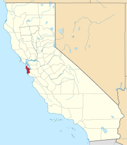
The San Mateo County is a county in the state of California in the area of San Francisco Bay . The county seat is Redwood City , the largest city of San Mateo .
geography
The county covers an area of 1919 km² . It covers most of the San Francisco Peninsula south of San Francisco and north of Santa Clara County . The International Airport of San Francisco is located in the northern part of the county and the Silicon Valley start in the southern part. Año Nuevo Island is located in the far south of the county .
history
San Mateo County was formed in 1856 from parts of San Francisco County . It was named after Saint Matthew . St. Matthew appears as a place name for the first time in 1776. Until 1850 the place name was San Matheo .
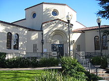
The Burlingame Public Library is located in the town of Burlingame, San Mateo County . It was founded by the established municipal ordinance on October 11, 1909. After the Loma Prieta earthquake in 1989 , the city approved the issuance of bonds for reconstruction. The library has won awards for its architecture and was featured in the Library Journal.
There are two National Historic Landmarks in San Mateo County , Ralston Hall and the San Francisco Bay Discovery Site , which commemorates the explorer Gaspar de Portolà . A total of 52 buildings and sites in the county are listed on the National Register of Historic Places .
Demographic data
| growth of population | |||
|---|---|---|---|
| Census | Residents | ± in% | |
| 1860 | 3214 | - | |
| 1870 | 6635 | 106.4% | |
| 1880 | 8669 | 30.7% | |
| 1890 | 10,087 | 16.4% | |
| 1900 | 12.094 | 19.9% | |
| 1910 | 26,585 | 119.8% | |
| 1920 | 36,781 | 38.4% | |
| 1930 | 77,405 | 110.4% | |
| 1940 | 111,782 | 44.4% | |
| 1950 | 235,659 | 110.8% | |
| 1960 | 444,387 | 88.6% | |
| 1970 | 556.234 | 25.2% | |
| 1980 | 587,329 | 5.6% | |
| 1990 | 649.623 | 10.6% | |
| 2000 | 707.161 | 8.9% | |
| 2010 | 718.451 | 1.6% | |
| Before 1900
1900–1990 2000 + 2010 |
|||
According to the 2000 census , San Mateo County had 707,161 people. There were 254,103 households and 171,265 families. The population density was 608 inhabitants per square kilometer. The racial the population was composed of 59.49% White, 3.51% African American, 0.44% Native American, 20.04% Asian, 1.33% Pacific Islander, and 10.17% other races Groups; 5.02% from two or more races. Hispanic or Latino of any race was 21.88% of the population.
Of the 254,103 households, 31.10% had children and adolescents under the age of 18 living with them. 53.00% were married couples living together, 10.10% were single mothers. 32.60% were not families. 24.60% are single households and 8.40% have someone who is 65 years of age or older. The average household size was 2.74 and the average family size was 3.29 people.
For the entire county, the population was composed of 22.90% residents under 18 years of age, 7.90% between 18 and 24 years of age, 33.20% between 25 and 44 years of age, and 23.50% between 45 and 64 years of age 12.50% were 65 years of age or over. The median age was 37 years. For every 100 females there were 97.80 males, and for every 100 females aged 18 and over there were 95.60 males.
The median income for a household in the county is $ 70,819 , and the median income for a family is $ 80,737. Males had a median income of $ 51,342 versus $ 40,383 for females. The per capita income was $ 36,045. 5.80% percent of the population and 3.50% of families are below the poverty line. 6.00% of these were under 18 years of age and 5.10% were 65 years of age or older.
Individual evidence
- ↑ GNIS-ID: 277305. Retrieved on February 22, 2011 (English).
- ↑ Listing of National Historic Landmarks by State: California . National Park Service , accessed August 27, 2017.
- ↑ Search mask database in the National Register Information System. National Park Service , accessed August 27, 2017.
- ↑ US Census Bureau - Census of Population and Housing . Retrieved March 15, 2011
- ↑ Extract from Census.gov . Retrieved February 28, 2011
- ↑ Extract from census.gov (2000 + 2010). Accessed April 2, 2012
Web links
Coordinates: 37 ° 26 ' N , 122 ° 22' W


