List of counties in California
The US state of California is now divided into 58 counties . They are responsible for all elections, property taxes, public notarizations and local jurisdiction. It also uses the sheriff as a police body, who is responsible for enforcing the law outside of the independent cities. In San Francisco, the city and county government are merged. The county sheriff is still primarily responsible for managing the prison.
California's symbol is CA and the FIPS code is 06 .
Establishment of the first counties of California
On January 4, 1850, the California Constitutional Commission proposed the creation of 18 counties. These first counties were Benicia, Butte, Fremont, Los Angeles, Mariposa, Monterey, Mount Diablo, Oro, Redding, Sacramento, San Diego, San Francisco, San Joaquin, San Jose, San Luis Obispo, Santa Barbara, Sonoma, and Sutter. On April 22nd, Branciforte, Calaveras, Coloma, Colusi, Marin, Mendocino, Napa, Trinity and Yuba were added, and Benicia was renamed Solano, Coloma in El Dorado, Fremont in Yolo, Mt.Diablo in Contra Costa, San Jose in Santa Clara, Oro in Tuolumne and Redding in Shasta. The actions of the first legislature of California then included the further renaming of Branciforte County in Santa Cruz, Colusi in Colusa and Yola in Yolo.
The youngest county in California is Imperial County, established in 1907.
table
|
county |
FIPS code |
County Seat |
Founded |
origin |
Origin of name |
population |
surface |
map |
|---|---|---|---|---|---|---|---|---|
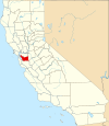
| Alameda County | 001 | Oakland | 1853 | Parts of Contra Costa County and Santa Clara County. | A Spanish word for a score in a poplar style | 1,474,368 | 738 sq mi (1,911 km² ) |
|
| Alpine County | 003 | Markleeville | 1864 | Amador County, El Dorado County, Calaveras County, Mono County, Tuolumne County. | Alps | 1,061 | 739 sq mi (1,914 km² ) |

|
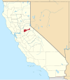
| Amador County | 005 | Jackson | 1854 | Calaveras County. | Jose Maria Amador (1794–1883), soldier, rancher and miner. The word means lover in Spanish | 38,238 | 1,536 km² ( 593 sq mi) |
|
| Butte County | 007 | Oroville | 1850 | One of the 27 originally established counties. | The Sutter Buttes mountain range , which was mistakenly believed to be within this county | 220.337 | 4,248 km² ( 1,640 sq mi) |

|
| Calaveras County | 009 | San Andreas | 1850 | One of the 27 originally established counties. | Calaveras River , whose name means skull in Spanish | 46,843 | 2,642 km² ( 1,020 sq mi) |

|
| Colusa County | 011 | Colusa | 1850 | One of the 27 originally established counties. | From two lands of Mexico; Coluses (1844) and Colus (1845). | 21,204 | 2,981 km² ( 1,151 sq mi) |

|
| Contra Costa County | 013 | Martinez | 1850 | One of the 27 originally established counties. | Spanish for opposite coast because Contra Costa is opposite San Francisco County | 1,029,703 | 1,865 km² ( 720 sq mi) |

|
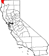
| Del Norte County | 015 | Crescent City | 1857 | Klamath County. | Spanish for north because it is the northernmost county | 29,100 | 2,611 km² ( 1,008 sq mi) |
|
| El Dorado County | 017 | Placerville | 1850 | One of the 27 originally established counties. | from the mythical Eldorado , as the area played a major role in the California gold rush . | 176.075 | 4,434 km² ( 1,712 sq mi) |

|
| Fresno County | 019 | Fresno | 1856 | Mariposa Counties, Merced Counties, and Tulare Counties. | Fresno Creek, Fresno means ash in Spanish | 909.153 | 15,444 km² ( 5,963 sq mi) |

|
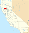
| Glenn County | 021 | Willows | 1891 | Colusa County. | Hugh J. Glenn (1824-1883), California businessman and politician | 28,237 | 3,406 km² ( 1,315 sq mi) |
|
| Humboldt County | 023 | Eureka | 1853 | Trinity County. | Humboldt Bay , after Baron Alexander von Humboldt (1769-1859), naturalist and explorer. | 129,000 | 9,254 km² ( 3,573 sq mi) |

|
| Imperial County | 025 | El Centro | 1907 | San Diego County | After the Imperial Valley, which takes its name from the Imperial Land Company has | 163.972 | 10,813 km² ( 4,175 sq mi) |

|
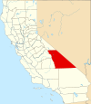
| Inyo County | 027 | Independence | 1866 | Mono County and Tulare County. | From an Indian word for where the great spirit dwells | 17,136 | 26,397 km² ( 10,192 sq mi) |
|
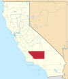
| Kern County | 029 | Bakersfield | 1866 | Los Angeles County and Tulare County. | Kern River , after Edward Kern , cartographer during the expedition of General John C. Frémont in 1845 | 800,458 | 21,088 km² ( 8,142 sq mi) |
|
| Kings County | 031 | Hanford | 1893 | Tulare County. | Kings River . | 149,518 | 3,600 km² ( 1,390 sq mi) |

|
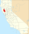
| Lake County | 033 | Lakeport | 1861 | Napa County. | Clear Lake, California . | 64,866 | 3,258 km² ( 1,258 sq mi) |
|
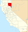
| Lassen County | 035 | Susanville | 1864 | Plumas Counties and Shasta Counties and the now defunct Lake County in Nevada | Peter Lassen (1800-1859), Danish explorer | 34,574 | 11,805 km² ( 4,558 sq mi) |
|
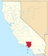
| Los Angeles County | 037 | los Angeles | 1850 | One of the 27 originally established counties. | Spanish for the Angels ; the Spanish galleons thought they would reach the sky if they reached the coast in the morning mist | 9,862,049 | 10,515 km² ( 4,060 sq mi) |
|
| Madera County | 039 | Madera | 1893 | Fresno County. | Spanish for wood or beams | 148.333 | 5,537 km² ( 2,138 sq mi) |

|
| Marin County | 041 | San Rafael | 1850 | One of the 27 originally established counties. | Controversial (see article), perhaps a mutilation of Marina as it is on San Francisco Bay. | 248,794 | 1,347 km² ( 520 sq mi) |

|
| Mariposa County | 043 | Mariposa | 1850 | One of the 27 originally established counties. | Spanish for butterfly | 17,976 | 3,758 km² ( 1,451 sq mi) |

|
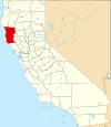
| Mendocino County | 045 | Ukiah | 1850 | One of the 27 originally established counties. | Cape Mendocino , perhaps after Antonio of Mendoza or Lorenzo Suárez of Mendoza , viceroys of New Spain | 86,221 | 9,088 km² ( 3,509 sq mi) |
|
| Merced County | 047 | Merced | 1855 | Mariposa County. | Merced River , from Spanish El Río de Nuestra Señora de la Merced , named during an expedition by Gabriel Moraga . | 246.117 | 4,996 km² ( 1,929 sq mi) |

|
| Modoc County | 049 | Alturas | 1874 | Siskiyou County. | Modoc Indians. | 9,184 | 10,215 km² ( 3,944 sq mi) |

|
| Mono County | 051 | Bridgeport | 1861 | Calaveras Counties, Fresno Counties, and Mariposa Counties. | Mono Paiute , an Indian tribe | 12,774 | 7,884 km² ( 3,044 sq mi) |

|
| Monterey County | 053 | Salinas | 1850 | One of the 27 originally established counties. | Monterey Bay . From the Spanish words for monte (hill) and rey (king) | 408.238 | 8,604 km² ( 3,322 sq mi) |

|
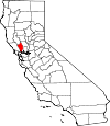
| Napa County | 055 | Napa | 1850 | One of the 27 originally established counties. | The Napans were an Indian tribe | 133,433 | 1,953 km² ( 754 sq mi) |
|
| Nevada County | 057 | Nevada City | 1851 | Yuba County. | Snowfall in Spanish | 97.118 | 2,481 km² ( 958 sq mi) |

|
| Orange County | 059 | Santa Ana | 1889 | Los Angeles County. | From the citrus fruit that was widely planted here when it was founded. | 3,010,759 | 2,046 km² ( 790 sq mi) |

|
| Placer County | 061 | Auburn | 1851 | Sutter County and Yuba County. | Small gold flakes that were found here during the gold rush. | 341.945 | 3,893 km² ( 1,503 sq mi) |

|
| Plumas County | 063 | Quincy | 1854 | Butte County. | Plumas means feathers in Spanish. | 20,275 | 6,615 km² ( 2,554 sq mi) |

|
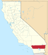
| Riverside County | 065 | Riverside | 1893 | San Bernardino County and San Diego County. | The city of Riverside | 2,100,516 | 18,669 km² ( 7,208 sq mi) |
|
| Sacramento County | 067 | Sacramento | 1850 | One of the 27 originally established counties. | Sacramento River , after the Spanish expression for the Most Holy Sacrament (the Eucharist ) | 1,394,154 | 2,502 km² ( 966 sq mi) |

|
| San Benito County | 069 | Hollister | 1874 | Monterey County. | Benedict of Nursia , Benito is a diminutive of Benedict | 54,699 | 3,597 km² ( 1,389 sq mi) |

|
| San Bernardino County | 071 | San Bernardino | 1853 | Los Angeles County. | Saint Bernard of Siena . San Bernardino is the largest county in the United States | 2,015,355 | 51,960 km² ( 20,062 sq mi) |

|
| San Diego County | 073 | San Diego | 1850 | One of the 27 originally established counties. | San Diego Bay , to San Diego de Alcalá | 3,001,072 | 10,888 km² ( 4,204 sq mi) |

|
| San Francisco County | 075 | San Francisco | 1850 | One of the 27 originally established counties. | Francis of Assisi , founder of the Franciscan order | 808.976 | 122 km² ( 47 sq mi) |

|
| San Joaquin County | 077 | Stockton | 1850 | One of the 27 originally established counties. | Saint Joachim , Father of Mary | 672,388 | 3,623 km² ( 1,399 sq mi) |

|
| San Luis Obispo County | 079 | San Luis Obispo | 1850 | One of the 27 originally established counties. | Spanish name of Bishop Ludwig of Toulouse | 265.297 | 8,557 km² ( 3,304 sq mi) |

|
| San Mateo County | 081 | Redwood City | 1856 | San Francisco County. | Spanish name of the evangelist Matthew | 712.690 | 1,163 km² ( 449 sq mi) |

|
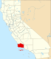
| Santa Barbara County | 083 | Santa Barbara | 1850 | One of the 27 originally established counties. | Barbara of Nicomedia | 405.396 | 7,091 km² ( 2,738 sq mi) |
|
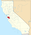
| Santa Clara County | 085 | San Jose | 1850 | One of the 27 originally established counties. | Clare of Assisi and the mission station in Santa Clara | 1,764,499 | 3,344 km² ( 1,291 sq mi) |
|
| Santa Cruz County | 087 | Santa Cruz | 1850 | One of the 27 originally established counties. | The city of Santa Cruz | 253.137 | 1,155 km² ( 446 sq mi) |

|
| Shasta County | 089 | Redding | 1850 | One of the 27 originally established counties. | To Mount Shasta , although this is actually not in it | 180.214 | 9,806 km² ( 3,786 sq mi) |

|
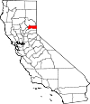
| Sierra County | 091 | Downieville | 1852 | Yuba County. | Spanish for mountain range | 3,263 | 2,468 km² ( 953 sq mi) |
|
| Siskiyou County | 093 | Yreka | 1852 | Shasta County and Klamath County. | Siskiyou Mountain Range ; The etymology of Siskiyou is controversial | 44,542 | 16,283 km² ( 6,287 sq mi) |

|
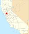
| Solano County | 095 | Fairfield | 1850 | One of the 27 originally established counties. | The Solanos were an Indian tribe | 407,515 | 2,145 km² ( 828 sq mi) |
|
| Sonoma County | 097 | Santa Rosa | 1850 | One of the 27 originally established counties. | After the place Sonoma | 466.741 | 4,082 km² ( 1,576 sq mi) |

|
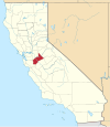
| Stanislaus County | 099 | Modesto | 1854 | Tuolumne County. | Named after Chief Stanislaus who fought the Mexicans in the 1820s | 510.694 | 3,872 km² ( 1,495 sq mi) |
|
| Sutter County | 101 | Yuba City | 1850 | One of the 27 originally established counties. | Johann August Sutter (1803–1880), Swiss pioneer, his ranch was originally called Nueva Helvetica , Latinized form for Switzerland | 92.207 | 1,562 km² ( 603 sq mi) |

|
| Tehama County | 103 | Red bluff | 1856 | Butte County, Colusa County, and Shasta County. | Arabicism in Spanish, meaning: hot lowlands | 61,550 | 7,643 km² ( 2,951 sq mi) |

|
| Trinity County | 105 | Weaverville | 1850 | Klamath County, one of the 27 originally established counties. | Trinity River , so named by Pierson B. Reading because he believed it would flow into Trinidad Bay . | 14,317 | 8,234 km² ( 3,179 sq mi) |

|
| Tulare County | 107 | Visalia | 1852 | Mariposa County. | Tulare Lake , a dry lake | 426.276 | 12,494 km² ( 4,824 sq mi) |

|
| Tuolumne County | 109 | Sonora | 1850 | One of the 27 originally established counties. | Tuolomnes Indians | 55,644 | 5,791 km² ( 2,236 sq mi) |

|
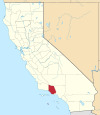
| Ventura County | 111 | Ventura | 1872 | Santa Barbara County. | Abbreviation of San Buenaventura , the Spanish name of Bonaventura | 797.740 | 4,781 km² ( 1,846 sq mi) |
|
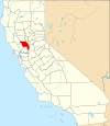
| Yolo County | 113 | Woodland | 1850 | One of the 27 originally established counties. | Yolans Indians | 197,658 | 2,621 km² ( 1,012 sq mi) |
|
| Yuba County | 115 | Marysville | 1850 | One of the 27 originally established counties. | The Yuba family owned lands in the Sacramento River Valley. | 73,067 | 1,632 km² ( 630 sq mi) |

|
Former counties
- Klamath County was spun off from part of Trinity County in 1851, and in 1874 it was split into Humboldt County and Siskiyou County, after parts of Del Norte had already merged in 1857.
- Pautah County was created in 1852 from a territory that actually belonged to Nevada because the State of California assumed Congress would reclassify the country accordingly, but it did not. Officially, the county that never existed was abolished in 1859.
Web links
Individual evidence
- ↑ EPA County FIPS Code Listing . In: EPA.gov . Retrieved February 23, 2008.
- ^ A b c National Association of Counties: NACo - Find a county . Archived from the original on September 23, 2012. Info: The archive link was automatically inserted and has not yet been checked. Please check the original and archive link according to the instructions and then remove this notice. Retrieved April 30, 2008.
- ^ US Census Bureau: County Population Estimates . Archived from the original on March 22, 2009. Info: The archive link was automatically inserted and has not yet been checked. Please check the original and archive link according to the instructions and then remove this notice. Retrieved March 30, 2009.
- ↑ Mariposa was originally the largest county, but its area has since been divided into twelve others: Fresno, Inyo, Kern, Kings, Los Angeles, Madera, Merced, Mono, San Benito, San Bernardino, San Luis Obispo, and Tulare.
