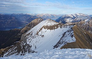
Latrejespitz
| Latrejespitz | ||
|---|---|---|
|
Latrejespitz from Dreispitz , to the left behind (green) the Morgenberghorn , Lake Thun and Lake Brienz |
||
| height | 2436 m above sea level M. | |
| location | Frutenland , Canton of Bern , Switzerland | |
| Mountains | Bernese Alps | |
| Coordinates | 625 323 / 160568 | |
|
|
||
The Latrejespitz is a peak in the Dreispitz massif in the Bernese Oberland .
location
The Latrejespitz is located on the main ridge of the massif, on the border between the communities Reichenbach im Kandertal and Aeschi bei Spiez , around 800 meters east-northeast from the main summit of the Dreispitz. In the east it slopes down towards Alp Latreje and in the northwest towards Alp Obersuld; both belong to the headwaters of Suld . The southern flank is drained by the Eggbach, which flows into the Kiental via Spiggenbach .
summit
The summit height is indicated on the Swiss national map as 2421 m, but this refers to a grassy pre-summit. This is followed by a rugged rock ridge, the highest point of which rises about 50 m southwest of the pre-summit at about 2430 m. The pre-summit can be reached on a demanding mountain hike, the highest point requires climbing.
literature
- Martin Gerber: Club Guide Berner Voralpen , 1997 SAC publishing house, page 313.

