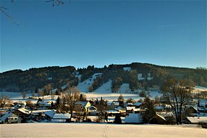
Laubenberg (mountain)
| Laubenberg | ||
|---|---|---|
|
The Laubenberg, in front of it Grünenbach |
||
| height | 919 m above sea level NN | |
| location | Grünenbach municipality , Lindau district (Bodensee) , Allgäu , Bavaria | |
| Mountains | Allgäu Alps | |
| Coordinates | 47 ° 37 '26 " N , 10 ° 1' 12" E | |
|
|
||
The Laubberg ( westallgäuerisch Lumberg ) is a 919 meter high mountain at Grünenbach in Allgäu . It is located in the northern end of the Allgäu Alps .
Geographical location
The Laubenberg is part of the Allgäu Alps. The Eistobel nature reserve borders in the east, the Grünenbach district in the north and the Ebratshofen district in the south .
history
In the 12th century, the Alt-Laubenberg Castle was built on the south-western side of the Laubenberg. The builder was the Lords of Laubenberg. In 1719 the castle burned down completely after a lightning strike and was no longer rebuilt.
In 1882 a lookout tower named Pavillon was built on the mountain . It was humorously called the Tower of Babylon by the locals . In 1932 it was replaced by a higher one. In 1946 the dilapidated tower was torn down again.
In 1965 a ski lift was opened on the north side of the Laubenberg , which was in operation until 1986.
At the beginning of the 20th century the mountain was still a grass mountain. Today it is mostly forested.

