Lauciene
| Lauciene ( German : Nurmhusen) | ||
|---|---|---|
 Help on coat of arms |
|
|
| Basic data | ||
| State : |
|
|
| Landscape: | Courland ( Latvian : Kurzeme ) | |
| Administrative district : | Talsu novads | |
| Coordinates : | 57 ° 14 ' N , 22 ° 45' E | |
| Residents : | 568 | |
| Area : | ||
| Population density : | ||
| Height : | 90 m | |
| Website: | ||
| Post Code: | ||
| ISO code: | ||
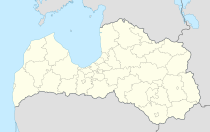
Lauciene is a village in the center of the Lauciene municipality in the Talsi District in western Latvia .
Until 1939 Lauciene was a country residence center and was named Nurmuiža (German: Nurmhusen ). In 1940 the municipality of Lauciene emerged from this, in addition to Nurmhusen with large and small Sehnjen, questions yard, Odern and Scheden.
history
In Lauciene located Nurmhusen Castle ; Until the expropriation, it was owned by the Fircks family in Kürland, along with the surrounding area . The local church was built in 1594.
literature
- Hans Feldmann , Heinz von zur Mühlen (ed.): Baltic historical local dictionary , part 2: Latvia (southern Livonia and Courland) . Böhlau, Cologne 1990, ISBN 3-412-06889-6 , pp. 430-431.
Individual evidence
- ↑ Hans Feldmann, Heinz von zur Mühlen (ed.): Baltic historical local dictionary , part 2: Latvia (southern Livland and Courland) . Böhlau, Cologne 1990, p. 431.
- ↑ Hans Feldmann, Heinz von zur Mühlen (ed.): Baltic historical local dictionary , part 2: Latvia (southern Livland and Courland) . Böhlau, Cologne 1990, p. 430.
- ↑ Lauciene (Nurmhusen). Retrieved September 26, 2013 .
- ^ Church of Nurmhusen. (No longer available online.) Archived from the original on September 28, 2013 ; Retrieved September 26, 2013 . Info: The archive link was inserted automatically and has not yet been checked. Please check the original and archive link according to the instructions and then remove this notice.
