Leech Lake
| Leech Lake | |||||||||
|---|---|---|---|---|---|---|---|---|---|
| Leech Lake with dam | |||||||||
|
|||||||||
|
|
|||||||||
| Coordinates | 47 ° 9 '38 " N , 94 ° 22' 59" W | ||||||||
| Data on the structure | |||||||||
| Data on the reservoir | |||||||||
| Altitude (at congestion destination ) | 395 m | ||||||||
| Water surface | 451 km² | ||||||||
| Maximum depth | 46 m | ||||||||
| Ojibwe women in a canoe on Leech Lake | |||||||||
| Shingobee Island | |||||||||
| Walker Bay and The Narrows , looking south from Oak Point of | |||||||||
| The larger eastern part of the lake of The Narrows seen from | |||||||||
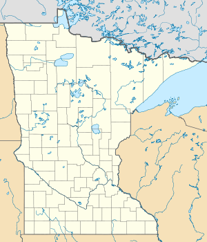
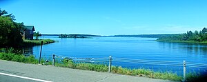
The Leech Lake is a reservoir in the northern US state of Minnesota . It is the third largest lake that is completely in Minnesota and is located southeast of Bemidji in Cass County .
Most of Leech Lake is in the Leech Lake Reservation and entirely in the Chippewa National Forest . Its area is 451 km², the depth up to 46 m. The dam was built in the 1880s.
The lake is a popular area for fishing . The main species of fish caught include eyeglasses , largemouth bass , black bass , European pike and muscle lung . Every year in February, the International Eel Pout Festival takes place at Leech Lake . In addition to various events, this also includes a competition for the largest eel mother caught .
The area of what is now the lake was the site of the Battle of Sugar Point on October 5, 1898 , when a firefight took place between the United States' 3rd Infantry Regiment and a division of the Ojibwe Indians.
geography
In Leech Lake there are seven islands with a total area of 1617 acres (= 654 hectares). From the largest to the smallest, these are:
- Bear Island
- Minnesota Island
- Pelican Island
- Headquarters Bay Island
- Big Pipe Island
- Goose Island
- Bog (Duck) Island
- Narrows Island
- Little Bear Island
- Little Pelican Island
- Gull Island
- Shingobee Island
The elongated Shingobee Bay is at the southern end of the lake. It and the neighboring Walker Bay contain some of the deepest parts of the lake.
Hydrology
Leech Lake is drained by the Leech Lake River , which flows into the Mississippi River. The outflow is regulated by a dam. The lake's seven largest tributaries are Portage Lake Creek, Sucker Creek, Steamboat River, Benedict River, Shingobee River, Bishop Creek, and Boy River. Nine other watercourses flow into the lake.
Settlements on Leech Lake
The settlements on the shore of the lake include:
Web links
- Minnesota Department of Natural Resources : Leech Lake (English)
- Information from the lake (English)
- Leech Lake in the United States Geological Survey's Geographic Names Information System
Individual evidence
- ↑ Archived copy ( Memento of the original from September 29, 2007 in the Internet Archive ) Info: The archive link was inserted automatically and has not yet been checked. Please check the original and archive link according to the instructions and then remove this notice. . Retrieved February 15, 2008
- ↑ tolatsga.org: Ojibwe History . Retrieved February 15, 2008
- ^ A b Donna Perleberg, Stephanie Loso: Aquatic Vegetation of Leech Lake . Minnesota DNR. August 2010.


