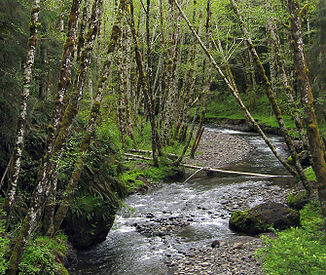
Lewis and Clark River
| Lewis and Clark River | ||
| Data | ||
| Water code | US : 1123054 | |
| location | Clatsop County , Oregon , USA | |
| River system | Columbia River | |
| Drain over | Columbia River → Pacific Ocean | |
| source | south of Saddle Mountain State Natural Area 45 ° 57 ′ 49 ″ N , 123 ° 38 ′ 21 ″ W |
|
| muzzle | in Youngs Bay Coordinates: 46 ° 10 '6 " N , 123 ° 51' 47" W 46 ° 10 '6 " N , 123 ° 51' 47" W.
|
|
The Lewis and Clark River is a tributary of the Columbia River with a length of approximately 20 miles in northwest Oregon in the USA . It was named after the Lewis and Clark expedition . It rises in the mountains of Clatsop County , near the source of the Youngs River , flows first west and then north and flows into Youngs Bay , which is part of the Columbia River just before its confluence with the Pacific . It has 6 small tributaries.
