List of architectural monuments in Rosendahl
The list of architectural monuments in Rosendahl contains the listed buildings in the area of the municipality of Rosendahl in the Coesfeld district in North Rhine-Westphalia (as of September 2017). These architectural monuments are entered in the list of monuments of the municipality of Rosendahl; The basis for the admission is the Monument Protection Act North Rhine-Westphalia (DSchG NRW).
List part A - Architectural monuments
| image | designation | location | description | construction time | Registered since |
Monument number |
|---|---|---|---|---|---|---|

|
Agricultural bourgeoisie | Holtwick Church Square 7 map |
04/11/1983 | 1
|
||

|
Residential building | Darfeld Nikolausplatz 6 card |
09/30/1985 | 2
|
||

|
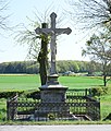
Wayside shrine | Holtwick Hegerort 30 card |
10/03/1985 | 3
|
||
 more pictures |
Parish Church of St. Nicholas Holtwick | Holtwick Church Square, 48720 Rosendahl Map |
neo-Gothic, three-aisled hall church | 1857-1860 | October 21, 1985 | 4th
|
 more pictures |
Catholic parish church St. Nikolaus Darfeld | Darfeld Nikolausplatz 11 card |
October 24, 1985 | 5
|
||

|
Altarpiece | Darfeld map |
December 19, 1985 | 6th
|
||
 more pictures |
Catholic Chapel of St. Anna | Darfeld (Höpingen) map |
10/22/1985 | 7th
|
||

|
Sacred Heart of Jesus statue | Darfeld Jägerheide 5 card |
10/22/1985 | 8th
|
||
| Wayside shrine | Darfeld on the L555 card |
October 23, 1985 | 9
|
|||

|
Sacred Heart statue | Darfeld Netter 37 card |
10/22/1985 | 10
|
||

|
Saint figure | Darfeld Oberdarfeld 39 card |
10/22/1985 | 11
|
||

|
Santa Claus figure | Darfeld Sudetenstrasse map |
October 23, 1985 | 12
|
||

|
Crossroads with wrought iron fence | Darfeld Höpingen 2 map |
10/22/1985 | 13
|
||
 more pictures |
House Burlo | Darfeld Geitendorf 50 card |
11/29/1985 | 14th
|
||

|
House Rockel | Darfeld Rockel 72 card |
25.10.1985 | 15th
|
||

|
Brick building | Darfeld Darfelder Markt 16 map |
October 24, 1985 | 16
|
||

|
Half-timbered house | Darfeld Eschstrasse 10 map |
October 23, 1985 | 17th
|
||

|
Half-timbered house | Darfeld Eschstrasse 13 map |
25.10.1985 | 18th
|
||

|
Residential and farm buildings | Darfeld Helenenweg 4 map |
October 24, 1985 | 19th
|
||
| two two-storey half-timbered storage facilities | Darfeld Hennewich 33 card |
25.10.1985 | 20th
|
|||

|
Residential building | Darfeld Höpingen 41 map |
October 23, 1985 | 21st
|
||

|
two-storey brick storage facility | Darfeld Netter 65 card |
October 24, 1985 | 22nd
|
||

|
House Gröninger | Darfeld map |
10/22/1985 | 23
|
||

|
Burloer Mühle and two-storey warehouse | Darfeld Heven card |
25.10.1985 | 24
|
||
| Herz-Jesu wayside shrine | Holtwick Bleck 8 map |
October 23, 1985 | 25th
|
|||

|
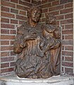
Mary figure | Holtwick Hegerort 50 map |
October 21, 1985 | 26th
|
||
| Saint figure | Holtwick Brock 21 map |
October 23, 1985 | 27
|
|||

|
Saint figure | Holtwick Squad 5 card |
October 23, 1985 | 28
|
||

|
Wayside cross | Holtwick Napoleon route map |
October 21, 1985 | 29
|
||
| Half-timbered store | Holtwick Bleck 7 map |
October 24, 1985 | 30th
|
|||

|
Residential building | Holtwick Hegerort 41 map |
11/29/1985 | 31
|
||
| two-storey storage | Holtwick Hegerort 48 map |
October 24, 1985 | 32
|
|||

|
Half-timbered house | Holtwick Church Square 6 map |
11/29/1985 | 33
|
||

|
two-storey half-timbered store | Holtwick Riege 1 card |
October 24, 1985 | 34
|
||
 more pictures |
Catholic parish church Ss. Fabian and Sebastian | Osterwick Fabianus-Kirchplatz, 48720 Rosendahl Map |
October 24, 1985 | 35
|
||

|
Figure of Mary in a modern chapel | Holtwick Höven map |
11/29/1985 | 36
|
||

|
Wayside chapel | Osterwick Midlich 11 card |
October 24, 1985 | 37
|
||

|
Wayside shrine | Osterwick 39 main street map |
October 24, 1985 | 38
|
||

|
Wayside shrine | Osterwick Schöppinger Strasse 10A map |
October 23, 1985 | 39
|
||

|
two-storey brick storage facility | Osterwick Fabianus-Kirchplatz 13 map |
December 27, 1985 | 40
|
||
| Half-timbered store | Osterwick 37 main street map |
October 24, 1985 | 41
|
|||
| Brick storage | Holtwick Höven map |
October 24, 1985 | 42
|
|||

|
Bretterscheune ("Mäuseschoppe") | Osterwick (Varlar) Varlar 108 map |
October 24, 1985 | 43
|
||

|
Warrior Memorial | Osterwick Fabianus-Kirchplatz 17 map |
October 23, 1985 | 44
|
||

|
Two-storey brick building | Osterwick Hauptstrasse 26 map |
08/07/1986 | 45
|
||

|
Closed Jewish cemetery | Darfeld Oberdarfeld 50 card |
Documented from 1824 to 1926 | October 19, 1985 | 47
|
|

|
Brick storage | Holtwick Bleck 4 map |
08/07/1986 | 48
|
||

|
Wayside shrine | Holtwick Bleck 4 map |
08/07/1986 | 49
|
||
| Half-timbered store | Osterwick Horst 43 map |
08/06/1986 | 50
|
|||

|
War memorial | Darfeld (Oberdarfeld) Oberdarfeld 64 card |
07/01/1986 | 51
|
||

|
War memorial | Darfeld Am Ehrenmal / Schulstrasse map |
07/21/1986 | 52
|
||

|
Mary shrine | Osterwick Brink 1 card |
07/25/1986 | 53
|
||
| three-storey store | Holtwick Bleck 1 map |
08/06/1986 | 54
|
|||
| Half-timbered store | Holtwick Horst 43 map |
08/05/1986 | 55
|
|||
| Two-storey half-timbered store | Holtwick Horst 56 map |
08/05/1986 | 56
|
|||

|
Two-storey half-timbered store | Darfeld Hennewich 21 card |
08/13/1986 | 57
|
||

|
Brick storage | Darfeld Höpingen 18 map |
08/14/1986 | 58
|
||
| two-storey half-timbered store | Darfeld Geitendorf 10 map |
08/14/1986 | 59
|
|||

|
Figure St. Joseph | Darfeld Geitendorf 10 map |
08/14/1986 | 60
|
||
| Three-column farmhouse | Darfeld Netter 24 card |
08/14/1986 | 61
|
|||
 more pictures |
Old Varlar Mill | Osterwick Varlar map |
01/22/1987 | 62
|
||

|
Double shrine "wounds of Christ" | Darfeld Am Bahndamm 2 map |
07/16/1987 | 63
|
||

|
Anthony figure | Darfeld Schlossallee map |
07/28/1987 | 64
|
||

|
Wayside shrine fall under the cross and mater dolorosa | Darfeld Helenenweg 4 map |
07/28/1987 | 65
|
||

|
Nepomuk statue | Darfeld Geitendorf map |
07/28/1987 | 66
|
||

|
Madonna figure | Osterwick Hauptstrasse 49 map |
07/29/1987 | 67
|
||

|
Madonna figure | Holtwick Squad 3 card |
07/30/1987 | 68
|
||

|
Wayside cross | Darfeld Nice 5 card |
07/30/1987 | 69
|
||

|
Roof, north and east facade of a residential and restaurant building | Darfeld Darfelder Markt 1 card |
08/04/1987 | 70
|
||

|
Gatehouse of House Holtwick | Holtwick House Holtwick 7A card |
08/06/1987 | 71
|
||

|
Castle mill | Darfeld Netter 17 card |
07/16/1986 | 72
|
||
 more pictures |
Darfeld Castle | Darfeld Netter 23 card |
08/05/1987 | 73
|
||
 more pictures |
Varlar Castle | Osterwick Varlar 70 card |
Former Premonstratensian monastery, later converted into a moated castle, today the seat of the Prince of Salm-Horstmar | 11th - 18th century | 08/07/1987 | 74
|

|
Way of the Cross, Station I | Darfeld Nikolausplatz 11 card |
08/10/1987 | 75.1
|
||

|
Way of the Cross, Station II | Darfeld Nikolausplatz 11 card |
08/10/1987 | 75.2
|
||

|
Way of the Cross, Station III | Darfeld Eschstrasse 28 map |
08/10/1987 | 75.3
|
||

|
Way of the Cross, Station IV | Darfeld Mohnweg 14 map |
08/10/1987 | 75.4
|
||

|
Way of the Cross, Station V. | Darfeld Mohnweg map |
08/10/1987 | 75.5
|
||

|
Way of the Cross, Station VI | Darfeld Mohnweg map |
08/10/1987 | 75.6
|
||

|
Way of the Cross, Station VII | Darfeld Schlossallee map |
08/10/1987 | 75.7
|
||

|
Way of the Cross, Station VIII | Darfeld Schlossallee map |
08/10/1987 | 75.8
|
||

|
Way of the Cross, Station IX | Darfeld Kortüms-Esch (sports field) map |
08/10/1987 | 75.9
|
||

|
Way of the Cross, Station X | Darfeld Kortüms-Esch (sports field) map |
08/10/1987 | 75.10
|
||

|
Way of the Cross, Station XI | Darfeld on the Worth 8 card |
08/10/1987 | 75.11
|
||

|
Way of the Cross, Station XII | Darfeld Sudetenstrasse (at the cemetery) map |
08/10/1987 | 75.12
|
||

|
Way of the Cross, Station XIII | Darfeld Sudetenstrasse (at the cemetery) map |
08/10/1987 | 75.13
|
||

|
Way of the Cross, Station XIV | Darfeld Schulstrasse 8 map |
08/10/1987 | 75.14
|
||

|
Dutch mill | Darfeld (Höpingen) map |
07/21/1986 | 76
|
||

|
Storage |
map |
08/15/1986 | 77a
|
||

|
Mouse Pillar Barn |
map |
08/15/1986 | 77b
|
||

|
Court chapel |
map |
08/15/1986 | 77c
|
||
| Storage with water mill and oven |
map |
07/24/1987 | 77d
|
|||
| Telgter image of grace |
map |
10/26/1987 | 78
|
|||
| Former bakery |
map |
10/26/1987 | 79
|
|||

|
Wayside shrine with Madonna figure |
map |
12/29/1987 | 80
|
||
| Madonna figure |
map |
12/29/1987 | 81
|
|||

|
Ludgerus figure |
map |
January 18, 1988 | 82
|
||

|
Wayside shrine crucifixion of Jesus |
map |
11/13/1986 | 83
|
||

|
Wayside shrine |
map |
01/14/1988 | 84
|
||

|
Wayside shrine "Jesus carrying the cross" |
map |
01/14/1988 | 85
|
||

|
Gate barn |
map |
01/28/1988 | 86
|
||
| Brick storage |
map |
07/07/1988 | 87
|
|||
| Nicholas shrine |
map |
December 8, 1988 | 88
|
|||

|
Draw well |
map |
12/12/1988 | 89
|
||
| Graves, sandstone gables, Madonna |
map |
December 13, 1988 | 91
|
|||

|
Half-timbered house | Holtwick card |
08/17/1989 | 92
|
||

|
Jewish Cemetery | Osterwick card |
occupied from 1822 | 12/03/2007 | 94
|
List part B - Ground monuments
The ground monuments of the municipality of Rosendahl are listed below (as of September 2017):
| image | designation | location | description | construction time | Registered since |
Monument number |
|---|---|---|---|---|---|---|
 more pictures |
Barenborg Tower Hill | Holtwick card |
Former fortification facility (tower hill castle) on the former road between Coesfeld and Ahaus, today a nature reserve | unknown | 02/13/1986 | 1
|
| Holtwick House | Holtwick card |
08/02/2004 | 2
|
References and comments
The original list was created on September 9, 2017 based on information from the GIS portal of the Coesfeld district , which coordinated the information in cooperation with the district's lower monument authorities and made it generally available on the Internet.
