List of architectural monuments in Nottuln
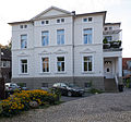
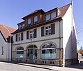
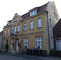
The list of architectural monuments in Nottuln contains the listed buildings in the area of the municipality of Nottuln in the Coesfeld district in North Rhine-Westphalia (status: October 2011). These architectural monuments are entered in the monuments list of the municipality of Nottuln; The basis for the admission is the Monument Protection Act North Rhine-Westphalia (DSchG NRW).
| image | designation | location | description | construction time | Registered since |
Monument number |
|---|---|---|---|---|---|---|
 more pictures |
Exterior facade of the building | Nottuln Kirchplatz 1 map |
A004
|
|||
 more pictures |
Outer facade of the former youth hostel building | Nottuln Baumberg 6, 48301 Nottuln Map |
Today the Hotel and Restaurant Haus Steverburg | A007
|
||
| Storage, shed, small tool shed, outdoor facilities | Nottuln |
A012
|
||||
| Four-column main building, excluding barn building | Nottuln |
A014
|
||||
| Main house barns | Nottuln |
A018
|
||||

|
Main house | Nottuln Mühlenstrasse 16 map |
A019
|
|||

|
building | Nottuln Stiftstrasse 19 map |
A021
|
|||

|
Kötterhaus | Nottuln Baumberg 46 map |
A023
|
|||

|
Wayside shrine Hagenstr./Havixbecker Str. | Nottuln Hagenstr./Havixbecker Str. Map |
The wayside shrine shows the Holy Family. The sculptor Hermann Hidding is believed to be the artist . | A024
|
||

|
Wegekapelle "Münnich", street Potthoff / corner of Dülmener street | Nottuln Strasse Potthoff / corner of Dülmener Strasse map |
A025
|
|||

|
"Sternemann" crossroads | Nottuln on the L 874 (after leaving town) map |
A027
|
|||

|
building | Nottuln Burgstr. 9 card |
A041
|
|||

|
Storage | Nottuln Stevern 2 card |
A042
|
|||
 more pictures |
Building ( Curia von der Recke ) |
Nottuln Stiftsplatz 7 card |
A044
|
|||
 more pictures |
Building (Von Senden's Curia) | Nottuln Stiftsplatz 8 card |
A045
|
|||
 more pictures |
Ascheberg's Curia | Nottuln Stiftsstrasse 4 map |
This building was built by the Ascheberg family according to Johann Conrad Schlaun's plans. It was still the residence of the last abbot of Nottuln Abbey . | 1750 | A046
|
|
 more pictures |
"Old Office" | Nottuln Stiftsstraße 13/15 map |
This building was built as the administrative center of the manor of the Nottuln Abbey for the bailiff according to Johann Conrad Schlaun's plans. | 1748, 1784 | A047
|
|
 more pictures |
House Klein-Schonebeck | Appelhülsen Wierling 14 card |
Haus Klein-Schonebeck is a mansion (around 1522) with stone structure and stepped gables near Appelhülsen, Nottuln, North Rhine-Westphalia, Germany. Remnants of the earlier enclosure have been preserved to this day. | 1522, stair tower 1587 | June 30, 1987 | A048
|

|
Dam, water wheel, bridge, enclosing walls, mill building | Nottuln Heller 49 card |
October 16, 1985 | A017
|
||
 more pictures |
building | Nottuln Stiftsplatz 10 card |
A049
|
|||
 more pictures |
Building, "The old Küsterei" | Nottuln Kirchplatz 10 map |
The old sexton's shop dates from the 19th century, in solid brick construction with sandstone windows and door frames. | A050
|
||
 more pictures |
building | Nottuln Kirchplatz 11 map |
The three-story building from the 17th / 18th centuries Century was laid out as a classic churchyard warehouse. | A051
|
||
| Statue of St. Francis | Nottuln Stiftstr. 14 card |
The monument is owned by the Catholic Church and was moved to a different location in 2018. It is unclear at the moment whether and where it is currently open to the public. | 1987 | A056
|
||

|
Wayside shrine | Nottuln Schapdettener Str./Havixbecker Str. Map |
1987 | A057
|
||

|
St. Anthony , church square | Nottuln church square map |
1894 | 1987 | A058
|
|

|
building | Nottuln Hagenstrasse 100 map |
The single-storey arable citizen's house is an important example as a sandstone structure for this period. | 1890 | A059
|
|
 more pictures |
building | Nottuln Stiftsplatz 1 card |
A060
|
|||
 more pictures |
building | Nottuln Stiftsplatz 4 card |
A061
|
|||
 more pictures |
building | Nottuln Stiftsplatz 9 card |
A062
|
|||
 more pictures |
building | Nottuln Stiftstrasse 12 map |
A063
|
|||

|
building | Nottuln Hagenstrasse 20 map |
A065
|
|||
| Nottuln Daruper Berg 5 map |
A067
|
|||||

|
Transformer station | Nottuln Oberstockumer Weg map |
A068
|
|||

|
building | Nottuln Stiftstr. 8 card |
A069
|
|||

|
Glass painting inside the "Baumberger Chapel" | Nottuln card |
A071
|
|||

|
"Haus Sternemann" building | Nottuln Hagenstrasse 13 card |
A073
|
|||

|
Adjoining house | Nottuln Stiftstrasse 6 map |
A074
|
|||

|
Street facade and gable ends of the building, here: semi-detached house | Nottuln Stiftstr. 20 card |
A075
|
|||

|
Street facade and gable ends of the building, here: semi-detached house | Nottuln Stiftsstr. 20 card |
A076
|
|||

|
Wayside shrine | Nottuln Horst 4 map |
A077
|
|||
 more pictures |
building | Nottuln Stiftsplatz 6 card |
A078
|
|||

|
Garden shed | Nottuln Stiftsplatz 6 card |
A079
|
|||
 more pictures |
Watermill "Schulze Westerath" | Nottuln Stevern 37 card |
The mill is located on the Stever watercourse . | 1559 | A083
|
|

|
Courtyard (except storage) | Nottuln Stevern 2 card |
A084
|
|||

|
Building (old kindergarten) | Nottuln Kastanienplatz 11 map |
A086
|
|||

|
building | Nottuln Stiftsstr. 3 card |
A091
|
|||

|
Watermill | Nottuln Mühlenstr. 14 card |
A092
|
|||

|
Residential storage | Nottuln Heller 19 card |
1890 |
|
||

|
Building (rectory) | Nottuln Kirchplatz 7 map |
A095
|
|||

|
building | Nottuln Stiftsplatz 11 map |
A096
|
|||

|
Both gable sides u. Eaves side as well as kl. Gatehouse | Nottuln Stevern 36 card |
A099
|
|||

|
Residential and studio building | Nottuln Baumberg 27 map |
A100
|
|||
 more pictures |
Longinusturm (Baumberge) | Nottuln card |
A101
|
|||

|
Former watermill | Nottuln Heller 24 card |
A102
|
|||

|
building | Nottuln Horst 19 map |
A103
|
|||

|
Gatehouse, granary and mouse barn | Nottuln Horst 3 map |
A104
|
|||

|
Wayside shrine | Nottuln Stevern 40 card |
A105
|
|||

|
Storage | Nottuln Stevern 40 card |
A105
|
|||

|
building | Nottuln Hagenstrasse 17 card |
A108
|
|||

|
building | Nottuln Daruper Str. 33 map |
A110
|
|||

|
"Haus Gertz" building | Nottuln Hagenstrasse 11 card |
A two-storey half-timbered building with 3 axes, the interior of which has largely been preserved. First mentioned in a document in 1810. Served as a residential area for the poorer Nottulner population. | A111
|
||

|
Wayside shrine | Nottuln Horst 3 map |
A112
|
|||

|
Farmhouse | Nottuln Stevern 53 (formerly Stevern 57) map |
A114
|
|||

|
Göpel in the courtyard | Nottuln Horst 6 map |
A116
|
|||

|
Main house on the courtyard | Nottuln Horst 1 card |
A118
|
|||

|
Coat of arms stone on the building | Nottuln Stiftstr. 5 card |
1731 | A119
|
||

|
former farmhouse | Nottuln Hagenstrasse 4 card |
A121
|
|||

|
Stiftsmühle | Nottuln Stevern 4 card |
A134
|
|||

|
building | Nottuln Kastanienplatz 1 card |
A135
|
|||

|
Weir storage from 1536 | Nottuln Heller 19 card |
1536 | A094
|
||

|
Villa Alstede courtyard | Nottuln Heller 19 card |
1877 |
|
||

|
Half-timbered brick store, facade, roof u. Veranda of the house, roof u. Facade of the gatehouse |
Appelhülsen Heller 34 card |
A001-A003
|
|||

|
former courtyard "Schulze Frenking"; Main house u. Storage |
Appelhülsen Schulze-Frenkings-Hof 40 card |
A016
|
|||

|
Crucifixion group |
Appelhülsen Münsterstraße (L551) corner Pastorskamp map |
The crucifixion group made of sandstone shows the passion of Jesus with Mary and John under the cross. | 1765, 2004 | A026
|
|
 more pictures |
Catholic parish church St. Maria Himmelfahrt |
Apple pods card |
1032, 1821-1823, 1885 | A029
|
||

|
building |
Appelhülsen Bahnhofstr. 72 card |
A032
|
|||

|
Schulze Frenking wayside shrine |
Appelhülsen Behind the Pastorate, Marienplatz 15 map |
A034
|
|||

|
Marian column |
Appelhülsen Kirchplatz map |
The neo-Gothic Marian column is located in front of the Church of the Assumption of Mary on Marienplatz. | 1904 | A052
|
|

|
Wayside chapel |
Appelhülsen processional route map |
A053
|
|||

|
Storage |
Appelhülsen processional path 6 map |
A055
|
|||

|
Nottuln-Appelhülsen station entrance building |
Appelhülsen Bahnhofstrasse 59 map |
Demolished in 2007 after storm damage . | 1870 | A070
|
|

|
"House Giesking" |
Appelhülsen Hangenau 25 card |
A072
|
|||

|
Building, "Gasthaus zur alten Post" |
Appelhülsen Münsterstr. 1 card |
A089
|
|||

|
War memorial chapel |
Appelhülsen Marienplatz map |
The chapel particularly commemorates the dead of the two world wars. | 1923, 1953 | A109
|
|
| Wayside shrine "Jesus with a burning heart" | Darup |
A008
|
||||
| Wayside shrine "Saints Sebastian and Fabian" | Darup |
A009
|
||||

|
"Old hall" | Darup Coesfelder Str. 31 map |
A011
|
|||
| Wayside shrine "Mount of Olives", e.g. Currently in storage | Darup |
A013
|
||||

|
Extension of the sandstone barn | Darup Gladbeck 2 card |
A028
|
|||
 more pictures |
Catholic parish church St. Fabian u. Sebastian | Darup card |
A030
|
|||

|
building | Darup Coesfelder Str. 35 map |
A033
|
|||
 more pictures |
House Darup | Darup Coesfelder Strasse 19 map |
A038
|
|||

|
Courtyard | Darup Am Hagenbach 3 map |
A039
|
|||

|
War memorial | Darup Coesfelder Str. 60 map |
A043
|
|||

|
building | Darup Coesfelder Str. 62 map |
A085
|
|||

|
Kreuzkapelle Daruper Berg | Darup Daruper mountain map |
A088
|
|||

|
Granaries and graves in the courtyard | Darup Hanrorup 1 card |
A093
|
|||

|
Storage | Darup Gladbeck 3 card |
A098
|
|||

|
building | Darup Coesfelder Strasse 28 map |
A102
|
|||

|
Wayside shrine | Darup Hastehausen 3 card |
A113
|
|||

|
Residential building | Darup Coesfelder Str. 38 map |
A122
|
|||

|
Courtyard house | Darup Gladbeck 1 card |
A129
|
|||

|
Courtyard building |
Limbergen Hövel 20 map |
A040
|
|||
| Wayside shrine | Limbergen Hövel 17 map |
A097
|
||||

|
Main house, stable extension, coach house / barn, gate pillars and wall on the courtyard | Limbergen Hövel 2 map |
A127
|
|||

|
Sandstone storage | Schapdetten Roxeler str. 13 card |
A010
|
|||

|
Catholic parish church St. Bonifatius | Schapdetten card |
A031
|
|||
 more pictures |
Stations of the Cross at the Schapdetten cemetery | Schapdetten card |
A036
|
|||
| Wayside shrine | Schapdetten Schenkingstrasse 25 map |
A037
|
||||

|
War memorial | Schapdetten Roxeler Str. 18 map |
A066
|
|||

|
Wayside shrine | Schapdetten Schenkingstr. 5 card |
A081
|
|||
| Wayside chapel | Schapdetten Roxeler Str. Map |
A082
|
||||
| Pastorate building | Schapdetten Fuldastr. 4 map |
A107
|
||||

|
Residential building | Schapdetten Roxeler Strasse 13 map |
A115
|
|||

|
Main house, attic and gatehouse in the courtyard | Schapdetten Roxeler Str. 1 map |
A123 |
Subsequent entries
The aforementioned list of monuments is incomplete as of August 2016 . It comprises a total of 148 monuments. The list includes some of the monuments that have been added or not numbered.
| image | designation | location | description | construction time | Registered since |
Monument number |
|---|---|---|---|---|---|---|

|
Protection of the courtyard | Nottuln Baumberg 78 map |
|
|||

|
Geschwister-Scholl-Hauptschule | Nottuln Niederstockumer Weg 45 map |
Arch. Wolfgang Pantenius and Ruth Pantenius-Lohmann | 1969-1971 | According to newspaper report |
|
| former courtyard house | Nottuln Heller 42 card |
|
||||
| Storage of the courtyard | Nottuln Stevern 53 card |
identical to No. A114? |
|
|||
 more pictures |
Parish church St. Martinus (former collegiate church) | Nottuln card |
1986 | A022 |
||

|
Storage | Nottuln Hagenstrasse 2 card |
A064
|
|||

|
building | Nottuln Stiftstr. 25 card |
A087
|
|||

|
Jewish Cemetery | Nottuln Uphovener Weg map |
A090
|
|||

|
Wayside cross | Nottuln Uphovener Weg map |
A132 |
Web links
Commons : Cultural monuments in Nottuln - Collection of images
Individual evidence
- ↑ a b Theo Damm: Alte Dörfer im Münsterland Aschendorff Verlag, Münster 2012, ISBN 978-3-402-12872-5 , p. 54
- ↑ a b Theo Damm: Alte Dörfer im Münsterland Aschendorff Verlag, Münster 2012, ISBN 978-3-402-12872-5 , p. 45
- ^ Message from the lower monument authority of the municipality of Nottuln v. June 16, 2020
- ^ Theo Damm: Alte Dörfer im Münsterland Aschendorff Verlag, Münster 2012, ISBN 978-3-402-12872-5 , p. 50
- ↑ Nottuln Municipality: Monument Protection and Preservation ( Memento of the original dated August 11, 2016 in the Internet Archive ) Info: The archive link was inserted automatically and has not yet been checked. Please check the original and archive link according to the instructions and then remove this notice.
- ↑ Bunker and school building: an "uncomfortable monument"
