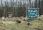
List of soil monuments in Querfurt
The list of archaeological monuments in Querfurt lists all archaeological monuments in the city of Querfurt and its districts. The basis is the publication of the state monument list as of February 25, 2016. The architectural monuments are listed in the list of cultural monuments in Querfurt .
| Monument ID | Find type | District | designation | Time position | location | Remarks | image |
|---|---|---|---|---|---|---|---|
| 428300308 | Fortification> castle | Spielberg | Spornburg "Old Castle" | middle Ages | 0.2 km east of the village | Spornburg delimited by a clearly recognizable wall in the arable area to the east, wall widened and flattened by plowing over, systematic destruction no more structural remains. | |
| 428300312 | Tomb> burial mound | Vitzenburg | Barrow field "Ebigt-Eiche", 19 burial mounds | Neolithic | 2.0 km southwest of the place | Some hill-like elevations are rather doubtful to be referred to as burial mounds. | |
| 428300876 | Tomb> burial mound | Ziegelroda | Tumulus group, 7–10 burial mounds | undated | Ziegelrodaer Forst, at the north-west foot of the Mittelberg, east of the "Long Frame" | protected since 1989; various burial mounds, mostly disturbed | |
| 428300314 | Fortification> castle | Ziegelroda | Spornburg "Schlößchen" | middle Ages | 2.0 km southeast of the place | A flat, circumferential wall / ditch marks the area with gaps, no buildings etc. preserved. | |
| 428300302 | Tomb> burial mound | Precipitation | Burial mound "Height 239" | Neolithic | 1.5 km southeast of the village | large burial mound, densely overgrown buried / encircled, possible burial chamber obviously destroyed | |
| 428300700 | Tomb> burial mound | Querfurt | large hill on Eichstädter Höhe | undated | between Kleineichstädt and Oberschmon | No grave mound recognizable in the further and in the immediate vicinity, plowed flat? | |
| 428300313 | Tomb> burial mound | Vitzenburg | two burial mounds and three burial mounds | Neolithic | 3.0 km west of the place | Large, clearly visible grave mound on the roadside in a slight spur position, several times in the edge area, dug at almost regular intervals - central large excavation, in the vicinity of the grave mound further numerous smaller to medium-sized grave mounds | |
| 428300300 | Tomb> burial mound | Lodersleben | Burial mound | Neolithic | 1.2 km east of the village | Located on the slope edge, very well preserved | |
| 428300299 | Tomb> burial mound | Lodersleben | Burial mound | undated | 1.2 km east of the village | visually not clearly localized | |
| 428300304 | Fortification> castle | Querfurt | Talrandburg "Castle" | middle Ages | southern outskirts | Carolingian ramparts, built over as a medieval castle and fortress, 15th century, residence 17th / 18th century. Century | |
| 428300315 | Fortification> castle | Ziegelroda | Spornburg "Lautersburg" | middle Ages | 3.5 km northeast of the village | Spur separated by a ditch and rampart, the area to the west also separated by flat ramparts / ditches - possible outer bailey | |
| 428300682 | Attachment | Querfurt | Fortification and grave mound "Klaraburg" | undated | the former castle site was probably closed | ||
| 428300877 | Fixing> Wall | Ziegelroda | Ziegelroda | undated | Ziegelrodaer Forst, approx. 650 m northeast of the Spornburg "Schlößchen" in the direction of the "Eichstädter Desert" | The wall-ditch structure is very flat and can only be seen relatively clearly in the east-southeast. A deeply cut ravine leads into the complex from the south | |
| 428300689 | Tomb> burial mound | Querfurt | "Poppenhöhe" grave mound | undated | east of the B252, on the "Poppenhöhe" | Passed with chestnut, densely plowed, severely disturbed by tillage, remaining height approx. 0.2 - 0.3 m | |
| 428300875 | Tomb> burial mound | Ziegelroda | Barrow field | Neolithic | Ziegelroda Forest on the "Long Frame" | Protected since 1989, 157 burial mounds lined up in a chain | |
| 428300872 | Fixing> Wall | Ziegelroda | "Mittelberg" ring wall; Find place of the "sky disk" | undated | 2 km northeast of Nebra, district Kleinwangen on the Mittelberg | In addition to the ring wall system in the central area of the Mittelberg, the fortifications also include two upstream section walls in the west. |

|
| 428300871 | Fortification> castle | Ziegelroda | Fortification, castle hill, moated castle | undated | approx. 450 meters northeast of the Spornburg "Lautersburg" | Very small, well-preserved castle complex in the arch of a meandering brook (Querne). | |
| 428300707 | Tomb> burial mound | Ziegelroda | Burial mound | Neolithic | east of Ziegelroda on Hermannseck, near the campsite | flat but easily recognizable burial mound, undisturbed | |
| 428300311 | Tomb> burial mound | Vitzenburg | Barrows field "Der Bock", 45 burial mounds | Neolithic | 2.2 km southwest of the village 40 grave mounds, east of which 5 individual grave mounds | ||
| 428300687 | Fixing> Wall | Querfurt | semicircular wall "Bock" Ronneberge | undated | north of the place between Klein Wangen and Zingst | elongated flat wall, meaning unclear |