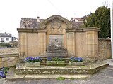
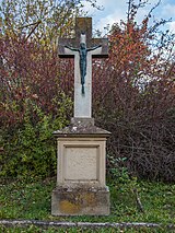
List of cultural monuments in Königsbach an der Weinstrasse
In the list of cultural monuments in Königsbach an der Weinstrasse all cultural monuments of the district Königsbach an der Weinstrasse of the Rhineland-Palatinate town Neustadt an der Weinstrasse are listed. The basis is the list of monuments of the state of Rhineland-Palatinate (as of April 10, 2017).
Individual monuments
| designation | location | Construction year | description | image |
|---|---|---|---|---|
| School and community center | Deidesheimer Strasse 7 location |
1893 | former school and community center; late founding two-winged sandstone block construction, neo-renaissance, 1893, small outbuilding; defining the townscape |

|
| Wine cooperative | Deidesheimer Strasse 12 location |
1902/03 | Wine cooperative, 1902/03; Half-hip roof building, marked 1903, single-storey hall building on an irregular floor plan with pavilion, furnishings |

|
| Wayside cross | Deidesheimer Strasse, in front of No. 19 location |
1815 | Wayside cross, marked 1815 |
 more pictures more pictures
|
| Wayside cross | Erika-Köth-Straße, between No. 63 and 65 location |
1845 | Road cross in relief, inscribed 1845 |
 more pictures more pictures
|
| Spoilage | Erlenbergstrasse, at No. 18 location |
1709 | baroque relief stone, inscribed 1709 |

|
| Residential building | Erlenbergstrasse 27 location |
17th century | Baroque half-timbered house, partly massive, probably from the 17th century |

|
| Courtyard | Franz-Kugler-Straße 1 location |
1856 | Three-sided courtyard; Late Classicist house with jamb, marked 1856, single-storey cellar wing marked 1878 |

|
| portal | Franz-Kugler-Straße, at No. 17 location |
1595 | Renaissance portal, marked 1595 |

|
| Residential building | Franz-Kugler-Straße 19 location |
18th century | Baroque hipped roof building with baluster balcony, 18th century |

|
| Bischofsschlößchen | Franz-Kugler-Straße 23 location |
1759 | former mansion of the auxiliary bishop Johann Adam Buckel ; Hipped roof building with outside staircase, marked 1759, stair tower with weather vane marked 1759 |
 more pictures more pictures
|
| Residential building | Hirschhornring 7 layer |
18th century | Baroque single-storey building with a half-hipped roof, partly half-timbered, 18th century, possibly older in the core | |
| Courtyard | Hirschhornring 12 layer |
18th century | baroque Winkelhof ; Formed half-timbered house with portico, courtyard arch marked 1811, barn marked 1742 |

|
| Courtyard | Hirschhornring 14 position |
1761 | late baroque courtyard; single-storey hipped roof building on high cellar, marked 1761, gate system |

|
| Residential building | Hirschhornring 17 position |
1707 | Half-timbered house (plastered), marked 1707, possibly older in the core | |
| Residential building | Hirschhornring 21 position |
1780 | Late Baroque overformed single-storey hipped roof building on high cellar, marked 1780 |

|
| Residential building | Hirschhornring 22 position |
1802 | stately classicist hipped roof building, marked 1802, gate system marked 1807, with equipment; defining the townscape |

|
| Residential building | Hirschhornring 26 location |
17th century | Baroque half-timbered building (plastered) on a high cellar, probably from the 17th century | |
| Parish hall | Hirschhornring 27 location |
16th or early 17th century | former parish hall; Half-hipped roof building, partly half-timbered, mainly from the 16th or early 17th century; Romanesque tower remains in the courtyard, 13th century, later added, marked 1783 |

|
| portal | Hirschhornring, in No. 28 position |
1612 | Renaissance basement portal, marked 1612 |

|
| Hirschhornschlößchen | Hirschhornring 34 location |
1604 | Renaissance building with crooked hip, marked 1604, staircase elevation 19th century, Renaissance gate, connecting building and barn marked 1605 |

|
| Parish garden | Hirschhornring, opposite No. 34 location |
early 19th century | Former parish garden with a cross-shaped path system from the early 19th century, remains of the Renaissance gate system |

|
| Rectory | Hirschhornring 36 location |
1618 | former rectory; Quarry stone building with half-timbered arcade, portal marked 1618, in the core probably older |

|
| sculpture | Hirschhornring, at No. 41 location |
1807 | Neighboring baroque Maria Immaculata, inscribed 1807 |

|
| Servants' house of the Hirschhornschlößchen | Hirschhornring 43/45 position |
from the 17th century | former servants' house of the Hirschhornschlößchen; No. 45 angular building with Renaissance ground floor, on the upper floor (remodeled in the 19th century) inscription stone marked 1603; No. 43 extension marked 1809; Renaissance archway; single-storey service wing, essentially early 17th century; overall structural system with (opposite) Hirschhornring 43/45 |
 more pictures more pictures
|
| portal | Hirschhornring, opposite No. 43/45 location |
1542 | Keel arch portal, marked 1542 |
 more pictures more pictures
|
| Catholic Church of St. John the Baptist | Hirschhornring 50 layer |
1753/54 | late baroque hall building with elaborate gable facade, 1753/54, architect court architect Johann Georg Stahl ; late Gothic tower, late 15th century, raised in 1903; Furnishing |
 more pictures more pictures
|
| Cross and tombs | Hirschhornring, at No. 50 location |
18th and 19th centuries | late baroque cross, marked 1781; two priest gravestones, around 1783 and 1820, grave cross marked 1720 |

|
| War memorial | Hirschhornring, at No. 50 location |
around 1925 | War memorial 1914/18; Baroque relief display wall, around 1925 |

|
| Residential building | Stabenbergstrasse 1 location |
1744 | Basically a baroque house with renewed half-timbered parts, marked 1744, an archway on the courtyard side | |
| Courtyard | Stabenbergstrasse 12 location |
third quarter of the 18th century | late baroque courtyard, third quarter of the 18th century; single-storey hipped mansard roof building, furnishings, archway, two courtyards |
 more pictures more pictures
|
| Wayside cross | On Harlenweg east of the village, at the intersection with Heidböhlweg; Hallway Heidböhl location |
1879 | Wayside cross; inscribed 1879, metal body |
 more pictures more pictures
|
| Observation tower | northwest of the village on the Stabenberg location |
1904 | former observation tower; Raised cuboid substructure with access via consoles, marked 1904, architect O. Volker |

|
| Stations of the Cross | north of the village on the way to the Klausenkapelle Lage |
1817 | Stations of the cross ; eight gabled houses with neo-Gothic groups of figures, 1817, on the way to the Catholic pilgrimage chapel of St. Fourteen Holy Helpers ; the remaining six stations on Ruppertsberger district |
 more pictures more pictures
|
| Loog rocks and landmarks | northwest of the village in the forest not far from the Stabenberg Lage |
17th to 19th century | four locations:
|
 more pictures more pictures
|
| Mount of Olives Chapel | in Wingert north of blossom road, northeast of the village; Corridor alimony location |
1879 | Boss block construction, 1879, limestone figures by Josef Wilhelm Renn , Speyer, 1902 |

|
literature
- Michael Huyer (editor): Cultural monuments in Rhineland-Palatinate. Monument topography Federal Republic of Germany. Volume 19.2: City of Neustadt an der Weinstrasse. Districts Diedesfeld, Duttweiler, Geinsheim, Gimmeldingen, Haardt, Hambach, Königsbach, Lachen-Speyerdorf, Mußbach. Werner, Worms 2008. ISBN 3-88462-265-X
- General Directorate for Cultural Heritage Rhineland-Palatinate (ed.): Informational directory of cultural monuments in the district-free city of Neustadt an der Weinstrasse (PDF; 4.8 MB). Mainz 2017.
Web links
Commons : Cultural monuments in Königsbach an der Weinstrasse - collection of images, videos and audio files
