List of cultural monuments in the southern quarter (Eisenach)

The four villa areas in the southern quarter of the core city of Eisenach:
Mariental
Marienhöhe
Karthäuserhöhe
Predigerberg / Hainstein
The list of cultural monuments in the Südviertel (Eisenach) contains the cultural monuments of the listed villa colony Südviertel in the south of Eisenach with its monument ensembles Predigerberg , Mariental , Marienhöhe and Karthäuserhöhe , as published in the monument topography published by the Thuringian State Office for Monument Preservation and Archeology in 2006 . Undeveloped parcels belonging to the monument ensemble are not included in the tables below.
Legend
- Name: gives the name, the description or the type of the cultural monument.
- Location: States the street name and, if available, the house number of the cultural monument. The list is basically sorted according to this address. The link "Map" leads to various map displays and gives the coordinates of the cultural monument.
- Dating: indicates the date; the year of completion or the period of construction. Sorting by year is possible.
- Description: Provides structural and historical details of the cultural monument, preferably the characteristics of the monument.
- ID: If available, indicates the object ID of the cultural monument assigned by the State Office for the Preservation of Monuments.
Predigerberg
| image | designation | location | Dating | description | ID |
|---|---|---|---|---|---|
| Monument ensemble Predigerberg | Am Hainstein (map) |
Part of the Predigerberg monument ensemble with buildings No. 1, 2, 3, 4, 14, 15, 16 |
|
||
| detached house | Am Hainstein 4 (map) |
1909-1910 | detached house |
|
|
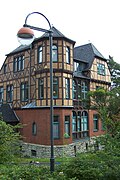 More pictures |
villa | Am Hainstein 14 (map) |
1888-1889 | Villa Anna |
|
| House Hainstein | Am Hainstein 15-16 (map) |
1890 | Hotel Haus Hainstein with Hainstein Chapel |
|
|
| Apartment building | Am Hainstein 17 (map) |
1892 | Apartment building |
|
|
 More pictures |
Monument ensemble Predigerberg | Am Roeseschen Hölzchen (map) |
1888 | Part of the Predigerberg monument ensemble with building No. 1 |
|
| More pictures | Monument ensemble Predigerberg | Barfüßerstrasse (map) |
Part of the Predigerberg monument ensemble with buildings no.7, 9, 11, 12, 13, 14, 15, 16, 16a, 17, 18, 19, 20, 22, 22a, 23, 24, 25, 26, 27, 28 , 29, 30, 32 |
|
|
 |
Apartment building | Barfüßerstraße 18 (map) |
1904-1905 | Multi-family house, enclosure |
|
 More pictures |
Apartment building | Barfüßerstraße 24 (map) |
1909-1910 | Apartment building |
|
| Apartment building | Barfüßerstraße 26 (map) |
1900-1901 | Apartment building |
|
|
 More pictures |
Apartment building | Barfüßerstraße 29 (map) |
1892-1893 | Apartment building |
|
| More pictures | Monument ensemble Predigerberg | Beethovenstrasse (map) |
Part of the Predigerberg monument ensemble with buildings No. 4, 5, 6, 7, 11, 15, 17, 19 |
|
|
 |
detached house | Beethovenstrasse 6 (map) |
1884 | detached house |
|
 More pictures |
detached house | Beethovenstrasse 11 (map) |
1906-1907 | Single-family house, enclosure |
|
| Monument ensemble Predigerberg | Burgstrasse (map) |
Part of the Predigerberg monument ensemble with buildings no.1a, 3, 5, 6, 7, 8, 9, 10, 1, 12, 13, 14, 16, 18, 18a, 20, 22, 24, 26 |
|
||
 More pictures |
Apartment building | Burgstrasse 24 (map) |
1900-1901 | Apartment building |
|
| Monument ensemble Predigerberg | Domstrasse (map) |
Part of the Predigerberg monument ensemble with buildings No. 1, 3 |
|
||
 |
detached house | Domstrasse 1 (map) |
1926-1927 | Single-family house, enclosure |
|
| Monument ensemble Predigerberg | Hainweg (map) |
Part of the Predigerberg monument ensemble with buildings No. 2, 4, 6, 7, 8, 9, 10, 11, 12, 13, 14, 15, 16, 17, 18, 19, 20, 21, 22, 23, 24 , 25, 26, 27, 28, 30, 30a, 31, 32,33, 33a, 36, 38 |
|
||
 |
Apartment building | Hainweg 8 (map) |
1909-1910 | Apartment building, retaining wall |
|
 |
Apartment building | Hainweg 14 (map) |
1899 | Apartment building, retaining wall |
|
 More pictures |
Apartment building | Hainweg 18 (map) |
1899-1900 | Apartment building, retaining wall |
|
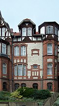 More pictures |
Apartment building | Hainweg 24 (map) |
1903-1904 | Apartment building |
|
 More pictures |
Villa Kesselring | Hainweg 32 (map) |
1898-1899 | Pension Villa Kesselring |
|
| Monument ensemble Predigerberg | Junker-Jörg-Strasse (map) |
Part of the Predigerberg monument ensemble with buildings no.3, 3a, 5, 6, 7 |
|
||
| detached house | Junker-Jörg-Strasse 3a (map) |
1904 | detached house |
|
|
| Monument ensemble Predigerberg | Klosterweg (map) |
Part of the Predigerberg monument ensemble with buildings No. 1, 1a, 1b, 3, 4, 5, 6, 7, 8, 9, 10, 14, 15, 17, 19, 21, 23, 25 |
|
||
 |
detached house | Klosterweg 10 (map) |
1896-1897 | detached house |
|
 More pictures |
Apartment building | Klosterweg 25 (map) |
1914 | Apartment building |
|
 |
Hotel Burgfried | Marienstraße 60 (map) |
1869 | Hotel Burgfried |
|
| Monument ensemble Predigerberg | Reuterweg (map) |
Part of the Predigerberg monument ensemble with buildings No. 1, 2, 3 |
|
||
 |
Villa Elisabeth | Reuterweg 1 (map) |
1858-1860 | Pension Villa Elisabeth |
|
| Reuter Wagner Museum | Reuterweg 2 (map) |
1866-1868 | Reuter Wagner Museum, garden, enclosure |
|
|
| Apartment building | Reuterweg 2a (map) |
1907-1908 | Apartment building, retaining wall |
|
|
| detached house | Reuterweg 2b (map) |
1908-1909 | detached house |
|
|
| detached house | Reuterweg 3 (map) |
1911-1912 | Single-family house, garden |
|
|
 |
Monument ensemble Predigerberg | Richard-Wagner-Strasse (map) |
Part of the Predigerberg monument ensemble with buildings No. 1, 3, 4, 5, 6 |
|
|
| Monument ensemble Predigerberg | Schloßberg (map) |
Part of the Predigerberg monument ensemble with buildings no.6, 7, 9, 10, 11, 13, 15, 17, 19, 21, 23, 29 |
|
||
 More pictures |
detached house | Schloßberg 8 (map) |
1894-1895 | detached house |
|
 More pictures |
Multi-family house with enclosure | Schloßberg 10 (map) |
1897-1899 | Multi-family house with enclosure |
|
| detached house | Schloßberg 29 (map) |
1852 | detached house |
|
|
| Monument ensemble Predigerberg | Steinweg (map) |
Part of the Predigerberg monument ensemble with buildings No. 1, 3, 3a |
|
Marienhöhe
| image | designation | location | Dating | description | ID |
|---|---|---|---|---|---|
| Marienhöhe monument ensemble | Fritz-Koch-Strasse 1 to 42 (map) |
Part of the Marienhöhe monument ensemble with buildings No. 1, 2, 3, 5, 7, 9, 10, 12, 14, 20, 23, 24, 25, 27, 28, 29, 30, 33, 34, 36, 37 , 38, 38a, 39, 40, 42 |
|
||
 More pictures |
Dorm | Fritz-Koch-Strasse 2 (map) |
1904-1905 | Dormitory, garage, retaining wall, enclosure |
|
 More pictures |
Apartment building | Fritz-Koch-Strasse 5 (map) |
1893-1894 | Apartment building, retaining wall, fencing |
|
 More pictures |
House on the Marienhöhe | Fritz-Koch-Strasse 8 (map) |
1907-1908 | Dormitory house on Marienhöhe with outbuildings, retaining wall, fence, pavilion, grotto |
|
 More pictures |
Two-family house | Fritz-Koch-Strasse 9 (map) |
1903 | Two-family house |
|
 More pictures |
Senior residence | Fritz-Koch-Strasse 11 (map) |
1904-1905 | Retirement home Haus Felseneck, enclosure, garden |
|
 More pictures |
Apartment building | Fritz-Koch-Strasse 23 (map) |
1906-1909 | Apartment building, retaining wall |
|
 More pictures |
detached house | Fritz-Koch-Strasse 25 (map) |
1906-1907 | Single-family house, garden pavilion |
|
 More pictures |
Apartment building | Fritz-Koch-Strasse 34 (map) |
1896-1897 | Multi-family house, enclosure |
|
 More pictures |
Apartment building | Fritz-Koch-Strasse 36 (map) |
1896-1897 | Multi-family house, garden, enclosure |
|
 More pictures |
Villa Magarethe | Fritz-Koch-Strasse 38 (map) |
1895-1896 | Single-family house, Villa Magarethe, enclosure, outbuildings |
|
 |
Villa Martha | Fritz-Koch-Strasse 40 (map) |
1894-1895 | Single-family house, Villa Martha, enclosure |
|
| Marienhöhe monument ensemble | Heinrich-Zieger-Strasse 1 to 8 (map) |
Part of the Marienhöhe monument ensemble with buildings No. 1, 2, 3, 4, 5, 6, 8 |
|
||
 More pictures |
Apartment building | Heinrich-Zieger-Strasse 4 (map) |
1906-1908 | Apartment building, retaining wall |
|
 More pictures |
detached house | Heinrich-Zieger-Strasse 8 (map) |
1906-1907 | Detached house, retaining wall with balustrade |
|
| Marienhöhe monument ensemble | Johannes-Falk-Straße 1 to 11 (map) |
Part of the Marienhöhe monument ensemble with buildings No. 7, 9, 10, 11 |
|
||
| Dorm | Johannes-Falk-Strasse 10 (map) |
1906-1907 | Dormitory, retaining wall, enclosure |
|
|
| Furnished villa with garden walls and pergola | Johannistal 4 (map) |
|
|||
| Marienhöhe monument ensemble | Joseph-Kürschner-Straße 1 to 8 (map) |
Part of the Marienhöhe monument ensemble with buildings No. 1, 3, 4, 4a, 4b, 4c, 6, 6a, 8 |
|
||
 More pictures |
Two-family house | Joseph-Kürschner-Strasse 1 (map) |
1921-1922 | Two-family house |
|
| Marienhöhe monument ensemble | Kapellenstrasse 1 to 24 (map) |
Part of the Marienhöhe monument ensemble with buildings No. 1, 1a, 1b, 1c, 1d, 2, 2a, 3, 4, 5, 5a, 6, 7, 8, 10, 11, 12, 13, 14, 15, 16 , 17, 18, 20, 20a, 22, 22a, 24 |
|
||
 More pictures |
Apartment building | Kapellenstrasse 2 (map) |
1900 | Multi-family house, enclosure |
|
 |
detached house | Kapellenstrasse 9 (map) |
1888-1889 | Single family home, Tusculum |
|
 |
Apartment building | Kapellenstrasse 11 (map) |
1904-1905 | Multi-family house, enclosure |
|
| Two-family house | Kapellenstrasse 11a (map) |
1904-1905 | Two-family house |
|
|
 More pictures |
Two-family house | Kapellenstrasse 13 (map) |
1904-1905 | Two-family house |
|
| Apartment building | Kapellenstrasse 14 (map) |
1899-1900 | Multi-family house, enclosure |
|
|
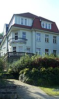 |
Apartment building | Kapellenstrasse 20 (map) |
1909-1910 | Apartment building |
|
| Apartment building | Kapellenstrasse 22 (map) |
1909-1910 | Apartment building |
|
|
| Apartment building | Kapellenstrasse 24 (map) |
1887-1889 | Apartment house, garden, gate |
|
|
| Marienhöhe monument ensemble | Kurstrasse 1 to 8 (map) |
Part of the Marienhöhe monument ensemble with buildings No. 1, 2, 4, 5, 6, 6a, 8 |
|
||
 More pictures |
music school | Kurstrasse 1 (map) |
1911-1914 | Johann Sebastian Bach music school, enclosure, terrace, fountain with putto |
|
| Two-family house | Kurstrasse 3 (map) |
around 1873 | Two-family house |
|
|
 More pictures |
Apartment building | Kurstrasse 8 (map) |
1908-1909 | Apartment building, garden, retaining wall, fencing |
|
| Marienhöhe monument ensemble | Mariental (map) |
Part of the Marienhöhe monument ensemble with buildings No. 3, 5, 7, 11 (demolished), 15, 17, 19 |
|
||
 More pictures |
Residential building | Mariental 7 (map) |
1861 | Residential house with outbuildings, fencing |
|
 More pictures |
Apartment building | Mariental 15 (map) |
1905-1906 | Apartment building |
|
 More pictures |
Apartment building | Mariental 17 (map) |
1905-1906 | Apartment building |
|
| Marienhöhe monument ensemble | Otto-Speßhardt-Strasse 1 to 19 (map) |
Part of the Marienhöhe monument ensemble with buildings No. 1, 2, 3, 4, 5, 5a, 6, 7, 8, 9, 10, 11, 12, 13, 15, 16 |
|
||
 More pictures |
Villa Musica | Otto-Speßhardt-Strasse 1 (map) |
1899-1900 | Therapy center Villa Musica |
|
 |
detached house | Otto-Speßhardt-Strasse 9 (map) |
1900 | detached house |
|
| Apartment building | Otto-Speßhardt-Strasse 15 (map) |
1903-1904 | Apartment building |
|
|
| Apartment building | Otto-Speßhardt-Strasse 16 (map) |
1874-1875 | Apartment building |
|
|
| Marienhöhe monument ensemble | Philipp-Kühner-Strasse 1 to 19 (map) |
Part of the Marienhöhe monument ensemble with buildings No. 1, 3, 5, 9, 11, 15, 19 |
|
||
| Apartment building | Philipp-Kühner-Strasse 2 (map) |
1895-1896 | Apartment building |
|
Former monument
| image | designation | location | Dating | description | ID |
|---|---|---|---|---|---|
 |
Villa Loisset | Mariental 11 (map) |
around 1866 | Residential house, enclosure, demolished in 2014 |
|
Mariental
| image | designation | location | Dating | description | ID |
|---|---|---|---|---|---|
| Mariental monument ensemble | Liliengrund 1 to 7 (card) |
Part of the Mariental monument ensemble with buildings No. 1, 1a, 1b, 1c, 3 |
|
||
| Apartment building | Liliengrund 1 (card) |
1899-1900 | Apartment building, taresse, balustrades, gate posts |
|
|
| detached house | Liliengrund 4 (card) |
1901-1902 | detached house |
|
|
| detached house | Liliengrund 6 (card) |
1904-1906 | Single-family house with southern fencing |
|
|
| Mariental monument ensemble | Mariental 21-33d, 4-54 (map) |
Part of the Mariental monument ensemble with buildings No. 4, 6, 8, 12, 14, 18, 20, 24, 26, 28, 36, 38, 38a, 38b, 40, 42, 44, 46, 50, 54; 21, 23, 25, 33, 33a |
|
||
| Apartment building | Mariental 18 (map) |
1869 | Apartment building |
|
|
| detached house | Mariental 20 (map) |
1928-1929 | Single family house with terrace |
|
|
| Residential building | Mariental 25 (map) |
1869 | Residential house with retaining wall and mountain garden |
|
|
 |
Training building | Mariental 28 (map) |
1903-1905 | Training building |
|
 More pictures |
Residential building | Mariental 33 (map) |
1830-1831 | Residential house, built as an inn " Phantasie " |
|
| Seminar building | Mariental 33a (map) |
1889 | Seminar building, built as a shooting range |
|
|
| Apartment building | Mariental 36 (map) |
1904-1905 | Apartment building with garden and fencing |
|
|
| detached house | Mariental 38 (map) |
1910-1911 | Single-family house with enclosure |
|
|
| detached house | Mariental 42 (map) |
1900 | Single family house with garden |
|
|
| Apartment building | Mariental 44 (map) |
1872-1873 | Apartment house with garden |
|
|
 |
detached house | Mariental 46 (map) |
1907-1908 | detached house |
|
| Mariental monument ensemble | Wartburgallee 57-75 (map) |
Part of the Mariental monument ensemble with buildings No. 57, 59, 61, 63, 65, 71, 73 |
|
||
| Apartment building | Wartburgallee 57 (map) |
1890-1892 | Apartment building |
|
|
| Apartment building | Wartburgallee 63 (map) |
1906-1907 | Apartment building |
|
Karthäuserhöhe
| image | designation | location | Dating | description | ID |
|---|---|---|---|---|---|
| More pictures | Karthäuserhöhe monument ensemble | Am Ofenstein (map) |
Part of the Karthäuserhöhe monument ensemble No. 1, 1b, 2, 3, 3b, 3c, 6, 7, 8, 8a, 8b, 9, 9a, 10, 10a, 10b, 11, 12, 13, 13b, 14, 15, 17, 19, 20, 21, 23, 25, 26, 27, 29, 30, 31 |
|
|
 More pictures |
Apartment building | Am Ofenstein 3b (map) |
1900-1901 | Apartment building |
|
| detached house | Am Ofenstein 8, 8a, 8b (map) |
1925-1927 | detached house |
|
|
| detached house | Am Ofenstein 10, 10a, 10b (map) |
1925-1927 | detached house |
|
|
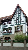 More pictures |
Restaurant to the boy | Am Ofenstein 12 (map) |
1905 | Pension with restaurant Zum Burschen |
|
 More pictures |
detached house | Am Ofenstein 13b (map) |
1929-1930 | detached house |
|
 More pictures |
Apartment building | Am Ofenstein 31 (map) |
1929 | Multi-family house, enclosure, garage |
|
| Karthäuserhöhe monument ensemble | Amalienstraße (map) |
Part of the monument ensemble Karthäuserhöhe No. 1, 2, 2a, 3, 4, 6 |
|
||
 More pictures |
Apartment building | Amalienstraße 1 (map) |
1904-1905 | Apartment building |
|
| Karthäuserhöhe monument ensemble | Augustastrasse (map) |
Part of the monument ensemble Karthäuserhöhe No. 2, 3, 4, 5, 6 |
|
||
 |
Apartment building | Augustastraße 2 (map) |
1911-1912 | Apartment building |
|
 More pictures |
Apartment building | Augustastraße 6 (map) |
1905-1906 | Apartment building |
|
| Karthäuserhöhe monument ensemble | Bornstrasse 1-44 (map) |
Part of the Karthäuserhöhe monument ensemble No. 1, 1a, 2, 4, 5, 6, 6a, 7, 9, 11, 12, 13, 14, 14a, 14b, 14c, 15, 17, 18, 19, 20, 21, 22, 23, 24, 25, 26, 26a, 26b, 27, 28, 29, 30, 32, 34, 36, 38, 40, 42, 44 |
|
||
 More pictures |
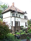
Apartment building | Bornstrasse 1 (map) |
1875-1876 | Apartment building |
|
 |
detached house | Bornstrasse 6a (map) |
1929 | detached house |
|
 More pictures |
detached house | Bornstrasse 9 (map) |
1886-1888 | detached house |
|
 |
Two-family house | Bornstrasse 12 (map) |
1928 | Two-family house |
|
 More pictures |
Apartment building | Bornstrasse 13 (map) |
1902-1903 | Apartment building, around 1898 as a summer house |
|
| detached house | Bornstrasse 24 (map) |
1931-1932 | Single-family house, enclosure |
|
|
 |
detached house | Bornstrasse 25 (map) |
1924-1926 | Single-family house (semi-detached house), enclosure, garage |
|
| Karthäuserhöhe monument ensemble | Dittenbergerstrasse (map) |
Part of the monument ensemble Karthäuserhöhe No. 1, 2, 3, 4 |
|
||
| detached house | Dittenbergerstrasse 1 (map) |
1910-1911 | detached house |
|
|
| Single-family house Marienheim | Dittenbergerstrasse 2 (map) |
1914-1915 | Single-family house Marienheim, enclosure |
|
|
| Karthäuserhöhe monument ensemble | Dr.-Siegfried-Wolff-Strasse (map) |
Part of the monument ensemble Karthäuserhöhe No. 1, 1a, 3, 4, 6, 7 |
|
||
 |
Two-family house | Dr.-Siegfried-Wolff-Strasse 6 (map) |
1891-1892 | Two-family house |
|
| Karthäuserhöhe monument ensemble | Elisabethstrasse (map) |
Part of the monument ensemble Karthäuserhöhe No. 1, 1a, 2, 2a, 3 |
|
||
 More pictures |
Two-family house | Elisabethstrasse 1 (map) |
1891-1892 | Two-family house |
|
| Karthäuserhöhe monument ensemble | Emilienstraße (map) |
Part of the Karthäuserhöhe monument ensemble No. 1, 2, 3, 4, 5, 6, 7, 8, 9, 10, 11, 12, 13, 14, 15 |
|
||
 More pictures |
Apartment building | Emilienstraße 2 (map) |
1880-1881 | Apartment building with retaining wall |
|
 |
Two-family house | Emilienstraße 10 (map) |
1892-1893 | Two family house, enclosure |
|
| Karthäuserhöhe monument ensemble | Erich-Honstein-Strasse (map) |
Part of the Karthäuserhöhe monument ensemble No. 2, 3, 4, 5, 5a, 6, 7, 8, 9, 10, 11, 11a, 12, 13, 14, 15, 16, 17, 18, 18a, 20, 20a, 23, 24, 25, 26, 27, 29, 30, 32, 38, 38a, 40 |
|
||
 More pictures |
Apartment building | Erich-Honstein-Strasse 3 (map) |
1900-1901 | Apartment building |
|
 More pictures |
Apartment building | Erich-Honstein-Strasse 8 (map) |
1909-1910 | Multi-family house, enclosure |
|
 More pictures |
Apartment building | Erich-Honstein-Strasse 14 (map) |
1910-1911 | Apartment building |
|
 More pictures |
Apartment building | Erich-Honstein-Strasse 16 (map) |
1913 | Apartment building |
|
 |
Apartment building | Erich-Honstein-Strasse 23 (map) |
1937-1938 | Multi-family house, enclosure, garage |
|
 More pictures |
Apartment building | Erich-Honstein-Strasse 32 (map) |
1928 | Apartment building with staircase, fencing |
|
 More pictures |
Apartment building | Erich-Honstein-Strasse 40 (map) |
1911 | Multi-family house, enclosure |
|
 |
Karthäuserhöhe monument ensemble | Ernst-Böckel-Strasse (map) |
Part of the Karthäuserhöhe monument ensemble No. 1, 2, 3, 4, 6, 7, 8, 9, 10, 11, 11a, 12, 15, 17 |
|
|
 More pictures |
Apartment building | Ernst-Böckel-Strasse 15 (map) |
1924-1925 | Apartment building, garden lamp, enclosure, garage |
|
 More pictures |
detached house | Ernst-Böckel-Strasse 17 (map) |
1928 | Single-family house, Landhaus Hagemeierm enclosure, garage |
|
 |
Karthäuserhöhe monument ensemble | Hedwigstrasse (map) |
Part of the monument ensemble Karthäuserhöhe No. 4, 7, 9 |
|
|
| Karthäuserhöhe monument ensemble | Johann-Sebastian-Bach-Strasse 1-12 (map) |
Part of the Karthäuserhöhe monument ensemble No. 2, 3, 3a, 3b, 4, 6, 7, 8, 9, 10, 12 |
|
||
| Residential, commercial building | Johann-Sebastian-Bach-Strasse 2 (map) |
1890-1891 | Residential, commercial building |
|
|
 |
Apartment building | Johann-Sebastian-Bach-Strasse 9 (map) |
1875 | Apartment building |
|
| Karthäuserhöhe monument ensemble | Luisenstrasse 1-16 (map) |
Part of the Karthäuserhöhe monument ensemble No. 1, 2, 3, 4, 5, 6, 7, 8, 9, 10, 11, 12, 13, 14, 16 |
|
||
| Residential building | Luisenstrasse 3 |
|
|||
 More pictures |
Apartment building | Luisenstrasse 7 (map) |
1899-1900 | Apartment building |
|
 More pictures |
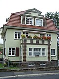
Apartment building | Luisenstrasse 9 (map) |
1899-1902 | Apartment building |
|
 More pictures |
Apartment building | Luisenstrasse 10 (map) |
1929-1930 | Apartment building |
|
 More pictures |
Hotel Fürstenhof or single-family house | Luisenstrasse 11/13 (map) |
1862 | former Hotel Fürstenhof or single-family house "Villa Bornemann" |
|
 More pictures |
detached house | Luisenstrasse 12 (map) |
1913-1914 | detached house |
|
 More pictures |
detached house | Luisenstrasse 16 (map) |
1900-1901 | detached house |
|
| More pictures | Karthäuserhöhe monument ensemble | Marienstrasse (map) |
Part of the monument ensemble Karthäuserhöhe No. 57, 59 |
|
|
 More pictures |
Residential and commercial building | Marienstraße 48 (map) |
|
||
 More pictures |
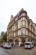
Residential and commercial building | Marienstraße 54 (map) |
|
||
 More pictures |
Golden Lion Memorial | Marienstraße 57 (map) |
1731 | originally an inn, in which the SDAP was founded in 1869, from which the Social Democratic Party of Germany (SPD), which still exists today, emerged until 1890; today memorial |
|
 More pictures |
Apartment building | Marienstraße 59 (map) |
1898-1899 | Apartment building |
|
 |
Karthäuserhöhe monument ensemble | Prellerstrasse (map) |
Part of the monument ensemble Karthäuserhöhe No. 1, 3, 5, 5a, 7, 9, 13, 14, 15, 17, 19, 21 |
|
|
 More pictures |
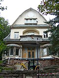
detached house | Prellerstraße 5 (map) |
1909-1910 | Single-family house, enclosure |
|
 More pictures |
Apartment building | Prellerstraße 7 (map) |
1908 | Apartment building |
|
 |
detached house | Prellerstraße 15 (map) |
1923 | Single family house with entrance stairs |
|
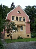 More pictures |
detached house | Prellerstraße 17 (map) |
1927 | Single-family house, entrance stairs |
|
 More pictures |
Villa at home | Prellerstraße 19 (map) |
1930-1931 | Single-family house Villa Daheim, entrance stairs |
|
 More pictures |
detached house | Prellerstraße 21 (map) |
1927-1928 | Single-family house, entrance stairs |
|
| Karthäuserhöhe monument ensemble | Stöhrstrasse (map) |
Part of the Karthäuserhöhe monument ensemble No. 2, 4, 6, 7, 11, 13, 15, 17, 23 |
|
||
 |
detached house | Stöhrstrasse 2 (map) |
1938-1939 | Single-family house, retaining wall |
|
 |
detached house | Stöhrstrasse 11 (map) |
1927-1928 | Single-family house with enclosure wall |
|
| Karthäuserhöhe monument ensemble | Waisenstrasse (map) |
Part of the monument ensemble Karthäuserhöhe No. 1, 2, 4, 6, 8 |
|
||
| Music hall | Waisenstrasse 1 |
|
|||
 More pictures |
Kartausgarten | Waisenstrasse 2 (map) |
1380 | Kartausgarten |
|
 More pictures |
Karthäuserhöhe monument ensemble | Wartburgallee (map) |
Part of the Karthäuserhöhe monument ensemble No. 29, 31, 33, 35, 37, 39, 41, 43, 45, 53, 55, 66, 68, 70, 72, 74, 76, 78 / 78a, 82, 84, 86, 88, 90, 92 |
|
|
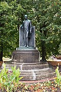 More pictures |
monument | Wartburgallee (map) |
Monument to Grand Duke Carl Alexander of Saxony-Weimar-Eisenach |
|
|
 |
detached house | Wartburgallee 43 (map) |
1936-1937 | Single-family house, garage, fencing |
|
 More pictures |
Exhibition pavilion with wall-mounted equipment, furniture and surrounding open space | Wartburgallee 47 (map) |
Former AWE automobile pavilion , today Eisenach art pavilion |
|
|
 More pictures |
Residential and commercial building | Wartburgallee 48 |
|
||
 More pictures |
Drinking and foyer | Wartburgallee 53 (map) |
1906 | Drinking and foyer |
|
 More pictures |
Residential and commercial building | Wartburgallee 54 |
|
||
 More pictures |
Apartment building | Wartburgallee 55 (map) |
1900-1901 | Apartment building |
|
 More pictures |
Ernst Abbe High School | Wartburgallee 60 |
|
||
 More pictures |
Residential, commercial building | Wartburgallee 68 (map) |
1925-1927 | Residential, commercial building, enclosure |
|
 |
Apartment buildings | Wartburgallee 72/74 (map) |
1904-1905 | Multi-family houses with fencing |
|
 More pictures |
Apartment building | Wartburgallee 84 (map) |
1903-1904 | Multi-family house, enclosure |
|
| More pictures | Karthäuserhöhe monument ensemble | Wernickstrasse (map) |
Part of the Karthäuserhöhe monument ensemble No. 2, 4, 6, 7, 11, 13, 14, 15, 16, 17, 21, 22 |
|
|
| detached house | Wernickstrasse 6 (map) |
1907-1908 | detached house |
|
|
| detached house | Wernickstrasse 7 (map) |
1914 | detached house |
|
|
| detached house | Wernickstrasse 9 (map) |
1909-1910 | Single-family house, front staircase |
|
swell
- Herlind Reiss, Thuringian State Office for Monument Preservation and Archeology: Monument topography Federal Republic of Germany. Cultural monuments in Thuringia, city of Eisenach - villas and country houses at the foot of the Wartburg, vol. 2.1, 2006, Theiss Verlag Stuttgart, ISBN 978-3-937940-24-3