Loch Faskally
| Loch Faskally | |||||||
|---|---|---|---|---|---|---|---|
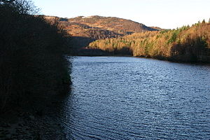
| Loch Faskally seen north | |||||||
|
|||||||
|
|
|||||||
| Coordinates | 56 ° 42 '25 " N , 3 ° 45' 35" W | ||||||
| Data on the structure | |||||||
| Construction time: | 1947-1950 | ||||||
| Data on the reservoir | |||||||
| Reservoir length | 3.2 km | ||||||
| Reservoir width | 700 m | ||||||
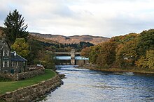
Loch Faskally ( Scottish Gaelic : Loch Faschoille ) is a reservoir in the Scottish Highlands . It is located in the Council Area Perth and Kinross about two kilometers northwest of Pitlochry .
Loch Faskally is approximately 3.2 kilometers long and approximately 700 meters wide. The lake is part of the Tummel hydro-electric power scheme and is used to generate electrical energy from hydropower. It was created in 1950 when the River Tummel was dammed during the construction of the Pitlochry hydroelectric power station . Loch Faskally is very easily accessible by car thanks to its proximity to the A9 and A925 . Even the station of Pitlochry is only about 500 meters from the dam removed.
Loch Faskally is a fishing area where trout , pike and salmon can be caught. The Loch Faskally dam has a fish ladder to maintain fish stocks in upstream regions . The surroundings of the lake are extremely picturesque and are therefore very popular with hikers.
Web links
- Description of the lake (en.)
- Information for anglers (en.)
- Information for hikers (en.)


