Luštica
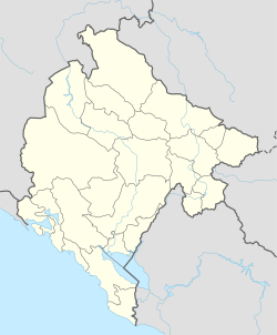
Luštica is a mountainous peninsula with many bays on the southeast Adriatic coast in Montenegro . The entrance to the Bay of Kotor is located between the Luštica peninsula and Prevlaka on the Croatian side . Due to its strategic location in front of the entrance to the former naval port of Kotor, important military facilities have been found on the peninsula since the expansion of the naval base under Austria-Hungary and later in Yugoslavia . Underground submarine entrances and a central polygon of the JNA and VJ for testing military equipment made the peninsula a restricted area until the end of the 1990s. During the NATO bombing of Serbia-Montenegro in 1999, the military installations on the peninsula were also repeatedly bombarded with uranium ammunition, which was particularly criticized by environmentalists.
relief
The peninsula covers an area of 47 km², is 13 km long and reaches a height of 582 m in Obosnik. The 35 km long coastline of the peninsula makes up 12% of the entire Montenegrin coast. On the side facing the sea, this is designed as a bay-rich karst steep coast with strong sea abrasion , on which several sea caves ( Plava spilja ) are special attractions. There are important bathing beaches in the bays ( Žanjice , Mirište , Arza and Dobreč ).
The coastline on the side facing the bay, on the other hand, has hardly any relief and, since it is protected from sea waves, it is also not frayed by abrasion. The formerly important submarine ports and other military facilities were also located here.
The interior of the peninsula is characterized by gentle and medium-high wooded mountain ridges. Several radar systems were originally located here, and coastal artillery equipment was also positioned there.
colonization
The peninsula is developed through several smaller villages, of which only two are on the coast. Olive tree cultures and pine forests shape the landscape.
The only port, Rose , existed in ancient times and is one of the oldest in the bay. Of the 20 smaller churches, 18 are Serbian Orthodox and two are Catholic.
history
In Roman times, Rose was once an important place on the Adriatic artery, from where the trade route crossed the Bay of Kotor. Even later, during the Byzantine period, there was a customs post in Rose and a shelter from storms. In one of the works of the Byzantine Basileus Konstantin Porphyrogennetos from the year 941 it is also clear that the harbor master's office of the bay was located here.
Coordinates: 42 ° 24 ' N , 18 ° 37' E

