
Karst


In geology and geomorphology, karst is understood to mean subterranean terrain forms ( karst caves ) and aboveground terrain forms ( surface karst ) in carbonate rocks (also in sulphate, salt rocks and sandstones / quartzites), which are mainly caused by the weathering of solutions and carbonic acid as well as the precipitation of biogenic limestones and similar sediments with high levels of calcium carbonate (CaCO 3 ). The main feature is the predominantly subterranean water balance , which is not based on a primary porosity of the rock, but secondary and in geological time on a corrosion of the rock, the karstification .
Karst can be found in large areas around the Mediterranean Sea as well as in Southeast Asia and South China , the Greater Antilles and in the Indo-Australian Archipelago , and on a smaller scale in the German low mountain ranges ( Swabian Alb , Franconian Alb ), the French and Swiss Jura , other parts of the Northern and Southern Alps and generally in Western Europe .
In terms of human geography , the use of natural space differs in particular from karst landscapes in the Mediterranean region (= Mediterranean ) and in Southeast and East Asia . Herding livestock and a seasonally adapted semi-nomadic herd animal migration have been widespread in the karst mountains of the Mediterran since ancient times , but the corresponding use of karst plateaus outside of the Mediterran rarely; it is often held responsible for their greater degradation and deforestation with subsequent damage to the soil cover, but postglacial faunas with a high proportion of alpine-adapted animal species on low-lying karst plateaus indicate that even in today's most highly developed Mediterranean karst landscape, the Dinarides, postglacial no development into forest landscapes has taken place. In terms of cultural topology, a more differentiated agro-economic form of farming with small animal husbandry and irrigated agriculture is established in tropical karst countries .
General
Deeply developed karst landscapes can have completely dry soils despite abundant and sometimes high amounts of precipitation. Karst landscapes are subject to an age-related erosion cycle . In principle, this is caused by stronger corrosion and erosion under humid tropical climatic conditions. The difference is between tropical and extra-tropical karst forms, as well as geomorphologically fully developed karst (holokarst) and underdeveloped karst (merokarst). Karstification and erosion of the karst relief are part of a global biogeochemical material and geological rock cycle ; in particular, the carbonate-silicate cycle is directly related to the carbon cycle through biogenic and geological processes that are the result of the evolution of life . Carbonates ( calcite CaCO 3 and dolomite CaMg (CO 3 ) 2 ) are also the largest carbon stores on earth.
Etymology of terms

The term karst (cf. Slovenian kras , Croatian krš , Serbian - Cyrillic крш , Italian carso , Latin carsus 'stony and sterile soil' ; Indo-European most likely * kar- 'stone, rock') was used by geographers who wrote in German in the 19th century generalized from the Kras landscape between Trieste in Italy and the Krainer Schneeberg in Slovenia as a type locality for the description of geomorphologically similar landscapes.
It was only in the wake of the first standard work Morphology of the Earth's Surface ( Albrecht Penck , 1884) and in particular through the work of the first karstologist Jovan Cvijić that geomorphology established itself as an independent science. The local names of karst forms of the Dinaric countries from Slovenian , Croatian and Serbian were generalized for German and French technical language (so dolina , polje , ponor , hum ). With the exploration of tropical karst areas in the Caribbean and Southeast Asia, the range of terms expanded (including the Spanish names Mogote and Cenote and the English term cockpit ). Karst terminology today uses a multitude of terms in different languages. Due to the historical development of karst research, some terms used in English differ from those in Central Europe.
Origin and characteristics
Carbonate and carbonic acid weathering, other chemical weathering processes
Karst arises in humid and semi-arid areas of hard, by carbonic corrodible mass rocks with a high content of calcium carbonate (CaCO 3 ), such as limestone , are constructed. The parent rock is not primarily porous; rather, primarily porous carbonates such as chalk prevent any deep karstification. Conversely, karstification in areas made up of uniform, massive limestone can reach several thousand meters below the surface of the earth.
When calcium carbonate corrodes, carbon dioxide physically dissolved in water first reacts with it chemically to form carbonic acid :

The latter reacts with calcium carbonate to form calcium hydrogen carbonate :

Both together result in the balance reaction of the solution of calcium carbonate:

The double arrow stands for the reversibility of the reaction, because lime-saturated solutions can form new rocks such as travertine or stalactite through the re-precipitation of calcium carbonate .
The mixture of two solutions saturated with calcium carbonate can bring further calcium carbonate into solution if the concentration of the calcium carbonate in the starting solutions is different (= mixed corrosion ). The higher the concentration in the lime-rich starting solution, the more additional calcium carbonate is dissolved (“paradox of mixed corrosion”). This effect explains why the large solution cavities observed in the karst mountains are not to be found at the point of entry of the water, but in the interior of the mountains.
Another weathering reaction that can play a role in karstification is the chelate complexation of metal ions by organic acids found in the soil, such as humic acids . The process is known as chemical-biotic weathering .
Karstification

Since karst rock is dissolved by carbonic acid (= carbonic acid weathering ) and rainwater drains underground through the channels created, rivers hardly arise in the karst. Instead, rivers that have sprung up elsewhere (i.e. in the non-karst) flow through all karst regions; In technical terms: rivers in karst regions are allochthonous , not autochthonous . Especially in the humid tropics, rivers make a major contribution to the formation of karst regions there. Karst forms are therefore not only to be found as larger or smaller closed forms, but also, especially in the tropics, as mixed forms with the open erosion forms of river-traversed reliefs. The karst is therefore not fundamentally an extra-polar opposite pole to wet regions, even if this is often claimed.
Although karst phenomena in the micro as well as in the macro range are without exception the consequences of chemical processes, the relief formation of large karst landscapes is also subject to other processes that depend on hydrogeographic and climatic conditions and tectonic conditions. For example, glaciated karst in high mountains is referred to as glaciocarst , local glaciers themselves as karst glaciers , and physical processes linked to karst glaciers cause a special relief of the glacial karst among them.
Climatic-geological preconditions
The basic prerequisites for the development of a karst relief are rock susceptible to carbonic acid weathering and the availability of liquid water (thus a suitable temperature), thus the given climatic zone and altitude . Karst is typically formed on adjacent limestone in sub-humid to humid climatic zones, from the tropics to cool temperate latitudes, from the coast to subnival heights of the high mountains .
Karstification is promoted by the high soil concentration of humic acids in the soil (see above section " #Carbonate and carbonic acid weathering, other chemical weathering processes "). In the tropics, the vegetation favors this situation and the karstification processes that depend on it. In temperate latitudes, the relationship is only effective in the micro range, especially under moss cushions.
Qualitatively, the formation of the karst relief depends above all on the amount of precipitation and on the purity and thickness of the limestone . Calcium carbonate purities of 99% and annual average precipitation rates of up to 5000 mm per year in Montenegro and New Guinea or 2500 mm per year in southwest China are conducive to the development of pronounced karst forms. Lower purity of calcium carbonate and precipitation below 500 mm per year prevent greater karstification. Soft limestones with a high clay content ( marl ) hardly carburized, while hard, corrosion-resistant carbonates with high magnesium content such as dolomite very slowly.
Fully developed types of karst, so-called full forms (see section “ Climatic geomorphological karst types”), are also always the result of uninterrupted development with only slight climatic variation over geological periods in which the aforementioned favorable weathering conditions prevailed.
Major carbonate series


In Alpine Central Europe, the Dachstein limestone in particular is a rock capable of karstification, while the main dolomite does not form any karst landscapes here. The main part of the Dinaric Mountains , the largest European karst area, consists almost exclusively of dolomitic and other carbonate sediments, the formation of which ranges from the Devonian to modern times. The thickness of the Cretaceous and Jurassic limestone is more than 4 km here in the high karst zone , and the karstification extends below sea level, as evidenced by submarine karst springs. Related karst regions can be found in the circum-Mediterranean limestone blankets of the Young Alpine folds of the Thetys Basin between Morocco and Iran.
Hard, pure Mesozoic limestones are also the basis of the tower and cone karst formations of the tropics, such as the geological formations of the Upper Jura in the Cuban Valle de Viñales . The base of the local Mogotes is formed by the oldest section called Jagua , which consists mainly of very impure limestone and changing deposit conditions . The Mogotes themselves, on the other hand, correspond to the middle section known as the Viñales Formation , a very pure mass limestone (over 98% CaCO 3 ).
Furthermore, tower and cone karsts are based on continuous and slow uplifts due to neotectonic processes. With faster uplift, erosion outweighs corrosion, and despite pure, thick limestone and high precipitation rates, there is no shape comparable to the tower karst, but a steep step. One example is the Bay of Kotor , which was created by the rapid neotectonic uplift of the Adriatic plate .
Erosion cycle of karst landscapes
The qualitative prerequisites for karstification (see section “Climatic-geological preconditions”) also determine its progress. Although similar phenomena can be observed between the identified karst regions , different karst types are regionally different in frequency. In geological time, other influences such as folds and faults in the rock layers play a role. With rapid tectonic uplift, erosion can also prevent karst formation, as can be seen, for example, in the Bay of Kotor (see section “Important carbonate series”).
In particular, the view of the erosion cycle established by William Morris Davis made the cyclical development of the karst landscapes understandable. The simple four-stage model presented by Alfred Grund (1914) as a consideration of the Jamaican cockpit country is today a model for karst areas in the tropics. Jovan Cvijić's complex erosion cycle model (1918) for the (originally considered exemplary) Dinaric Karst only applies to karst areas in which permeable and impermeable sediments alternate in layers, such as in the flysch of the Dinarides.
Karst hydrology

A karst forms a type-specific subterranean runoff regime , the karst hydrological system . Such systems play a key role in shaping the geomorphological development of karst landscapes. Different views on how they work led to heated debates within karstology (school of karst groundwater versus school of underground karst rivers). It was only Alfred Grund (1903, 1914) and Jovan Cvijić (1893) based on observations in the Dinarides who developed a further theory. Karst hydrological issues are still a focus of karst research and affect hydrogeological engineering, the particularly difficult and costly drinking water supply in the Karst , flood protection and the construction of water engineering structures such as large weirs and hydropower plants . In order to investigate the water management and cultural landscape-related problems occurring in karst areas, specially developed karst hydrological investigations are used, in which tracers and geological bombs are used in particular to track the karst water.
The treasure of karst forms (which is also referred to as "karst hydrology") includes, in addition to the subterranean ones, all special ones that occur in the wake of ponors , estavelles , karst springs , poljes , dry valleys , turloughs and seepage rivers in the karst. The three-layer hydrological zoning of the system, as it was first described by Grund and Cvijić , is essential for its formation ; these authors also introduced the term karst water table .
Karst types and geological evolution of karst
Climatic geomorphological karst types


Geomorphologically , a distinction is made between the karst forms of the temperate , subtropical and tropical regions. Landscapes that are only partially karst are geomorphologically referred to as Merokarst . They are to be found in the temperate latitudes, because outside of the high mountains there are usually no massive limestone limestone, and the geological evolution of the karst relief was particularly badly affected by the ice ages .
In Fluviokarst definition fluvial forms are as large ravines or gorges to find the allochthonous in other geological formations spring (s. Section karst ). However, Merokarst is often vaguely referred to as "Fluviokarst", although the karst itself in the Fluviokarst can be fully developed. Fluviokarst occurs mostly in temperate latitudes.
The fully developed karst, called holokarst , forms tropical and subtropical karst landscapes. Full forms found in the tropical holokarst (see section Climatic-geological preconditions ) are the steeply rising mountain tops of the cone and tower karsts . In the Mediterranean area, isolated karst cones , called Hum , are attested in the wetter and warmer regions of the Dinaric Karst ( Herzegovina , Montenegro ); otherwise full forms are mostly missing there, as their formation is interrupted by the Pleistocene glaciers.
Development and classification of karst types
Karst landscapes differ mainly in the expression of the underground karst hydrology, which explains a large part of the superficial karst forms. When the karst hydrology is fully developed, a practically vertical runoff occurs, which is particularly evident in the holokarst. Here, as a special feature, Poljen function as intermittent horizontal hydrological nodes of karst hydrological events, because Poljen often have short periodic or constant seepage flows and can be inundated seasonally.
If a karst hydrological system is not fully developed, it is called the Merokarst. This shows only part of the karst treasure trove; Large forms such as uvalas , poljen as well as deep karst chimneys and all full forms are missing.
Merokarst
Merokarst occurs in cool temperate latitudes. Merokarst is known in Central and Western Europe.
Typical are designed carts and swallow holes and small and shallow sinkholes . Since these karst landscapes are always vegetated, the term "green karst" (= karst under humus or sediment layers ) is also used here.
Holokarst
Holokarst occurs in tropical, subtropical and partly in temperate latitudes.
All karst forms occur in the holokarst, especially the large leveling areas of the Poljen, in the tropics the full forms of the karst cones also occur more frequently. The karst hydrological system is not necessarily just underground, and an interaction between geomorphological processes of karstification and fluvial relief dynamics, especially in the South Chinese karst region of Guilin , can be characteristic. For the holocarst of the subtropics, the interference with the Pleistocene processes is also important. As a result of the ice age cooling and increased glacial, fluvio-glacial and periglacial processes, high karst mountains in particular, as well as the poles at their foothills, are reshaped by the dynamics of fluvio-glacial and partly also glacial deposits. This is especially true for all karst mountains of the Mediterranean.
The karst landscapes of the Dinaric Karst , Kegelkarst and Turmkarst are part of the Holokarst .
Dinaric Karst

Dinaric Karst or "Dolinenkarst" is type form of the Mediterranean karst that by sinkholes is characterized -Reichtum, Großpoljen and superficial water poverty. It is common in the Mediterranean basin. Transitions of the Dinaric Karst type occur with high precipitation (per-humid climate) to the polygonal karst and with high precipitation and simultaneously high temperatures (subtropical (per) -humid) to the cockpit karst. All of the high mountains of the Dinaric Karst have experienced strong glaciation, especially during the Mindel period. The snow line sank below 1200 m and geomorphological forms of the glacial karst, as well as glacial and galziofluvial sediments occupy large areas.
Polygonal karst
In the places where there are a lot of sinkholes in a very narrow space, and where there are only narrow ridges in between, one speaks of polygonal karst, which can reach a diameter of 400 m. This form is common in New Guinea, New Zealand, and the littoral Dinarides.
Cockpit karst
Cockpit Karst is derived from a landscape in Jamaica called Cockpit Country . The cockpit country was one of the first known karst landscapes in the tropics.
The actual cockpit country is an inaccessible landscape, as if covered with pockmarks, which is made up of very steep depressions, some up to 120 m deep, the so-called cockpits, and hills and ridges separating them. Cockpits can be found in all karst regions that have very high levels of rainfall, but have different regional names: Jamaica Cockpit , New Guinea Polygonal Karst , Dinaric Region Boginjavi krš .
The floor of the cockpit is mostly flat and can be covered by washed-in sediments. In contrast to the sinkhole, the floor is significantly widened and the slopes are not funnel-shaped (inwardly concave), but consist of several segments convexly protruding towards the interior of the cockpit. That is why the floor of the cockpit is not round, but star-shaped.
Pinnacle Karst

First described as a karst form of the South China Karst, the Pinnacle Karst is a form of large cart formation in tropical climates.
Cone karst
Mogote , Cockpit and Honeycomb belong to this type of fully tropical karst . It occurs in the absence of strong fluvial erosion and is widespread in Cuba and Jamaica, as well as in Indonesia and the Philippines.
Tower karst
Tower karst is a type of marginal-tropical, subtropical and tropical karst, which is created by strong erosion; this is often caused by water-rich rivers or seas. Tower karst is widespread in southwest China, where forms are called peak cluster (Chinese fengcong ) or tower forest ( peak forest , Chinese fengling ). The type form also occurs in Vietnam, Indonesia, Malaysia and Thailand.
Glaziokarst


As glaciokarst or Alpine Karst rezent active karst landscapes of high mountains are called, which during the Ice Age glaciers were reliktisch and alpine glacial have, however, usually show no recent fluvial dynamics more. Characteristic forms in the Glaziokarst are karst plateaus, steep karst swells and kart stairs , layered stairs and round humps , which are characterized by glacial abrasion of karst mountains and on which soil formation occurs only slowly . The recent karstification of the formerly glaciated areas is therefore mostly of a very recent date and of little, mostly superficial development, but in most of the mountains belonging to the Glaziokarst there are usually no springs and mostly also the otherwise usual karst lakes , since here too the underground karst hydrology quickly after melting the glacier predominates. Sinkholes are small and shallow, but caves can also have formed directly under the surface of the glacier during glacial phases due to meltwater from the glaciers. The pre-glacial relief partly played a decisive role in the formation of glaciers, and a special type of glacier is also known as a karst glacier after its geomorphological favor . Glaziokarst can be found in particular in the high plateaus of the Northern Limestone Alps (e.g. Zugspitzplatt, Leutascher Platt, Koblat, Hoher Ifen, Reiteralpe, Steinernes Meer, Lattengebirge, Untersberg) and in some high mountains of the Dinarides as well as other glacial Mediterranean mountains. The transformation of karst forms to glacial forms is usually easy to recognize and also shows a different glacial treasure trove, as the karst formation in karst mountains used different morphological preconditions and in particular karst high plateaus as relict tertiary landscape forms were able to withstand the icing in modified form. Former karst valleys (Uvalas) are mostly filled as modified cirques by glacial deposits and also mostly open forms by fluvioglacial erosion forms in the form of narrow gorges (e.g. Partnachklamm and Reintal ).
Sulphate and salt karst
Karst phenomena also occur in sulphate rocks (anhydrite and gypsum) and salts, especially rock salt. One of the world's most valuable sulphate karst landscapes is located in the southern Harz in the triangle of Saxony-Anhalt, Thuringia and Lower Saxony. This also includes the Kohnstein , in whose tunnels the National Socialists set up the Mittelwerk as an armaments factory. A gypsum karst area near Sorbas (Spain) is designated as a nature park ( Karst en Yesos de Sorbas ). Well-known salt karst areas are located in Israel and Spain.
Karst formations in recent years have repeatedly led to soil collapses in Tyrol, so that by the Gypsum Karst Ordinance of 2011, soil test drillings were ordered in certain areas of Tyrol prior to the construction of structures, and the Austrian State Geologists' Day 2011 in Innsbruck recommends draining rainwater into bodies of water instead of seepage from rainwater, for example from roof surfaces. The last time a hole broke in a meadow near Reutte was on August 12, 2013 , with a 7 m diameter and deeper than the 7 m deep water table, therefore probably caused by gypsum leaching.
Sandstone karst / SiO 2 karst
Sandstones and quartzites are also subject to karstification under suitable climatic conditions, whereby these processes and the resulting form treasures are often only less noticeable, since they are accompanied by slow and low dissolution rates. In addition to Central American occurrences of this type of karstification, South African quartzite karst caves, the UNESCO World Heritage Purnululu National Park of Australia, the quartzite table mountain landscape ( Precambrian Roraima supergroup ) of the Roraima area in the Guayana shield of central Venezuela or the Central African Ennedi known for it. In the terminology of geographers, geologists and speleologists, these are synonymous terms for those landscapes and rocky areas that are characterized by largely underground drainage, peculiar surface shapes and cave formations. Similar to the (classic) lime (stone) karst, the rare gypsum karst and the particularly rapidly advancing salt karst, (quartz) sandstones and quartzites are also subject to a dissolution that is atypical for other rocks. This also applies within narrower limits to other rocks with a high quartz content (e.g. granites). These dissolution processes are referred to as corrosion, the eponymous minerals (calcite / calcite; gypsum with its precursor anhydrite, table salt / rock salt; quartz, opal, partly also silicates) pass into aqueous solutions.
A characteristic of karst-creating corrosion is that the minerals involved can also be reversibly excreted in solid form as sinter formations (speleothems). They are particularly noticeable in limestone karst (stalactite caves, sintered terraces), gypsum stalactites and quartz-opal sinter are among the rare and mostly inconspicuous sinter formations in such (gypsum or sandstone) caves. They are all suitable evidence of the previous corrosion. So it is not about the mechanical removal of rock through erosion, in which no sintering can take place.
Sandstones with their high porosity show a clear difference compared to limestones that only karstify on fissures and are in dissolution. While the limestone bodies, which are barely water-permeable in their interior, are essentially only water-permeable along their boundary surfaces (fissures, layer boundaries) and show solution forms based on these, what is known as internal karstification takes place in sandstone karst. This means that water can circulate in the entire volume between the sandstone grains. This leads to a very slow dissolution of the binding agent between the (quartz) sand grains and also to a more or less complete dissolution of the sand grains themselves. The processes can be described with the following formula:

For their part, layers that do not karst because they are impermeable to water (clayey intermediate layers) hold back the water circulating in the entire sandstone volume and concentrate the quartz dissolution in certain areas. As a result, layer joint cavities arise. The sandstone areas karstified in deep horizons cause the overlying (hanging), mighty rock packages to move and are the genetic cause of “tectonic” rift caves. In sandstone karst, loose sands are the residues of the dissolution, which corresponds to the loams in the karst of impure limestones.
Because the release speeds from rock salt to gypsum and limestone to sandstones and quartzites decrease in powers of ten, the geological processes of karstification of these last-named rocks are indeed in their results (water scarcity of the surfaces, tower karst, sandstone carts, kamenitsas (rock basin), corrosive layer joints and Fissure caves, karst springs, wart-shaped sinter formations) are conspicuous, but the very slow progress of karstification often remains hidden from the casual observer. That was also the reason why in some countries (sometimes even wrongly for all caves outside the limestone karst) the term “pseudokarst” was used, but this soon turned out to be an unusable and indifferent technical term.
The SiO 2 karst (sandstone karst, quartzite karst) exists in several climatic zones. Examples are the 350 m deep caves of Simas de Sarisariñama / Venezuela, the Iron Square and Chapada Diamantina areas in Brazil, where the 1.6 km long sandstone cave Gruta do Lapão is located. Striking sandstone caves can also be found in the Republic of South Africa, but also in Australia and the Sahara.
Microclimate in the Karst
.jpg)

Regionally, karst landscapes have a warmer bioclimate than landscapes that are not made of carbonate stones. The greater sums of heat in the karst are due to a low-thickness soil development, the relatively large dominance of the rock and the lack of superficial flowing waters. Karst landscapes therefore often have the character of semi-arid landscapes. In the Alps, areas with limestone underlay are bioclimatically warmer than neighboring regions in which silicate rock forms the subsoil. Nevertheless, microclimatic cold islands often occur in the karst, which can lead to the deepest frosts regionally and subcontinental. There are sinkholes and uvalas in which on nights with plenty of radiation, due to the closed ridge line, no normal mountain-valley wind cycles are effective. Therefore, under the influence of high pressure and dry weather conditions, daily temperature inversions form, in which cold air gathers at night. Such cold air lakes have been climatologically examined in the Alps since the 1930s. A minimum temperature of below −52 ° C was measured for the Uvala of the Grünloch in Austria. In Germany, the Uvala of the Funtensee in the Berchtesgaden Alps is the nationwide cold pole with -45.8 ° C. A precondition for extremely deep frosts is that the elevation of the horizon in sinkholes is relatively low and the so-called sky-view factor is high. This is the case when the mean slope is not particularly great and the surrounding mountains are not too high. Sinkholes with very steep slopes and severe narrowing due to high mountains or mountain ridges have less long-wave radiation on high-radiation nights.
In addition to the susceptibility to frost, frost sinkholes often show a reversal of the vegetation levels. This has been described in classic form, especially in the NW Dinarides. Here, some sinkholes show the sequence of steps snow valleys - curved pine - spruce forest - beech forest, which is from the bottom (coldest) to the top (warmest).
Geomorphology of karst forms

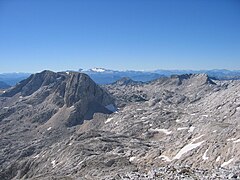
Above-ground karst treasure trove
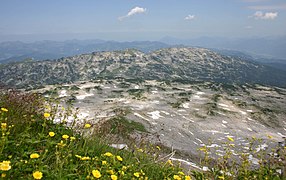
The typical superficial features of a classic karst landscape are carts , sinkholes , gorges , cenotes , uvalas , poljen .
- Cart : Trolleys are formed on the surface of limestone. Grooves in the millimeter to centimeter, grooves in the centimeter to decimeter or even shapes of the mega-carts in the meter range can be formed. Carts come in very different shapes and classifications divide them not only according to the shape and inclination of the rock, but above all the place of education.
- Doline : Dolines are regular, mostly flat, closed depressions of predominantly oval shapes in the meter to a decimeter scale, less often than megadolines they are also significantly larger. Mostly as a superficial form of solution belonging to the solution doline type (sinkhole in the true sense of the word ), there are also occasional collapse dolines (false sinkholes, collapse funnels and sinkholes) that can also reach a depth of several hundred meters and have split sides.
- Schlund (Schlundloch): a shaft-like, deep-reaching, mostly circular tube of a few meters in diameter. It is created when the lime dissolves along crevices and rock joints and becomes steeper when the water flows later. In the depths, larger cavities and connections to the underground water network are formed.
- Uvala : A Uvala is a larger closed depression from decameter to hectometer depth and hectometer up to kilometer in size and irregular shape. The bottom is often characterized by a flat and somewhat uneven floor, which is covered with eluvial, thin sediments on a decimeter scale. A uvala is created when several sinkholes collapse.
- Polje : A polje is a deep, large depression on a kilometer scale, which is characterized by a flat bottom and thick accumulated sediments. A polje forms on tectonic structures due to lateral corrosion. At the same time, the sediments of the ground cover hinder further vertical deepening. Karst poljes have a special position in the karst hydrological system in that they form hydrological nodes here. In the Dinaric area as in neighboring Mediterranean regions there are poljes that are flooded permanently, periodically or episodically depending on their position in the karst hydrological system. In addition to ponors, Estavellen as well as permanent karst springs and karst rivers can exist in a polje.
- Hum : In the subtropics, a hum is an isolated hill that stands in a polje. The tropical mogote (old German Karstinselberg ) is synonymous .
- Mogote : Tropical karst cone. Originally called karst cones in Cuba, the term is used today for all tropical karst cones.
Karst hydrological treasure trove
.jpg)
The karst hydrological forms include dry valleys , ponors (Schluckloch, Schwinde) and gullies , estavelles , karst springs , seepage rivers and caves .
Typical river forms for karst landscapes are the Ponornica ( seepage ), the dry valley , the canyon and the gorge .
Karst plains and plateaus
Karst plains and plateaus that characterize the landscape can be found partly as a stepped Poljentreppe like in the Central Dalmatian-Herzegovinian area, as a karst basin like in Greece in the Stymfalia or as a karst plateau of the "Lapiaz de Loulle" in the French Jura or in the Causse in southern France or in the Burren in Ireland, in all karst areas of the world.
Underground karst treasure trove
For subterranean Karst design corpus includes the cavity and its Speleothems , so the resulting by precipitation of lime cavity jewelery , which mainly by forming the stalagmites ( stalactites , stalagmites , stalagnates ) and gours is characterized.
International specialist terms for karst forms
Although the geosciences have developed a specialized terminology and have an influence on uniform or consistent terms, the names are quite different depending on the cultural language and geography. The internationally used term of the sinkhole for geomorphological forms of the karst comes from Slovenian, Croatian and Serbian, but is not used in the countries of origin for the karst form, but here generally stands for a river valley. As a more precise description, an attempt was made here to introduce the addition Karst-Doline , as well as for the term Poljes Karst-Polje , since this term only generally designates a field. Synonymy of terms is therefore one of the problems of technical language and has led to extensive works since the 1970s that deal only with the Karst glossary.
| German | English (differentiated) |
French | Italian | Spanish (differentiated) |
Serbian / Croatian | Chinese | Polish | Russian | Slovenian | Slovak |
|---|---|---|---|---|---|---|---|---|---|---|
| cart | Grykes | lapiaz | lapies | Lapiaz (Dente del Perro, Cuba ) |
Шкрапа / Škrape | карры | Škraplja | škrapy | ||
| Sinkhole | Sinkhole (cockpit, Jamaica ) |
doline | dolina | Dolina (Cenote, Mexico ) |
Вртача / Ponikva | Tiankeng | долины | Vrtača | závrt | |
| Uvala | Uvala | ouvala | uvala | Увала / Uvala | увала | Uvala | Uvala | |||
| Polje | Polje | poljé | polje | Poljé | Крашко поље / Polje | полья | Polje | polje | ||
| Karst vent | Jama | cheminée karstique | camino carsico | Sima | Јама / Jama | шахты | Jama | komín krasový, krasová jama |
||
| Karst pools | Karst pond | локва / lokva | ||||||||
| Dry valley | Lost river | perte de rivière | rio sumers | ѕушица / sušica | исчезная река | |||||
| River shrinkage | понор / ponor | sponsor | ||||||||
| Hum | Hum | butte karstique / houm | hum | Mogote | Хум / Hum | карстовый останец | Hum | hum | ||
| Mogote | Mogote | mogote | mogote | Mogote | могот | Hum | mogot | |||
| Cockpit karst | cockpit karst | karst cockpit | campo carsico a doline | karst esponja | богињави крас / boginjavi krš | boginjavi krš | ||||
| Cone karst | Cone karst | karst à pitones | carso a coni | Karst de conos | Stožasti krš | конический карст | Stožčasti kras | kras kuželový | ||
| Tower karst | Tower karst | karst à tourelles | carso a torri, campo | Karst de torres | / boginjavi krš | Fengkong / Fengling | башенный карст | kras věžový | ||
| Glaziokarst | glaciokarst | glaciokarst | carso glaciale | carso glacial | глациокарст / glaciokarst | kras glacjalny | Гляциокарст | |||
| Layer stairs | Layered stair karst | karst à banquettes structurales | ||||||||
| Layer ribs | Cuestas | Cuestas | ||||||||
| Sandstone karst | sandstone karst | karst greseux | карст песчаниковый |
Quantification of lime removal rates (karst denudation)
The lime removal describes the surface subsidence per unit of time (e.g. mm / year; µm / year; cm / 10,000 years) and can be measured using various methods. One method that was used in the earlier research periods of the 1950s and 1960s (e.g. Bögli 1951, Bögli 1960; Bauer 1964) is morphometric measurement in hollow karst forms (e.g. determining the depth of carts or cart footpots). Here, in areas that were formerly glaciated in the Pleistocene, the lime removal is related to the last 10,000 years after the ice was completely cleared. It is assumed that the aboveground, pre-glacial karst treasures (e.g. interglacials) have already been eroded by glacial erosion processes. The erosion value determined morphometrically is therefore referred to as postglacial limestone erosion (cm / 10,000 years).
Examples of morphometrically determined karst discharge in the Northern Limestone Alps:
| Study area | Lime removal (cm / 10,000 years) |
method | Author, research paper |
|---|---|---|---|
| Zugspitzplatt, Wetterstein Mountains, medium erosion | 28 | Depth of gutter carts | Huettl, 1999 |
| Zugspitzplatt, Wetterstein Mountains, bare karst | 4-10 | Depth of gutter carts | Huettl, 1999 |
| Zugspitzplatt, Wetterstein Mountains, half-covered karst | 8-50 | Depth of gutter carts | Huettl, 1999 |
| Steinernes Meer, Berchtesgaden Alps, half-covered karst | 15-20 | Cart foot pan method | Haserodt, 1965 |
| Hagen Mountains, Berchtesgaden Alps, bare karst | 6-14 | Height of cart thorns | Haserodt, 1965 |
| Warscheneck Plateau, Austria, bare karst | 10-20 | Depth of gutter carts | Zwittkovits, 1966 |
| Rax plateau, Austria, bare karst | 4-10 | Height of cart thorns | Zwittkovits, 1966 |
| Warscheneck plateau, half-covered karst | 10-30 | Depth of round carts | Zwittkovits, 1966 |
Most frequently, however, the indirect determination of lime removal (e.g. mm / year) via the carbonate content (CaCO 3 mg / l) in karst waters (e.g. flowing waters, springs) is still used today. This can then be used to calculate a surface removal from the dissolved carbonate or lime amount. If one also wants to take into account various influencing factors (e.g. layer inclination, small relief, vegetation and soil cover) in a karst area, the chemical analysis of runoff water (rain and snow melt water) from rock surfaces, debris and soil coverings has proven itself. In this way, a detailed area quantification can be carried out within small sections of space, so-called karstokotopes, or an average lime removal can be determined from numerous individual measurements for a mountain karst relief (e.g. Glaciokarst in the Northern Limestone Alps) for each elevation.
Examples of medium limescale removal from solution on the Zugspitzplatt depending on the altitude
| Altitude level | Total area (km²) |
Lime removal (µm / year) |
Area discharge through solution weathering (t / year) |
|---|---|---|---|
| nival step (2600–2700 m) | 0.204 | 26.7 | 14.7 |
| subnival level (2350–2600 m) | 2.648 | 30.1 | 215.2 |
| alpine level (2000–2350 m) | 2.853 | 34.1 | 262.7 |
| subalpine level (1960–2000 m) | 0.283 | 39.5 | 30.2 |
| The rock faces of the Zugspitze plateau | 1.910 | 13.6 | 69.9 |
| Average removal (weighted average) | 27.8 | 592.7 |
Karst and the environment

Man and Karst
Due to the lack of water and the (in the extra-tropical area) lack of deep, large-scale arable soils , many karst areas belong to the sub-ecumenism . Traditionally, extensive cultivation of small, fertile sinkholes is possible in the Mediterranean Karst and, if necessary, in intensive form in Poljen, which has only recently led to changes in the agricultural economy due to the cultivation of maize . Until then, remote grazing and nomadism were, for centuries, the most adapted form of natural space utilization in the Mediterranean Holokarst, due to the special nature equipment. Tropical karst regions, on the other hand, often offer high-yield and large-scale arable land for rice cultivation and do not have grazing on karst plateaus .
Since in particular the karst landscapes of the classic Dinaric Karst are partly completely free of vegetation due to the basic ecological requirements such as frequent winter hurricane storms , the term "naked karst" (karst without humus cover and without vegetation) is also used here. The absence of forest and vegetation in the Dinaric Karst is not primarily due to karstification, but is indicated in particular by the Bora winds .
A completely different use of karst formations is the mining of suitable limestone in them. The most famous regions are the karst areas near Trieste and the neighboring parts of the country, as well as Istria to the south of it. Due to their excellent properties, these limestones have gained national importance. Although they have been traded under many proper names since the Roman era, they have also been commonly referred to as karst marbles since the 19th century .
In Puerto Rico, a natural hollow form of the cockpit karst was used to build one of the largest radio telescopes in the world, the Arecibo Observatory . The FAST radio telescope in the Chinese province of Guizhou , the telescope with the largest area in the world, was also built in a karst area.
Remote grazing as a differentiated use of space in the Karst
The Mediterranean karst regions are considered to be the classic European region of long-distance grazing. Taking advantage of natural conditions, cattle-breeding-related cultural behavior shaped social and cultural development. A side by side, partly in the immediate vicinity, and close interweaving of the various forms of pasture farming has created a differentiated use of space, which was also based on ethnic characteristics. In regions whose agricultural economy seems to be hardly suitable for any other type of economy due to the natural environment, this way of life has survived to this day.
In the most extreme regions of the Dinaric Karst, only small-scale migratory movements are possible due to the water poverty of the Holokarst. The traditional economy in western Montenegro is therefore the hummingbird economy .
Water and settlement, drinking water production
With regard to human-environmental relationships, karst hydrology is a particularly vivid example of the close interrelationships. The particular geological situation often makes water supply for settlements very difficult. Deep wells had to be dug here, sinkholes had to be used, or rainwater and cisterns had to be used. On the other hand, travertine formation and settlement mutually influence each other: limestone tufa terraces offer good settlement areas and mill locations. On the other hand, heavy land use and the associated interventions in the waters prevent lime precipitation.
Approx. 25% of the world's population get their drinking water from karst aquifers . The Institute for Applied Geosciences at the Karlsruhe Institute of Technology (KIT) published as a project of IAH Karst Commission ( International Association of Hydrogeologists ) in September 2017 at the 44th annual congress of the IAH in Dubrovnik in addition to the 2000 published groundwater - World Map (WHYMAP, World-wide Hydrogeological Mapping and Assessment Program ) together with the Federal Institute for Geosciences and Natural Resources (BGR) and UNESCO a " World Karst Aquifer Map ".
biogeography
Vegetation in the karst


The limestones in the karst generally provide base-saturated, shallow calcareous soils (high soil pH ) that promote limestone species. Ecologically, limestone sites are predominantly dry and have high levels of solar radiation. In extreme cases, physiological adaptation to karst locations can range up to lithophytia (e.g. Iris pallida ) and poikilohydria (e.g. spleen fern ( Asplenium ceterach ), Ramonda ( Ramonda serbica ) or winter savory ( Satureja montana )). Adaptations to the drought occur mainly physiognomically through persistence organs such as bulb and rhizome ; Leaf reduction and xeromorphism (e.g. sclerophylly and micromeria ) and succulence (e.g. bottle trees , leaf succulents ). Depending on the floristic region , Lamiaceaen , Iridaceaen , agave plants and conifers are particularly rich in species in the individual karst regions .
Typical plant species and vegetation formations in the karst regions are:
Mediterranean region
Dinarides : Iris pallida , snake skin pine , Petteria ramentacea , Neumayer jug fruit ( Amphoricarpos neumayerianus ), rock Moltkie ( Moltkia petraea ), rock mint , Viola chelmea , Dinaric karst log dump fir forest
Taurus Mountains : Cilician Fir ( Abies cilicica ), Lebanon Cedar ( Cedrus libani )
Rif Atlas : Spanish fir ( Abies pinsapo var. Marocana ), Cedrus atlantica
Pindus : Greek fir ( Abies cephalonica ), Viola chelmea
Caribbean region

Mogotes (Cuba): Guassia princeps (endemic palm with Stammsukkulenz) Ekmanianthe actinophylla (Cuban "roble caimán"), Bursera schaferi , Agave tubulata , Microcycas calocoma The its distribution center owning National Park Vinales in Cuba Zwergpalmfarn Microcycas calocoma is considered a living fossil and has the largest egg cell of all plant species.
The calcareous riddle is a particular mystery of the European flora , since almost a third of all plant species in Central Europe are considered to be calcareous and a remarkable number of plants from higher latitudes specialize in limestone locations.
fauna
The herpetological and cave fauna, among others, are of great importance within the faunistic biogeography of karst landscapes. The most species-rich center of diversity of the European endemic herpetofauna is located in a small corner in the high karst of the south-east Dinarides of Montenegro and parts of northern Albania (referred to as the “Adriatic Triangle” in biogeography). In 2007, the Prokletije rock lizard ( Dinarolacerta montenegrina ) was newly described from karst mountains in this area as an ancient, crevice colonizing, cold-adapted high mountain lizard , whose line of development goes back at least 5 million years ago.
Coincident with the Southeast Dinaric Center of the Reptile Diversity of Europe is the species richness of pseudoscorpions ( arachnida ) for which 200 species are given in the Montenegrin-Herzegovinian high karst by Božidar Čurčić . The region is thus a global center of tertiary humicolous and hygrophilic pseudoscorpions, among which a substantial part of the former tropical fauna in the Tertiary originated. Their real ancestors were once thermophilic inhabitants of the soil fauna, who only adapted to an underground life in caves during the climatic changes in the ice ages. The Balkan pseudoscorpions are considered to be the oldest land-living animals in Europe and in number of tertiary relic species surpass the karst regions of Southeast Asia and North America.
Well-known karst inhabitants are still cave-dwelling salamander species, among which the cave olm ( Proteus anguinus ) from the underground river systems of the Pivka and Reka in Slovenia is known. Non-aquatic cave-dwelling salamander species are numerous endemic species of the genus Eurycea and Speleomantes .
History of scientific karst research
Geomorphological and hydrological phenomena made the Dinarides the classic study area of karst research , which began with the phenomenological and geological description of the Austrian karst regions in the Trieste Karst as part of general geological survey work by the Imperial and Royal Geological Institute by Guido Stache . Stache's first publication on this dates back to 1864, but it was not until Albrecht Penck established a chair in geomorphology in Vienna that karst research became a branch of its own, in which numerous geologists and geographers of the KuK monarchy showed interest.
Penck's student Jovan Cvijić developed a standard work on karst geomorphology in 1893, the scope of which continues to this day. This first purely descriptive work soon posed general questions about the type of karst hydrology and the temporal genesis and development of karst forms, which were first obtained by Penck and William Morris Davis (1901) on a joint excursion to Bosnia . On the problem of karst hydrography, there were soon two camps which, with Penck and Alfred Grund, represented the theory of karst groundwater and from the camp of geologists and speleologists under the leadership of Friedrich Katzer (1909) a theory of karst rivers.
With Jiří Daneš's (1910) research into tropical karst regions, which was continued and systematized by Herbert Lehmann in 1936, theories quickly emerged in karst research that blame the climatic geomorphological causes for the differences in geomorphology, but never the Cvijće basic idea of the sole dominance of the Doubting solution processes, which is no longer valid scientific opinion since Sweeting.
Among the students of the Cvijćen Geomorphological School, Josip Roglić (1906–1987) in particular was the most talented, dealing with topics related to Poljen genesis and typification, the distribution of karst types, karst and humans, karst and Quaternary geology, as well as vegetation and karst, especially on issues in the Dinarides found in-depth and new research content.
Examples

Karsty Dachstein limestone on the Kehlstein , Berchtesgaden Alps

Cleft carts, Velebit

Karrenfeld in the Dolomites

Karrenfeld in the Schrattenfluh
Karrenfeld on the Gottesacker plateau (Allgäu Alps) - view from the summit of the Hohen Ifen
High mountain karst meadows in the Dead Mountains , Upper Austrian Limestone Alps

Burren Panorama, Northern County Clare , Ireland


bibliography
Special karst forms:
- Alfred Bögli: Karst hydrography and physical speleology. Springer Verlag, Berlin / Heidelberg / New York 1978, ISBN 3-540-09015-0 . ( ISBN 0-387-09015-0 )
- Jovan Cvijić: The karst phenomenon. Vienna 1893 (A. Penck (Ed .: Geographische Abhandlungen. V, 3)
- Jovan Cvijić: Hydrographie Souterraine et Évolution Morphologiyue du Karst. In: Recueil des travaux de l'Institur de Géogr. Alpine. T. 6, Fasc. 4, Grenoble 1918.
- Jovan Cvijić: La Géographie des Terrains Calcaires . Monograph of the Serbian Academy of Sciences and Arts, v. 341, no.26, Belgrade 1960.
- William M. Davis: Origin of limestone caverns. In: Bulletin of the Geological Society of America. Volume 41, 1930, pp. 475-625.
- Alfred Grund: The karst hydrography. Studies from Western Bosnia. Teubner, Leipzig 1903 (A. Penck (Ed .: Geographische Abhandlungen. VII, 3).
- Alfred Grund: The geographic cycle in the Karst. In: Journal of the Society for Geography. 52. Berlin 1914, pp. 621-640.
- Carola Hüttl: Control factors and quantification of chemical weathering on the Zugspitzplatt (Wetterstein Mountains, Germany). Geobuch-Verlag, Munich 1999, ISBN 3-925308-51-2 (Münchner Geographische Abhandlungen, B30).
- Friedrich Katzer: Karst and Karst Hydrography. To the customer of the Balkan Peninsula. Sarajevo 1909.
- Hermann Lehmann: The Tropical Cone Karst in the Greater Antilles. In: Geography. 8, 2, 1954, p. 130.
- Herbert Louis: The formation of the Poljen and their position in the karst borehole, based on observations in the Taurus. In: Geography. X. 1956, pp. 33-53.
- Vladimír Panoš: Karsologická a speleologická terminologie. Žilina (Knižné centrum) 2001, ISBN 80-8064-115-3 .
- Karl-Heinz Pfeffer: Karst morphology (= income from research. Vol. 79). Scientific Book Society Darmstadt, 1978, ISBN 3-534-07187-5
- V. Cilek, R. Winkelhöfer : Si02 - Sinter in sandstone caves of Saxon-Bohemian Switzerland. In: The cave explorer. 20 (1988), Dresden, ISSN 0138-2519 , pp. 2-5.
- RH Winkelhöfer: Through caves in Saxon Switzerland. Cave guide and cadastral documentation. Verlag Der Höhlenforscher, Dresden 2005, ISBN 3-00-002609-6 .
- RH Winkelhöfer: Through the caves of Bohemian Switzerland. Cave guide and cadastral documentation. Verlag Der Höhlenforscher, Dresden 1997, ISBN 3-00-002317-8 .
- RH Winkelhöfer: The internal karstification of the sandstone - a small inventory of the cave formation in the chalk sandstone. In: The cave explorer. 35.1 (2003), ISSN 0138-2519 , pp. 2, 5-11, 31.
- Albrecht Penck: The karst phenomenon. In: Writings of the association for the dissemination of scientific knowledge. 44, 1st Vienna 1904.
- Carl Rathjens: Observations on high poljes in the southern Dinaric Karst. In: Geomorphology. 4, 1960, pp. 141-151.
- Josip Roglić: The poljés du Karst dinarique et les climatiques du quaternaire. In: Revue Belge de Géogr. 88, 1964, pp. 105-123.
- EM Sanders: The Cycle of Erosion in a Karst Region (After Cvijić). In: Geographical Review. Vol. 11, No. 4 (Oct. 1921) New York 1921, pp. 593-604.
- MM Sweeting: Reflections on the development of Karst Geomorphology in Europe and a comparison with its development in China. In: Journal of Geomorphology. 93, 1993, ISBN 3-443-21093-7 , pp. 1227-136.
- MM Sweeting: Karst in China, Its Geomorphology and Environment. Springer-Verlag, Berlin 1995, ISBN 3-540-58846-9 .
- Engelbert Altenburger (1983): The South China Karst Landscape. In: Geosciences in Our Time. 1, 4, ISSN 0723-0834 , pp. 115-121, doi: 10.2312 / geoswissenschaften.1983.1.115 .
Web links
General
- Karst Geomorphology. (No longer available online.) In: daac.gsfc.nasa.gov. Archived from the original on October 4, 2006 (English, with NASA - satellite images of important karst regions of the world).
- karst.iah.org: IAH Commission on Karst Hydrogeology ( International Assocation of Hydrogeologists )
- A Lexicon of Cave an Karst Terminology with special Reference to environmental Karst Hydrology. (PDF; 2.0 MB) In: karstwaters.org, February 2002 (English, dictionary of karst terminology )
- Andy Ridgwell, Richard E. Zeebe: The role of the global carbonate cycle in the regulation and evolution of the Earth system. (PDF file; 1.11 MB) (No longer available online.) In: lgmacweb.env.uea. ac.uk. October 6, 2004, archived from the original on January 17, 2012 (English, The carbonate cycle as an important global geo-ecological cycle).
- Karst. In: mineralienatlas.de
- Комиссия спелеологии и карстоведения / Speleology and Karstology Committee. In: rgo-speleo.ru ( The Moscow center of the Russian Geographic Society with a large interactive literature list, Russian / partly English)
- Karst Hydrology. In: waterencyclopedia.com
- Annika Wachsmuth: Karst learning module "Karst basics". In: webgeo.de. Institute for Physical Geography (IPG) of the Albert Ludwig University of Freiburg , November 10, 2002
- whymap.org: World Karst Aquifer Map
National
- Karst studies in Italy and Slovenia. (PDF 1.61 MB) (No longer available online.) In: iag.tu-darmstadt.de. Technical University of Darmstadt formerly in the original (no mementos). ( Page no longer available , search in web archives )
- isska.ch : Swiss Institute for Speleology and Karst Research (SISKA)
- Caves and Karst. (No longer available online.) In: pbslearningmedia.org. WGBH Educational Foundation, 2006, archived from the original on November 28, 2013 (English, "Caves and Karst").
- speleo.ch : Swiss Society for Speleology (SGH)
Regional
- ArGe für Karstkunde Harz e. V. (No longer available online.) In: argekh.net. Archived from the original on January 12, 2014 .
- Friedhart Knolle, Stefan Kempe: The South Harz Gypsum Karst - A Unique Landscape. (No longer available online.) In: geoberg.de. June 11, 2010, archived from the original on August 19, 2012 (English, Gipskarst in the southern Harz; private website of Lutz Geißler).
- Roland H. Winkelhöfer: Karst in the Elbe Sandstone Mountains. (No longer available online.) In: geoberg.de. June 12, 2010, archived from the original on October 15, 2013 (private website of Lutz Geißler): "This text appeared on the old version of geoberg.de on November 23, 2006 and was adopted."
- karstwanderweg.de ( Karstwanderweg Südharz )
- Homepage of the Karst Research Institute in Postojna, Slovenia (English)
- lwl.org : Karst in Westphalia
Individual evidence
- ^ Preston Miracle, Derek Sturdy 1991: Chamois and the Karst of the Herzegovina. Journal of Archaeological Science. 18: 89-101 ( PDF ).
- ^ Andrej Kranjc The Origin and evolution of the term “Karst”. In: sciencedirect.com, accessed December 27, 2017.
- ^ Jovan Cvijić: La Géographie des Terrains Calcaires. Monograph of the Serbian Academy of Sciences and Arts, v. 341, no.26, Belgrade 1960 (212 p.).
- ↑ Calcium hydrogen carbonate can formally be written as neutral salt without ions; however, the corresponding crystal cannot be represented chemically.
- ↑ According to the meaning of the word, the subnival height level is the one directly below the level ; in the latter, precipitation falls as snow all year round (cf. nivalence ). In the Wikipedia article Altitude level (ecology) , the subnival altitude level is defined as the upper limit of a vegetation with vascular plants .
- ↑ This period ranged from 160 million to 140 million today
- ^ Jovan Cvijić: Hydrographie Souterraine et évolution morphologique du Karst. Recueil des travaux de l'Institut de Géographie Alpine, Grenoble 1918.
- ↑ H. Lehmann: The Tropical Cone Karst in the Greater Antilles. In: Geography. 8, 2, 1954, p. 130.
- ↑ Sudden holes as a threat to settlements. In: ORF.at, June 30, 2011, accessed on August 13, 2013.
- ↑ Spontaneous large hole in the ground near Reutte. In: ORF.at, August 13, 2013.
- ^ Radim Kettner: General Geology. Volume 2. Deutscher Verlag der Wissenschaften, Berlin 1959, pp. 292–293.
- ↑ UNESCO: World Heritage Scanned Nomination: Purnululu National Park. (PDF; 4.6 MB) pp. 8–12 (English).
- ↑ Lukáš Vlček, Branislav Šmída, Charles Brewer-Carías u. a .: The new results from International Speleological Expedition Tepuy 2009 to Chimantá and Roraima Table Mountains (Guyana Highlands, Venezuela) . In: aragonite . tape 14 , no. 1 , 2009, p. 57–62 (Slovak, English, fns.uniba.sk ( memento from March 1, 2012 in the Internet Archive ) [PDF; 696 kB ; accessed on October 20, 2018] Main text in Slovak, summary in English; numerous illustrations).
- ↑ a b Whiteman CD, T. Haiden, B. Pospichal, S. Eisenbach, and R. Steinacker, 2004: Minimum temperatures, diurnal temperature ranges, and temperature inversions in limestone sinkholes of different sizes and shapes. In: J. Appl. Meteor. 43, pp. 1224-1236.
- ↑ Steinacker, R. Whiteman, CD, Dorninger, M., Pospichal, B., Eisenbach, Holzer, AM, Weihs, P., Mursch-Radlgruber, E., Baumann, K. 2007: A Sinkhole Field Experiment in the Eastern Alps. In: Bull. Americ. Meteo. Soc. May 2007, 88 (5), pp. 701-716.
- ^ SZ Dobrowski: A climatic basis for microrefugia: the influence of terrain on climate. In: Global Change Biology. 17, 2011, pp. 1022-1035.
- ↑ Antonić, O., Kusan, V., Hrašovec, B. 1997: Microclimatic and Topoclimatic Differences between the Phytocoenoses in the Viljska Ponikva Sinkhole, Mt Risnjak, Croatia. In: Hrvatski meteorološki časopis. 32, pp. 37-49.
- ^ Glossary and multilingual equivalents of karst terms. ( PDF )
- ↑ Glossary of Karst and Cave Terms, accessed December 27, 2017
- ^ A. Bögli: Problems of cart formation. In: Geographica Helvetica. Volume 6, 1951, pp. 191-204.
- ^ A. Bögli: Lime solution and cart formation. In: Journal of Geomorphology. Supplement Volume 2, 1960, pp. 4-21.
- ^ F. Bauer: Limestone removal measurements in the Austrian high limestone Alps. In: Geography. Volume 18, 1964, pp. 95-102.
- ↑ a b c d e Carola Hüttl: Control factors and quantification of chemical weathering on the Zugspitzplatt (Wetterstein Mountains, Germany). In: Münchner Geographische Abhandlungen. Volume 30. Munich 1999.
- ↑ K. Haserodt: Investigations into the height and age structure of the karst forms in the Northern Limestone Alps. In: Munich Geographical Hefts. Issue 27, Munich 1965.
- ↑ F Zwittkovits: Climate-related karst formations in the Alps, the Dinarides and in the Taurus. In: Communications of the Austrian. Geographic Society. 108, 1966, pp. 73-97.
- ^ Kurt Kayser: Westmontenegro - a cultural-geographic representation. In: Geographical Treatises. 4. Stuttgart 1931.
-
↑ R. Schreg: Water in the Karst: Medieval hydraulic engineering and the interaction between man and the environment. In: Mitt. Dt. Ges. Arch. Middle Ages a. Modern times. 21, 2009, pp. 11-24; -
G. Veni: Maya utilization of karst groundwater resources. In: Environmental Geology. 16, 1990, pp. 63-66. - ↑ Merk, Markus (AGW): KIT - AGW: WOKAM. September 10, 2017. Retrieved December 8, 2017 .
- ^ Nico Goldscheider, Neven Kresic: Karst hydrogeology home. Retrieved December 8, 2017 .
- ↑ BGR - WHYMAP. Retrieved December 8, 2017 .
- ↑ BGR - WHYMAP - BGR, KIT, IAH, and UNESCO presented new World Karst Aquifer Map. Retrieved December 8, 2017 .
- ↑ J. Ewald: The calcareous riddle: why are there so many calciphilous species in the Central European flora? In: Folia Gebotanica. 38, 2003, pp. 357-366.
- ↑ Georg Džukić, Miloš Kalezić: The biodiversity of amphibians and reptiles in the Balkan peninsula. In: Huw I. Griffiths, Boris Krystufek, Jane M. Reed (Eds.): Balkan Biodiversity: Pattern and Process in the European Hotspot. Kluwer Academic Publishing, 2004, pp. 167-192, here: u. a. P. 181.
- ↑ K. Ljubisavljević, O. Arribas, G. Džukić, S. Carranza: Genetic and morphological differentiation of Mosor rock lizards, Dinarolacerta mosorensis (Kolombatović, 1886) with the description of a new species from the Prokletije Mountain Massif (Montenegro) (Squamata : Lacertidae). In: Zootaxa 1613, 2007, pp. 1–22 (PDF)
- ↑ Martina Podnar, Branka Bruvo Mađarić, Werner Mayer: Non-concordant phylogeographical patterns of three widely codistributed endemic Western Balkans lacertid lizards (Reptilia, Lacertidae) shaped by specific habitat requirements and different responses to Pleistocene climatic oscillations. In: Journal of Zoological Systematics and Evolutionary Research. 52/2, pp. 119–129, May 2014 (PDF; 1.7 MB)
- ↑ Pavle Cikovac: Sociology and site-related distribution of fir-rich forests in the Orjen Mountains (Montenegro). Diploma thesis LMU Munich, Department of Geosciences, 2002, p. 87 ( PDF )
- ↑ BPM Ćurčić, RN Dimitrijević, SB Ćurčić, VT Tomić, NB Ćurčić: On some new high altitude, cave and endemic Pseudoscorpions ( Pseudoscorpiones , Aranchida ) from Croatia and Montenegro. In: Acta Entomologica Serbica. 2002, 7 (1/2), pp. 83–110 (PDF; 496 kB) , here: p. 108.
- ↑ Stjepan Bertović: In Memoriam Akademik Josip Roglić. In: Sumarski list. 11-12, Zagreb 1988, pp. 577-580 ( sumari.hr ( Memento of May 22, 2013 in the Internet Archive )).