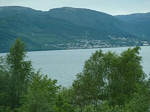
Lundevatnet
| Lundevatnet | ||
|---|---|---|

|
||
| Geographical location | Flekkefjord ( Agder ); Lund ( Rogaland ) | |
| Tributaries | Sira , Moisåna | |
| Drain | Sira | |
| Data | ||
| Coordinates | 58 ° 24 '6 " N , 6 ° 36' 26" E | |
|
|
||
| Altitude above sea level | 49 moh. | |
| surface | 25.93 km² | |
| volume | 4.49 km³ | |
| scope | 59.80 km | |
| Maximum depth | 314 m | |
Lundevatnet (or: Lundevatn ) is the name of a lake on the borders of the municipality of Lund in the province of Rogaland and Flekkefjord in Agder . The European route 39 runs with many tunnels on the east side of the lake.
The main tributaries are the Sira , which flows into the lake at Sirnes , and the Moisåna , which drains the lake Hovsvatnet and which flows into the lake at Moi .
At Åna-Sira , the Sira leaves the Lundevatnet. There is a dam and the Åna Sira power plant here.
