Lustenau (Linz)
| Linz district Lustenau | |
|---|---|
| Basic data | |
| political district | Linz (L) |
| Statistical districts |
Kaplanhof Franckviertel Eastern part of Bulgariplatz |
| surface | 8.77 km² |
| Geographical location | 48 ° 17 ' N , 14 ° 18' E |
| height | 266 m above sea level A. |
| Residents | 17,074 (as of 2006) 1947 inhabitants per km² |
| Post Code | 4020 |
Lustenau is a former municipality that was incorporated into Linz in 1873 . 1957–1913 Lustenau was one of nine districts of the Upper Austrian capital. According to today's terms, the district includes the statistical district of Franckviertel and the eastern part of the Bulgariplatz district , the Makartviertel .
The cadastral community of the same name is still located in the area .
geography
Geographical location and neighboring communities
The cadastral community of Lustenau is located east of the center of the Upper Austrian capital Linz and borders in the north on the cadastral communities of Katzbach and Innenstadt , in the east on the cadastral communities of St. Peter and the community of Steyregg , in the south on the cadastral communities of Kleinmünchen and in the west on the cadastral communities Waldegg and Downtown.
The greatest extent from east to west was around 2.9 kilometers, from north to south around 3.9 kilometers.
Districts
Port district
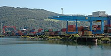
The port district in the east of Lustenau has an area of 5.53 square kilometers. It houses the winter harbor , the commercial harbor and the tank harbor, which means that the harbor district has the largest proportion of water in all of Linz's urban areas. Only the Voest port is the only port in Linz that is not located in the Lustenau port district, but in the neighboring district of St. Peter to the south . The port district is characterized by wholesalers, warehouses and some industrial and commercial operations. Numerous track systems for the commercial and industrial companies in the port area are just as characteristic of the quarter as the city motorway that crosses the quarter in a north-south direction. The few residential buildings are located in the north-west of the district, which has a total of only 1,277 inhabitants (January 1, 2006).
Franckviertel
The Franckviertel is characterized by numerous residential complexes, most of which were built in the inter-war period for workers in Linz's industrial areas. The Franckviertel is home to 9,237 residents on an area of 1.51 square kilometers (January 1, 2006). This district was given the nickname “Broken Glass District” because of a glass factory that was located in Garrisonstrasse until 40 years ago and offered work to many residents of the district. It had to give way to an army barracks. The most striking building in the Franckviertel is the Don Bosco Church .
Makartviertel
The Makartviertel , which was a separate statistical district until 2013, is located in the south-east of the center of Linz and in the south-west of Lustenau. The 1.73 square kilometer district is bordered to the north and east by the Western Railway, which, with its sidings and sidings, takes up a wide strip on the edge of the Makart district. The Makartviertel borders the Neustadtviertel in the north, the Franckviertel in the east, the Wankmüllerhofviertel , the Spallerhof and St.Peter in the south, and the Andreas-Hofer-Platz district in the west . The area share in the urban area of Linz is 1.8%.
After the incorporation at the end of the 19th century , the typical Wilhelminian- style houses were built in a grid-like construction as a continuation of the Neustadtviertel , albeit on a smaller scale, especially along Wiener Straße . The south-eastern area of the district developed into a working-class district, which was promoted by the settlement of industry. Until the post-war period, the main employer was the Poschacher brewery, which experienced a rise from a small local brewery to a large brewery.
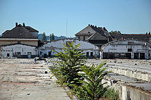
From the 1950s onwards, numerous residential buildings were built, such as the Lenau high-rise. This created a rather inconsistent cityscape. The weak infrastructure and the heavy through traffic, despite the location close to the center, made the quarter unattractive. Efforts have been made since the 1990s to improve the quality of life in the district, a decisive step being taken with the construction of the “Lenaupark”, a modern residential and office district with the two high-rise City Towers 1 + 2. As a result of this impulse, many renovation and renewal measures were started in the entire quarter, the building fabric improved and old building gaps closed. Until recently, the former freight station also marked the appearance of the small city district enormously. However, since it has not been needed for years, it was demolished in 2006 and will provide the area for a new residential area in the coming years. At the beginning of 2006 the Makartviertel had 6,560 inhabitants.
Other public buildings and facilities in the area of the Makartviertel are the Sacred Heart Church , the St. Barbara cemetery , the Jewish cemetery, the vocational training institute and the Hamerling school.
economy
There are numerous industrial and trading companies in Lustenau. The entire port of Linz is located in this district.
See also
literature
- Franz Dobusch , Johann Mayr (Hrsg.): Linz - city of work and culture. Gutenberg-Werbering, Linz 1997.
- City research Linz: CD-ROM Linz 2000. Facts, pictures, graphics. Linz 2000.
Web links
- Bibliography on Franckviertel in the forum OoeGeschichte.at
Individual evidence
- ^ Linz - Politics / Administration - Linz Figures - City Area (with an overview of the current and former statistical districts of Linz that were valid from 1957 to 2013).


