
Mörmter
|
Mörmter
City of Xanten
Coordinates: 51 ° 41 ′ 0 ″ N , 6 ° 24 ′ 0 ″ E
|
|
|---|---|
| Height : | approx. 20 m |
| Postal code : | 46509 |
| Area code : | 02801 |
Mörmter is a district of the city of Xanten on the Lower Rhine . In 2004 the farmers belonging to the Wardt district comprised around 30 farms and the Mörmter monastery .
history
A reformed church was built in Mörmter in 1655 after the peasantry had emerged in 1546 and the Quadt-Wickrath family's own reformed church had been founded. In 1547 the evangelical community of Mörmter was established. From 1572 a Protestant congregation can also be attested for nearby Xanten and from 1647 a separate church building. As a result, two separate Reformed parishes existed in the area of the city of Xanten until 1811. From 1811 to 1993 both parishes were united, but kept separate presbyteries . In 1993 the Mörmter parish finally became an independent parish within the "Parish Xanten-Mörmter ".
In 1921 the farmers Beckmann, Seegers and Siebers gave 19 acres of land to the Franciscan Order , who built the " Kloster Mörmter " there until 1921 , which also served as a hospital during World War II . About 300 m to the west of the monastery are a moat and a round tower as the remains of a castle complex. According to legend, this castle is connected to the Protestant church via a tunnel. On July 1, 1969, the Wardt community , to which Mörmter belonged, was incorporated into the city of Xanten. There Mörmter was assigned to the Wardt district . The inhabitants of the peasantry, who only played a subordinate role in the urban development of Xanten, then joined forces with the peasantry Ursel and Willich to form the " Free Republic of Mörmter - Ursel - Willich ".

The Evangelical Church in Mörmter
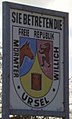
Logo of the "Free Republic of Mörmter - Ursel - Willich"


literature
- Wilhelm Thomas: The glory of Mörmter and the Duisterfeld church. Xanten 1990
Individual evidence
- ↑ Martin Bünermann: The communities of the first reorganization program in North Rhine-Westphalia . Deutscher Gemeindeverlag, Cologne 1970, p. 103 .