Mýrdalssandur

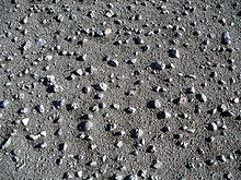
The Mýrdalssandur is a sand area on the south coast of Iceland .
Location and description
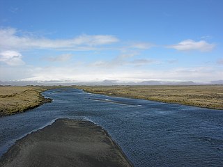
The sand lies between the rivers Kúðafljót in the east and Múlakvísl in the west. Both rivers carry water from the Mýrdalsjökull glacier to the sea.
The Mýrdalssandur forms a 35 km long coastline, including Cape Kötlutangi , the southernmost point of the island of Iceland (63 ° 23'N, 018 ° 45'W).
The ring road crosses this flat area for 25 km.
Emergence
The sand area was built up by the numerous courses of the Mýrdalsjökull glacier . The last major glacier run occurred as a result of an explosive eruption of the Katla volcano located below the glacier in 1918 and it is assumed that the amount of water at the height of the glacier run was around 200,000 - 300,000 m³ / s.
Settlement history
South of the road, Hjörleifshöfði rises to an altitude of 231 m. The mountain is named after Hjörleifur Hródmarsson . He was the first settler to come to Iceland with Ingólfur Arnarson .
In the Middle Ages there was an arm of the sea called Kerlingarfjörðer at today's mouth of the Múlakvísl . It was probably not a fjord, but rather an extension of an estuary. The name (isl. Kerling = dt. Old woman ) was created according to the land acquisition book after an old woman fell overboard from one of the settler ships and floated on its water. Around the year 1000 there seem to have been many farms on Mýrdalssandur. Sources mention 4 parishes in Álftaver. However, these farms were mostly given up again in the next centuries up to the 15th century as a result of volcanic eruptions of the Katla, subsequent glacier runs and ash rain. At the beginning of the 21st century there are still a few farms in Álftaver.
Þykkvabær Monastery
In 1168 an Augustinian monastery was founded in what was then Þykkvabær í Veri on Mýrdalssandur. The name was subsequently changed to Þykkvabæjarklaustur and St. Þorlákur was the first abbot there . He later became bishop in Skálholt and some of his successors were either bishops there or in Hólar .
In 1550, with the Reformation , the King of Denmark took over the monastery with all its possessions, it was dissolved, but existed as a rich farm for a long time until it was finally abandoned in 1945.
See also
Individual evidence
- ^ W. Schutzbach: Katla. Sogu Kötluelda. Reykjavík 2005, p. 19
- ↑ Schutzbach, ibid., P. 20ff.
- ↑ Schutzbach, ibid., P. 25ff.
Web links
- Icelandic Meteorological Office: water level in the rivers on Mýrdalssandur, e.g. B. Hólmsá
- Webcam of the Icelandic road traffic watch on Mýrdalssandur in the Eldhraun lava field
Coordinates: 63 ° 28 ′ 6 " N , 18 ° 37 ′ 48" W.
