
Maga (Cameroon)
| Maga | |||
|---|---|---|---|
|
|||
| Coordinates | 10 ° 51 ' N , 14 ° 56' E | ||
| Basic data | |||
| Country | Cameroon | ||
| Extreme north | |||
| district | Mayo Danay | ||
| ISO 3166-2 | CM-EN | ||
| height | 307 m | ||
| Residents | 85,000 (2005) | ||
 The Maga reservoir
|
|||

Maga is a municipality in the province of Extreme North , which forms the northern tip of Cameroon . It lies on the Logone River and on the border with Chad . Maga is located in the Mayo-Danay district . The central point in the municipality is the Maga Dam reservoir .
traffic
Maga is on the P3 provincial road.
photos

at the reservoir
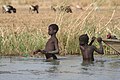
in the reservoir

.jpg)
Web links
- Maga at citypopulation.de