Malangas
| Municipality of Malangas | ||
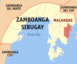
| Location of Malangas in the Zamboanga Sibugay Province | ||
|---|---|---|

|
||
| Basic data | ||
| Region : | Zamboanga Peninsula | |
| Province : | Zamboanga Sibugay | |
| Barangays : | 25th | |
| District: | 3. District of Zamboanga Sibugay | |
| PSGC : | 098308000 | |
| Income class : | 3rd income bracket | |
| Households : | 5762 May 1, 2000 census
|
|
| Population : | 33,380 August 1, 2015 census
|
|
| Coordinates : | 7 ° 37 ′ N , 123 ° 0 ′ E | |
| Geographical location in the Philippines | ||
|
|
||
Malangas is a Filipino municipality in the Zamboanga Sibugay Province . It has 33,380 inhabitants (August 1, 2015 census). The Dumanquilas Bay lies partly in the administrative area of the municipality.
Barangays
Malangas is politically divided into 25 barangays .
|
|
