Marienplatz (Leipzig)
| Marienplatz | |
|---|---|
| Place in Leipzig | |
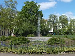
 Central ornamentation with fountain |
|
| Basic data | |
| place | Leipzig |
| District | Center-east |
| Created | 1850 |
| Newly designed | 1993 |
| Confluent streets | Chopinstrasse, Egelstrasse, Lange Strasse, Ranftsche Gasse |
| use | |
| User groups | pedestrian |
| Technical specifications | |
| Square area | 0.6 ha |
The Marienplatz is a jewelry place in Leipzig district center-east. It is one of the first green city squares in Leipzig and is a listed building. The green area of the square is sometimes called Marienpark.
Location and layout
Marienplatz extends as a rectangle in north-south direction with a length of approx. 120 m and a width of approx. 50 m. It is bounded in the north by Chopinstrasse, in the east by Langen Strasse and in the south by Egelstrasse. The road in the west is called Marienplatz. The Ranftsche Gasse meets the square from the east.
The square is lined with double rows of over 80 linden trees of different species, such as summer linden , winter linden , Krimlinden and Dutch linden . The trees were planted in different years, the earliest being in 1885, the youngest in 2013. In the middle of the square there is a planted roundabout with a diameter of 20 m. In its center, an 8 m bowl holds a fountain . There are meadows to the north and south of the roundabout. Paths with park benches run along the rows of linden trees.
On the inside of the rows of linden trees there is still shrubbery, including hornbeam , pea bush , Japanese quince and pipe bush . On the east side of Langen Straße there is a restored historical hand pump of the Delphin type .
history
From the middle of the 19th century, the Leipzig suburbs experienced an enormous development through industrialization . In 1844, the eastward leading Marienstrasse (since 1946 Chopinstrasse) was named, on which the Marienvorstadt was built around the excursion restaurant Milchinsel . The lawyer Julius Gebhard Ranft (1791–1841) had sold building land there, but retained a space east of Milk Island with the intention of offering it to the city to create a jewelry space because he was of the opinion that every new district needed one. In 1842 the city bought the area from Ranft's heirs, and the rows of linden trees were planted around 1850.
The northern part of the graphic quarter was built in Marienvorstadt , and upper-class villas were built on Marienplatz. The publisher Johann Jacob Weber (1803–1880) had the imposing Weber Villa built very close to his publishing house between Reudnitzerstrasse and Mittelstrasse (today Hans-Poeche-Strasse) on the corner of the square with Chopinstrasse. In 1876, two residents there, the psychologist Wilhelm Wundt (1832–1920) and the Slavist August Leskien (1840–1916), demanded a beautification of the square. In 1878/79, according to a plan by the council gardener Otto Wittenberg (1834–1918), a central circular plant with two lawns on the sides, as they are still present today. The fountain followed in 1889. Linden trees were later replanted several times. The houses on the north and east sides of the square were completely destroyed in the air raids on the Graphic Quarter, while those on the west side were partially destroyed.
A new apartment block was built on the north side in the mid-1990s and a few years later a new city villa on the west side instead of a villa destroyed in the war. In 2018, the construction of new residential buildings began on the site of the fallow land on the east side along Langen Strasse.
- Buildings on Marienplatz
From 1993 the now desolate square was restored according to the historical model. The roundabout was planted and the fountain reconstructed. Park benches based on the old Leipzig pattern were set up and the roundel was framed with a Wittenberg type border railing.
literature
- Petra Mewes, Peter Benecken: Leipzig's Green - A Park and Garden Guide . Passage-Verlag, Leipzig 2013, ISBN 978-3-938543-49-8 , pp. 144/145 .
Websites
Individual evidence
- ↑ Monument protection object ID 09290407
- ↑ a b Official city map (theme park and street trees). In: Website of the city of Leipzig. Accessed May 1, 2019 .
- ↑ Gina Klank, Gernoth Griebsch: Encyclopedia Leipziger street names . Ed .: City Archives Leipzig. 1st edition. Verlag im Wissenschaftszentrum Leipzig, Leipzig 1995, ISBN 3-930433-09-5 , p. 46 .
Coordinates: 51 ° 20 ′ 34 ″ N , 12 ° 23 ′ 36 ″ E


