
Matiu / Somes Island
| Matiu / Somes Island | ||
|---|---|---|
 |
||
| Waters | Wellington Harbor , South Pacific | |
| Geographical location | 41 ° 15 ′ S , 174 ° 52 ′ E | |
|
||
| surface | 24.9 ha | |
| Highest elevation | 74 m | |


Matiu / Somes Island is the largest of three islands in the northern half of Wellington Harbor in New Zealand with an area of 24.9 hectares . It is 3 km south of the suburb of Petone and from the mouth of the Hutt River and about 5 km northwest of the much smaller Makaro / Ward Island .
According to Māori legend , the islands of Matiu and Makaro got their original names from Kupe , the legendary first navigator who returned to his native Hawaiki with reports about New Zealand . He is said to have named the islands after his daughters (other versions of the legend speak of nieces) when he first entered Wellington Harbor about 1000 years ago.
After the European colonization, the island was known as Somes Island for centuries . In 1839 it came under the control of the New Zealand Company, along with much of the wider Wellington region . The island was named after Joseph Somes, the lieutenant governor and financier of the company at the time. In 1997 the island was officially given the bilingual name Matiu / Somes by the New Zealand Geographic Board . In the meantime, the island has become the property of the local Iwi (tribe) and is now administered by them together with the Department of Conservation .
Matiu / Somes became part of the city of Lower Hutt in 1989 and was placed under the Department of Conservation in August 1995 as a reserve of both natural and historical importance. The island is free of any introduced predatory mammals such as ermine , which is unusual for an island so close to a metropolitan area.
history
The island is of historical importance for both the Māori and the later European settlers.
Before the mid-19th century, there were 2 Pā (fortified villages) of the Māori on the island. Similar to the Pā of the Ngāti Ira on Ward Island, they were not permanently inhabited and served as a refuge for the tribesmen during wartime. A Pā was in the center of the island, little more than a few Køkkenmøddinger (rubbish heaps) left of him. The other Pā, built on the northern tip of the island, was in an easily defended position with cliffs on three sides.
In 1866 a lighthouse was built on the southwest end of the island - the first lighthouse at a New Zealand harbor. The lighthouse, which stands today in the same place, dates from 1900 and was later automated. In the 20th century, the island served as an internment camp for foreigners and a quarantine station for immigrants and animals. In 1942, flak positions were built at the highest point, but they were not used during the war. For this purpose, the entire area was leveled, the island thereby lost 17 m of its height. A demagnetization station for ships was built on the island. Many remains of these systems can still be seen on the island today.
Geography and ecology
An erosion channel that begins south of the quarantine station and ends at the south end of the island runs through the island. To the west and east of it are two ridges, which are now largely wooded. The channel is more of a marshland, but during and after periods of heavy rain a small stream forms at times.
The island is a retreat for the little penguin , several species of cormorants , the spotted skink, and several rare and endangered plant species.
The Royal Forest and Bird Protection Society of New Zealand has repopulated the island with plants since 1984 and successfully exterminated the rats and mice between 1988 and 1989. 2004 eleven male was Spring parakeets ( kakariki ) exposed on the island, which began immediately zubrüten 2005 eleven other female birds. More than 500 species of invertebrates live on the island , including some species of weta . Wellington tree wetas ( Hemideina crassidens ) and Cook Strait giant wetas ( Deinacrida rugosa ) were successfully relocated to the island from Mana Island .
Six native reptile species live on the island: Chatham island skink ( Oligosoma nigriplantare ), spotted skink ( Oligosoma lineoocellatum ), copper skink ( Oligosoma aenea ) and the gecko Hoplodactylus maculatus . In 1998 bridge lizards ( Sphenodon guntheri ) were released, in 2006 geckos of the species Hoplodactylus granulatus . The long-legged flycatcher ( Petroica australis ) was naturalized from Kapiti Island in April 2006 and began to breed in September. A solar powered speaker system is said to attract shearwater divers .
Many of the projects were supported by the local Te Ati Awa tribe. The Matiu / Somes Island Charitable Trust was founded in 1998 as a partnership between Te Ati Awa and the local community to protect, promote and improve the island. For this purpose, funds are to be raised to increase biodiversity and for better use by visitors to the island. The active arm belonging to the trust, the “The Friends of Matiu / Somes” promotes the participation of the community residents in the work on the island.
Matiu / Somes Island is an increasingly popular tourist attraction and is also used for educational purposes by local schools. 15,000 people visit the island every year.
Immediately to the north is the much smaller Mokopuna Island . It is forbidden to moor there to protect endemic fauna, especially nesting seabirds.
Photo gallery

Pier of the island

Quarantine station

Gun emplacement

Gun emplacement

lighthouse
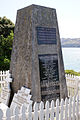
Memorial to those who died on the island

Shag Rocks at the south end of the island

Weta ( Deinacrida rugosa )
.jpg)

.jpg)
.jpg)

.jpg)


literature
- "Matiu / Somes island- Scientific and historic reserve" , information brochure of the Department of Conservation and the Matiu Somes charitable trust
- Dave Hansford: Matiu / Somes-Secrets in plain view . In: Forest and Bird Magazine . Volume 318, November 2005, p. 14-17 (English).
Web links
- Historic Matiu / Somes Island. Department of Conservation , accessed August 28, 2014 .
Individual evidence
- ^ Matiu / Somes Island. Department of Conservation, accessed November 5, 2010 .