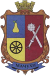
Matschuchy
| Matschuchy | ||
| Мачухи | ||

|
|
|
| Basic data | ||
|---|---|---|
| Oblast : | Poltava Oblast | |
| Rajon : | Poltava Raion | |
| Height : | 148 m | |
| Area : | Information is missing | |
| Residents : | 3,337 (2004) | |
| Postcodes : | 38754 | |
| Area code : | +380 5322 | |
| Geographic location : | 49 ° 31 ' N , 34 ° 26' E | |
| KOATUU : | 5324083201 | |
| Administrative structure : | 8 villages | |
| Address: | вул. Л. Убийвовк 1 38754 с. Мачухи |
|
| Website : | City council website | |
| Statistical information | ||
|
|
||
Matschuchy ( Ukrainian Мачухи ; Russian Мачехи Matschechi ) is a village in the Ukrainian Poltava oblast with 3,300 inhabitants (2004).
The village, which was founded in the first half of the 17th century, lived around 1,350 people in 1850 and around 3,080 in 1863.
Matschuchy is located in the southwest of Poltava Rajon on the M 22 / E 584 highway 6 km southwest of the city of Poltava and is the administrative center of the district council of the same name , which also includes the villages
- Bairak ( Байрак ⊙ ) with about 80 inhabitants
- Wasky ( Васьки ⊙ ) with about 40 inhabitants
- Kowantschyk ( Кованчик ⊙ ) with about 210 inhabitants
- Kuklynzi ( Куклинці ⊙ ) with about 60 inhabitants
- Masurivka ( Мазурівка ⊙ ) with about 20 inhabitants
- Mykolaivka ( Миколаївка ⊙ ) with about 50 inhabitants
- Snopowe ( Снопове ⊙ ) with about 80 inhabitants
belong.
Individual evidence
- ↑ Page of the village on the Verkhovna Rada website , (Ukrainian)
- ↑ history Matschuchy in the history of the towns and villages of the Ukrainian SSR ; accessed on August 27, 2019 (Ukrainian)

