Mamry
| Mamry | ||
|---|---|---|

|
||
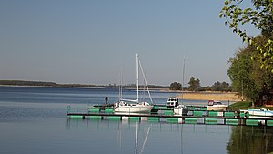
| Święcajty Bay | ||
| Geographical location | Masurian Lake District | |
| Drain | Rapped | |
| Islands | Upałty | |
| Location close to the shore | Giżycko (Lötzen), Węgorzewo (Angerburg), Kętrzyn (Rastenburg) | |
| Data | ||
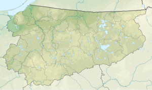
| Coordinates | 54 ° 7 ' N , 21 ° 42' E | |
|
|
||
| surface | 104 km² | |
| Maximum depth | 44 m | |
| Middle deep | 11 m | |
|
particularities |
Second largest lake in Poland |
|
The Mauersee (Polish: Mamry , Prussian Maurow ) is a 104 km² inland lake in the Polish Warmian-Masurian Voivodeship . It is the second largest lake in the Masurian Lake District (see Müritz : 112 km²).
It is made up of six basins: the actual Mamry (Mauersee from maurai: "Entenflott, Gras") in the north, Kirsajty (Kirsaitensee), Kisajno (Kissainsee from kisis: " Ruff "), Dargin (Dargainensee from dergia: "stormy") ), Święcajty (Schwenzaitsee from swints: "holy") and Dobskie (Dobensee from daubis: "gorge, cave"); the connection to Dobskie is also called Łabap (Lababsee from labape: "small river"). This system includes 33 islands of a total of 213 hectares that are under nature protection . At the southern end of the Kisajno is the town of Giżycko (Lötzen); other towns nearby are Węgorzewo (Angerburg) and Kętrzyn (Rastenburg) .
Worth seeing
In the northwest bay the Masurian Canal flows into the Mauersee. The Army High Command had its headquarters there near Mauerdorf (Mamerki) from 1941 to 1944 . Some of the bunker relics are still preserved. There is also a campsite and a marina there. The nearby Rastenburg – Angerburg railway line continues to be operated by the SKPL (Association of Local Railway Companies) for excursions.
Boat tourism
In the northeast bay near Angerburg, a leisure center with a swimming pool, viewing platforms and a jetty for houseboats was created near the runoff of the Angerapp . The Mauersee is very popular as part of the Masurian Waterway .
literature
- August Eduard Preuss : Prussian country and folklore. Königsberg 1835, pp. 35-36.
- Maria Biolik: Hydronymia Europaea. The names of the standing waters in the Pregel inflow area and in the catchment area of the tributaries to the Baltic Sea between Pregel and Memel. Stuttgart 1993
- Georg Gerullis: The old Prussian place names . Berlin, Leipzig 1922.
- Rozalia Przybytek: Hydronymia Europaea. Place names of Baltic origin in the southern part of East Prussia. Stuttgart 1993.
