Angrapa
|
Angrapa Węgorapa, Angerapp |
||
|
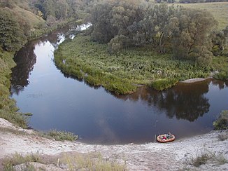
The Angrapa near Mayakowskoje (Nemmersdorf) |
||
| Data | ||
| Water code | RU : 01010000212104300010053 | |
| location |
Kaliningrad Oblast ( Russia ), Poland |
|
| River system | Pregel | |
| Drain over | Pregel → Baltic Sea | |
| source |
Mamry (Mauersee) 54 ° 11 ′ 52 ″ N , 21 ° 43 ′ 6 ″ E |
|
| confluence | At Tschernjachowsk with the Inster zum Pregel coordinates: 54 ° 38 '52 " N , 21 ° 47' 27" E 54 ° 38 '52 " N , 21 ° 47' 27" E
|
|
| length | 169 km | |
| Catchment area | 3960 km² | |
| Discharge at the Berestowo gauge |
MQ |
14.5 m³ / s |
| Right tributaries | Goldap , Wika (Wiek) , Pissa | |
|
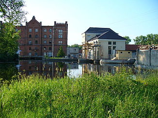
Angrapa barrage in Osyorsk (Darkehmen) |
||
|
Railway bridge across the river northeast of Osjorsk, before 1938 (destroyed today) |
||
The Angrapa ( Cyrillic Russian Анграпа [anˈgrapa] , German Angerapp , Polish Węgorapa [vɛŋɡɔˈrapa] ) is a river in the Russian Oblast Kaliningrad and in Poland , in historical East Prussia . The name is derived from Prussian angurgis / angurys-ape and means “eel river” in Old Prussian .
It has a length of 169 km, 120 km of which it flows through Russia.
The Angerapp rises in Masuria , leaves the Mauersee at Węgorzewo (Angerburg) , flows through the Osjorsk Rajon (until 1945 about Darkehmen or Angerapp district ) with the city of Osjorsk and forms the Pregel near Tschernjachowsk (Insterburg) together with the Inster . Shortly before the border to Russia, the Goldap flows into the Angerapp. The river used to be known for its abundance of fish. Angerburg used to be one of the largest fish hatcheries in Europe, where vendace in particular was bred.
Web links
Footnotes
- ↑ a b Angrapa in the State Water Register of the Russian Federation (Russian)
- ↑ UNESCO - Angrapa near Berestowo ( Memento of March 3, 2016 in the Internet Archive )


