Mazatzal Mountains
| Mazatzal Mountains | ||
|---|---|---|
|
East side of the mountains |
||
| Highest peak | Mazatzal Peak ( 2409 m ) | |
|
|
||
| Coordinates | 33 ° 43 ′ N , 111 ° 22 ′ W | |
| surface | 2,802 km² | |
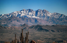
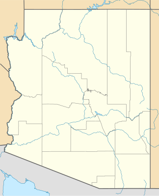
The Mazatzal Mountains are a mountain range in south-central Arizona in the United States , approximately 30 to 45 miles (48 to 64 km) northeast of Phoenix . The origin of the name remains unclear, but one possibility is that it comes from the Nahuatl language and means "place of the deer". The ridge of the Mazatzal Mountains forms the border between Maricopa County and Gila County . The State Route 87 crosses the Mazatzals on the way to Payson . The highest peak is Mazatzal Peak at 2409 m (7903 feet). The mountains also include the Four Peaks at 2,334 m, a prominent landmark of the area to the east of Phoenix.
The Mazatzal Wilderness Area protects 1022 km² (252,500 acres) of the Tonto and Coconino National Forests . Established in 1940 and expanded to today's size in 1984, these range in elevation from 640 m (2100 feet) in the southwest to 2409 m (7903 feet) at Mazatzal Peak.
The east side of the wilderness area consists of mountains covered with bushes or pine trees, which are sometimes interrupted by narrow canyons with vertical walls. On its west side, below the steep, bush-covered foothills, the Verde River flows through the Sonoran Desert . The Verde River was designated by the US Congress in 1984 as one of the two Wild and Scenic Rivers of Arizona.
geology
In Pine , in the northeast region of the Mazatzal Wilderness , at the northern end of the Mazatzal Mountains, Arizona State Route 87 crosses the transition between two important geological areas. The horizontally lying Tapeats sandstone was deposited on Precambrian granite, the Zoroaster granite . The time between the erosion of the lower unit and the deposition of the overlying horizontal sandstone is about 1 billion years and is called " Great unconformity " (large discordance ), respectively.

In addition to its occurrence in the Grand Canyon , it can also be found in the west, in the Las Vegas Valley on Frenchman Mountain . The Zoroaster granite and other granites were invaded into the main unit of the Vishnu Schist , which was found inside the Grand Canyon. The neighboring Sierra Ancha Mountains have another emergence of the Great Unconformity, with a sandstone unit that is an analogous example of the Tapeats sandstone.
At the section of Arizona Highway 87 south of Pine, the northern Mazatzal Mountains merge into the western region of the Mogollon Rim , while the rim merges northwest into the Oak Creek Canyon region.
Web links
- Mazatzal Mountains on Peakbagger.com (English)
- Mazatzal Mountains in the United States Geological Survey's Geographic Names Information System
- Geology of the Mazatzal Mountains (PDF, English)
Individual evidence
- ^ Chronic, Halka. Roadside Geology of Arizona, p. 172.

