Mazza Point
| Mazza Point | ||
| Geographical location | ||
|
|
||
| Coordinates | 71 ° 19 ′ S , 73 ° 36 ′ W | |
| location | Alexander I Island , West Antarctica | |
| Waters | Brahms Inlet | |
| Waters 2 | Mendelssohn Inlet | |
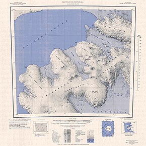
 Topographic map sheet (1: 250,000) with the Derocher peninsula (right of center) and Mazza Point |
||
The Mazza Point is a snow-covered headland in southwest West Antarctic Alexander Island . It marks the north-western end of the Derocher peninsula and separates the Brahms Inlet from the Mendelssohn Inlet .
The United States Geological Survey mapped it using aerial photographs from the United States Navy from 1967 to 1968 and Landsat photographs from 1972 and 1973. The Advisory Committee on Antarctic Names named the headland after Joseph D. Mazza, commander of the Navy flight squadron VXE-6 from May 1986 to May 1987.
Web links
- Mazza Point in the Geographic Names Information System of the United States Geological Survey (English)
- Mazza Point on geographic.org (English)
