Medicine River (Red Deer River)
| Medicine River | ||
|
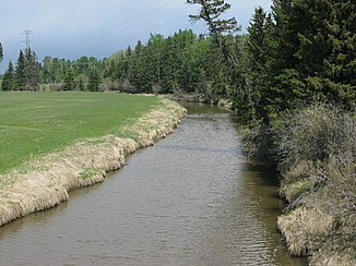
Medicine River on Alberta Highway 53 , 100 miles above the mouth |
||
| Data | ||
| location | Alberta (Canada) | |
| River system | Nelson River | |
| Drain over | Red Deer River → South Saskatchewan River → Saskatchewan River → Nelson River → Hudson Bay | |
| origin | Cosling Lake 52 ° 47 ′ 37 " N , 114 ° 45 ′ 41" W. |
|
| Source height | approx. 1000 m | |
| muzzle |
Red Deer River Coordinates: 52 ° 3 '38 " N , 114 ° 5' 58" W 52 ° 3 '38 " N , 114 ° 5' 58" W. |
|
| Mouth height | 894 m | |
| Height difference | approx. 106 m | |
| Bottom slope | approx. 0.82 ‰ | |
| length | approx. 130 km | |
| Catchment area | approx. 2200 km² (effective catchment area: approx. 2140 km²) | |
| Discharge at gauge Hwy 11 A Eo : 1860 km² Location: 50 km above the mouth |
MQ 1962/2016 Mq 1962/2016 |
4.1 m³ / s 2.2 l / (s km²) |
| Left tributaries | Wilson Creek | |
| Flowing lakes | Medicine Lake | |
| Communities | Eckville | |
|
Medicine River at Markerville, 15 km upstream of the estuary |
||
The Medicine River is an approximately 130 km long left tributary of the Red Deer River in the western Canadian province of Alberta .
River course
The headwaters of the Medicine River is located approximately 120 km southwest of Edmonton . The Medicine River has its origin in the small lake Cosling Lake at an altitude of about 1000 m . The Medicine River flows along its entire route in a predominantly south-southeast direction through the Great Plains in western Alberta. The river runs almost parallel to the Canadian Rocky Mountains, 100 km further south-west . After 4 km he reaches Medicine Lake , which is also where the Medicine Lake Provincial Recreational Area is located. Eckville , a 1000-inhabitant village, is located about 50 km above the mouth of the river. The Medicine River finally flows into the Red Deer River 10 km west-northwest of Innisfail . The Medicine River forms a strongly meandering behavior with countless narrow river loops along its entire course .
Hydrology
The Medicine River drains an area of approximately 2200 km². The effective catchment area is approximately 2140 km². The mean discharge on Alberta Highway 11 , 50 km above the mouth, is 4.1 m³ / s. April is the month with the highest discharge with an average of 15.1 m³ / s.

