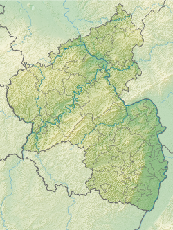
Menhir of Nack
| Menhir of Nack | ||
|---|---|---|
|
|
||
| Coordinates | 49 ° 44 '53.1 " N , 8 ° 0' 3.9" E | |
| place | Nack , Alzey-Worms district , Rhineland-Palatinate , Germany | |
The menhir of Nack is a menhir in Nack in the district of Alzey-Worms in Rhineland-Palatinate .
Location and description
The Nacker Menhir was discovered in 1986 south of the community on state road 407 leading to Bechenheim . It was about 30 m west of the road and 300 m north of the municipality boundary. An excavation carried out in the vicinity of the site in 1987 brought no further information. The stone is now in the middle of the village on the street Zum Ahrenberg , near the confluence with Bechenheimer Straße .
The menhir consists of freshwater quartzite and is monolithic in type . It has a height of 262 cm, a width of 250 cm and a depth of 70 cm. It is irregularly plate-shaped, rounded at the top and ends in a roof-shaped point.
literature
- Otto Gödel: Menhirs, witnesses of cult, border and legal customs in the Palatinate, Rheinhessen and the Saar area. Speyer 1987, pp. 54ff.
- Johannes Groht : Menhirs in Germany. State Office for Monument Preservation and Archeology Saxony-Anhalt, Halle (Saale) 2013, ISBN 978-3-943904-18-5 , pp. 276, 338–339.
See also
Web links
Individual evidence
- ^ Johannes Groht : Menhirs in Germany . State Office for Monument Preservation and Archeology Saxony-Anhalt, Halle (Saale) 2013, ISBN 978-3-943904-18-5 , p. 248-349 .
- ↑ Kai Hofmann: Nack Monolith Standing Stone (Menhir). megalithic.co.uk, November 20, 2013, accessed April 25, 2019 .
- ^ Johannes Groht : Menhirs in Germany . State Office for Monument Preservation and Archeology Saxony-Anhalt, Halle (Saale) 2013, ISBN 978-3-943904-18-5 , p. 338-339 .
