Mesa Range
| Mesa Range | ||
|---|---|---|
| location | Victoria Land , East Antarctica | |
| part of | Transantarctic Mountains | |
|
|
||
| Coordinates | 73 ° 11 ′ S , 162 ° 55 ′ E | |
|
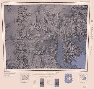
Map of the Freyberg Mountains from 1967, at the lower edge of the map in the west the north end of the Mesa Range |
||
|
Map of the Mesa Range (to the northwest), Southern Cross Mountains, and Mountaineer Range from 1967 |
||
The Mesa Range ( English for Table Mountain Chain ) is a mountain range in the East Antarctic Victoria Land . The northern group of a campaign carried out from 1961 to 1962 as part of the New Zealand Geological Survey Antarctic Expedition named them after their appearance. The following mountains belong to the chain:
![]() Map with all coordinates: OSM | WikiMap
Map with all coordinates: OSM | WikiMap
- Sheehan Mesa ( 73 ° 1 ′ S , 162 ° 18 ′ E ), named after Maurice Sheehan, a surveyor on the expedition,
- Pain Mesa ( 73 ° 0 ' S , 163 ° 0' O ), named after Kevin Patrick Pain (≈1927-2015), the vice manager expedition,
- Tobin Mesa ( 73 ° 17 ′ S , 162 ° 52 ′ E ), named after James Tobin, a geographer on the expedition, and the
- Gair Mesa ( 73 ° 28 ′ S , 162 ° 52 ′ E ), named after geologist and expedition leader Henry Stephen Gair.
Web links
- Mesa Range in the Geographic Names Information System of the United States Geological Survey (English)
- Mesa Range on geographic.org (English)
Individual evidence
- ↑ Sheehan Mesa at geographic.org (accessed October 10, 2015).
- ^ Pain Mesa at geographic.org (accessed October 10, 2015).
- ↑ Tobin Mesa on geographic.org (accessed October 10, 2015).
- ↑ Gair Mesa at geographic.org (accessed October 10, 2015).


