Southern Cross Mountains
| Southern Cross Mountains | ||
|---|---|---|
| location | Victoria Land , East Antarctica | |
| part of | Transantarctic Mountains | |
|
|
||
| Coordinates | 73 ° 40 ′ S , 164 ° 0 ′ E | |
|
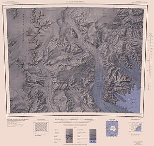
Map sheet Mount Murchison from 1967, in the middle to the southern edge of the map the Southern Cross Mountains |
||
The Southern Cross Mountains comprise a series of mountain ranges between the Mariner and Priestley glaciers in East Antarctic Victoria Land .
The seaward side of the mountain range was first sighted in 1841 by James Clark Ross and subsequently also visited by expeditions of the polar explorer Carsten Egeberg Borchgrevink , Robert Falcon Scott , Ernest Shackleton and Richard Evelyn Byrd . The detailed mapping was carried out using aerial photographs by the United States Navy and geodetic surveys from New Zealand and American expeditions in the 1950s and 1960s. The naming of the constellation of the Southern Cross ( English Southern Cross ) took the northern group of from 1965 to 1966 carried out the campaign as part of the New Zealand Geological Survey Antarctic Expedition ago.
Web links
- Southern Cross Mountains in the Geographic Names Information System of the United States Geological Survey (English)
- Southern Cross Mountains on geographic.org (English)

