Priestley Glacier
| Priestley Glacier | ||
|---|---|---|
|
Sidewall of the Priestley Glacier |
||
| location | Victoria Land , East Antarctica | |
| Mountains | Transantarctic Mountains | |
| length | 100 km | |
| Coordinates | 74 ° 20 ′ S , 163 ° 22 ′ E | |
|
|
||
| drainage | Nansen ice cream board | |
|
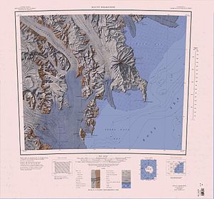
Lower section and mouth of the Priesley Glacier in the Nansen Eistafel (left of the center of the map) |
||
The Priestley Glacier is a large, around 100 km long valley glacier in East Antarctic Victoria Land . It flows from the edge of the northern polar plateau in a south-easterly direction between the Deep Freeze Range and the Eisenhower Range and flows into the northern section of the Nansen ice table on the Scott coast .
Participants in the Terra Nova Expedition (1910–1913), led by the British polar explorer Robert Falcon Scott, explored the glacier for the first time. It is named after the geologist Raymond Priestley (1886–1974), a member of this and the Nimrod Expedition (1907–1909) under Ernest Shackleton .
Web links
- Priestley Glacier in the Geographic Names Information System of the United States Geological Survey (English)
- Priestley Glacier on geographic.org (English)


